
Route: Pienza Old Town
Area: Italy, Tuscany
Date of walk: 9th October 2019
Walkers: Andrew and Gilly
Distance: 2.0 miles
Ascent: 100 feet
Weather: Late afternoon sunshine and good light
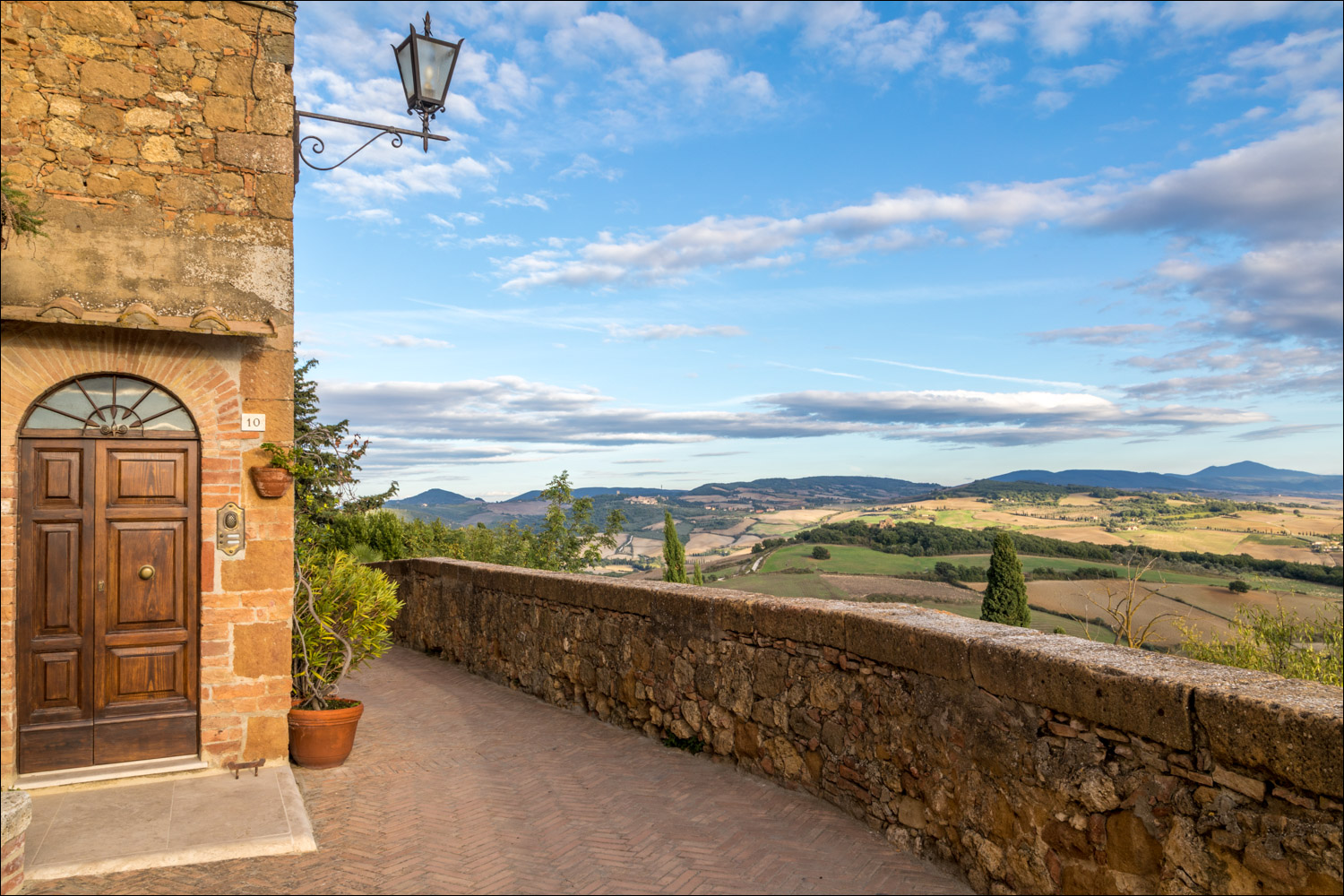
This morning’s walk around Radicofani was only a short one, and this left sufficient time for us to revisit Pienza Old Town on this last day of our walking holiday in the Val d’Orcia region of Tuscany. We’d visited the town on the first day, having walked there from San Quirico, so we knew what to expect. Having passed under the arched Porta al Murello, which is the western entrance to the old town, we turned right to join the Passeggiata Panoramica. This is a belvedere path along the edge of the town walls, with wonderful views over the Val d’Orcia, which were shown in good light in the late afternoon sun
The path ends briefly at the walls of the Cathedral, but resumes again at the other side. We followed it to the end and then walked into the old town and wandered around the streets. We then returned to the Passeggiata Panoramico and the friendly Bar Il Casello for a prosecco and a final gaze over the rolling hills of the Tuscan countryside, a wonderful end to a wonderful walking holiday
In conclusion, some notes on walking in the Val d’Orcia area:
- Pienza is a good base, as is nearby San Quirico. All the walks this week were within a short drive, save for Pitigliano, which is about 1 hour away
- We stayed in the Tenuta Santo Pietro, about 5 minutes drive from Pienza. This is a 12 bedroom inn which produces its own wine, olive oil and fruit. All the food served here is fresh, seasonal, locally sourced – and delicious. The staff were all very friendly and efficient and I can recommend the place without hesitation
- A hired car is necessary
- We used the Tiemme bus service several times as a means of getting back to the start of a linear walk. Note however that it is serving remote rural communities and may only pass through some villages a couple of times a day. It’s necessary to check times before planning a walk
- Navigation – we used the Kompass set of 4 maps of Tuscany, sourced from Stanfords. These are on a scale of 1:50,000, which is adequate for the terrain. The quality of the paper maps doesn’t match that of the Ordance Survey, but then nothing does
- We used the Cicerone guides as a source of the routes. ‘Walking in Tuscany’ by Gillian Price is to the same high standard as the other guidebooks
- Route finding was generally easy, and many of the paths were waymarked. Thanks to the gentle rolling nature of the Tuscan hills, the paths were easy to walk, many of them being along ‘strada bianca’ – white chalk roads – which make for quick progress, with only the occasional passing car
Click on the icon below for a map of Pienza (I’ve not shown a route as it’s best to wander where your fancy takes you)
![]()
Scroll down – or click on any photo to enlarge it and you can then view as a slideshow

Tenuta Santo Pietro before we drove over to nearby Pienza

The start of the belvedere walkway 'Passeggiata Panoramica'

Val d'Orcia and Monte Amiata from the walkway...


Cypress trees and olive groves, which typify the Tuscan landscape...


The walkway ends briefly at the Cathedral, and we walk around it, through Piazza Pio II

An unusual but very attractive bricklaying technique in one of the walls


We rejoin the next section of the walkway, with more views over Val d'Orcia...


Monte Amiata again

At the end of the walkway we head into the Old Town for a wander around its streets...


The circuit is complete but we can't resist another amble along the belvedere walkway as the sun sets over the Val d'Orcia...


We celebrate the end of a wonderful holiday at a bar with a view - the friendly Bar Il Casello
Follow the link for more walks in Italy (23)
