
Route: Borrowdale
Area: North Western Lake District
Date of walk: 16th October 2019
Walkers: Andrew and Gilly
Distance: 4.5 miles
Ascent: 900 feet
Weather: Mixture of sunshine and cloud
Just as forecast it rained all morning, but by lunchtime there were signs of clearing skies, so there was just enough time for a short afternoon walk. We could think of nowhere better than Borrowdale, which many would contend is the most beautiful valley in the Lake District. It’s hard to argue with this, especially in autumn when the ancient deciduous woodland is seen at its best
We parked in the National Trust car park in the small village of Seatoller at the foot of the Honister Pass. We followed a path out of the corner of the car park, heading steadily uphill towards High Doat. This isn’t one of the lakeland fells, but it is a great little vantage point with views over Borrowdale
From High Doat there followed a down and an up to the glorious mid-level path leading to Castle Crag, the smallest of the fells but one of the best. We’d been intending to climb to the top, but realised that time was running short, so contented ourselves with more good views over Borrowdale from the foot of the fell. (For anyone wishing to climb Castle Crag, the summit is within easy reach of this walk – click here for a visit 6 months ago)
From here we retraced our steps for a short distance before turning off to the left and making the easy descent down into the valley via a grassy path down Lingy Bank. We arrived at the bank of the River Derwent and here joined the Cumbria Way for a short distance. The Cumbria Way turns east into Rosthwaite, but we continued along the western bank of the Derwent. There’s a rocky section near Glaramara YHA where chains are provided, but there are no dangers and progress would be safe without them
Beyond the river, the path continued to circuit around the edge of Johnny Wood, bringing us back to Seatoller just as the sun was starting to drop behind the fells
For other walks here, visit my Find Walks page and enter the name in the ‘Search site’ box
Click on the icon below for the route map (subscribers to OS Maps can view detailed maps of the route, visualise it in aerial 3D, and download the GPX file. Non-subscribers will see a base map)

Scroll down – or click on any photo to enlarge it and you can then view as a slideshow

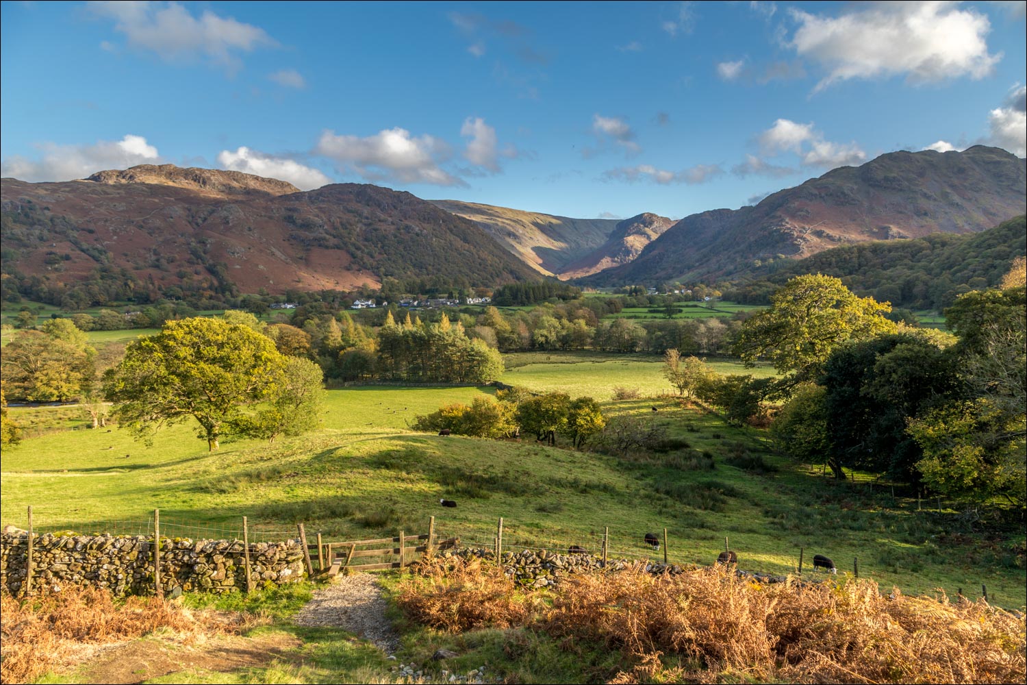
Autumn colours in Borrowdale at the start of the climb out of Seatoller

Looking back to Seatoller

Heading up to High Doat

Looking back

Sunbeams on Seathwaite at the head of the valley

The big toe of Rosthwaite Fell

Looking back to Seatoller, right of picture

High Doat ahead

Rosthwaite Fell

We traverse the top of High Doat

Castle Crag, the far point of our walk, comes into view in the centre

A down and an up follows as we aim for the path running beside the dry stone wall in the distance

We follow the path towards Castle Crag

Dramatic light looking back

Rosthwaite on the other side of Borrowdale


Rosthwaite again...

Borrowdale

Looking back to High Doat and the Borrowdale Fells...


We reach the hause below Castle Crag. From here it's only about 10 minutes to the top but time is running short for us so we give it a miss today

Derwent Water and Skiddaw in the distance

Rosthwaite Fell and Glaramara beyond High Doat

Great End, and Scafell Pike top right

The start of the descent back into Borrowdale via Lingy Bank

A couple of herdies

The head of Borrowdale

Looking back up Lingy Bank

We reach the valley floor and pass by (but don't cross) New Bridge as we follow the Cumbria Way for a short distance

We keep the River Derwent on our left

We pass by Borrowdale Youth Hostel Association, where old walking boots are put to good use

Looking along the River Derwent

A slightly awkward section where chains are fixed

A proud herdwick ram

We follow a path along the edge of Johnny Wood

Seatoller is just around the corner

A final look across Borrowdale at the end of a great walk
