
Route: Radicofani
Area: Italy, Tuscany
Date of walk: 9th October 2019
Walkers: Andrew and Gilly
Distance: 2.8 miles
Ascent: 700 feet
Weather: Sunshine and blue skies
On the last day of a wonderful walking holiday in Tuscany, we decided to visit the old hilltop town of Radicofani in the Val d’Orcia region. For centuries this was one of the most important strongholds in Italy. Its fortress can be seen from dozens of miles away, and it appears to dominate the village, where it guarded the border between the Grand Duchy of Tuscany and the Papal States for hundreds of years. Built just after the year 1000, the fortress was renovated many times over the centuries, partially knocked down in the 1700’s before being officially restored at the beginning of the last century
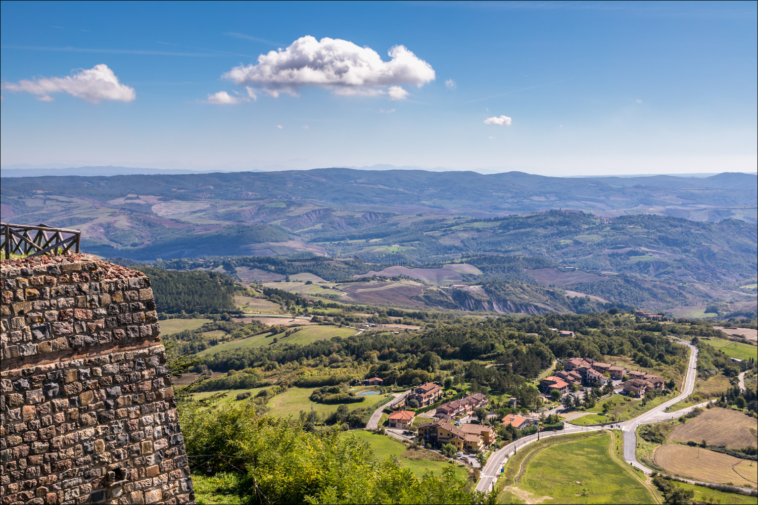
We parked at the western edge of the town and headed south along a lane, passing by the town graveyard and then climbing up to the castle entrance (a small fee is payable for entry). We wandered around the fortifications and then climbed a series of staircases up to the balcony at the top of the tower. From here we enjoyed huge views, from the entire Val d’Orcia to Monte Amiata, the Apennines and the Trasimeno and Bolsena lakes. This is arguably the most extensive viewpoint in the whole of Tuscany
After leaving the castle grounds we rejoined the road and after a short distance turned off to follow a green lane around the hillside. The views from there were restricted by trees and shrubs, but it was a pleasant stroll. We emerged at a road leading to the east end of the village. Here we followed the main street, Via Roma, which runs through the town. Radicofani is an attractive and unspoilt place, built in dark volcanic stone from nearby Monte Amiata, and we enjoyed a ramble through its old streets before arriving back at the start
It’s worth mentioning that although I’ve shown a walking route on the maps links, it’s a very short one and could easily be omitted from the itinerary – the main points of interest are the village itself and the fortress above
Click on the icon below for the route map
![]()
Scroll down – or click on any photo to enlarge it and you can then view as a slideshow

Before we set off for Radicofani, I made another dawn start - the curvaceous lumps and bumps of this wonderful landscape are best seen when the sun is low...

These photos were taken near San Quirico d'Orcia


San Pietro Apostolo Church in Radicofani at the start of today's walk...

The church was built in the 10th-11th centuries using local volcanic stone

We walk out of the village past the statue of Ghino di Tacco

Looking up to the isolated Rocca fortress, which we'll visit shortly

We leave the road at this bend...

...and climb through the ruins of Castle Morro , dating back to the 13th century

We arrive at the Rocca fortress (there's a small admission fee but it's good value)


View from the battlements

It's possible to climb up to the top of the tower, and we head for the staircase

Looking down to Radicofani


After climbing some steep and narrow stairs we arrive at the top of the tower - the views from here are huge

Val d'Orcia

Radicofani far below

Monte Amiata

We leave the fortress and join a grassy path to complete the short circuit around the hilltop...


We arrive back in the village of Radicofani and stroll around its old streets...


The end of an excellent short walk
Follow the link for more walks in Italy (23)
