
Route: Watendlath and Borrowdale
Area: Central Lake District
Date of walk: 29th January 2016
Walkers: Andrew
Distance: 7.9 miles
Ascent: 1,500 feet
Weather: sunny intervals, clouded over half way with some rain
Storm Gertrude, the latest in a long line of storms, had done its worst overnight and deposited yet more rain on an already saturated lakeland. The weather forecast indicated that there would be a break in the weather in the morning and this prediction turned out to be spot on as I headed over to Grange in the sunshine
I parked by the church and walked away from the River Derwent, turning left to join the Cumbria Way. The path followed the course of the swollen river, through stunningly beautiful landscape
When I reached Rosthwaite I crossed the Borrowdale road and started the climb up towards Watendlath. This isolated little hamlet is owned by the National Trust and is set next to an attractive tarn and surrounded by fells – a wonderful location
I set off on the long descent back into Borrowdale, following the course of Watendlath Beck all the way. The beck had clearly burst its banks in the floods and the route down was more like a stream than a footpath. On reaching the footbridge I turned left towards Lodore, passing a huge waterfall on the way down
The last short section was in poor light and rain along the roadside back into Grange but this didn’t put a dampener on what had been a fantastic walk
For other walks here, visit my Find Walks page and enter the name in the ‘Search site’ box
Click on the icon below for the route map (subscribers to OS Maps can view detailed maps of the route, visualise it in aerial 3D, and download the GPX file. Non-subscribers will see a base map)

Scroll down – or click on any photo to enlarge it and you can then view as a slideshow

Red squirrel in the garden the day before the walk

and a great spotted woodpecker next day, just before I set off for Grange

Start of the walk from Grange, looking along the River Derwent towards Castle Crag and High Spy

Walking through Grange

I follow a quiet country lane


I leave the lane at this junction to join the Cumbria Way

Dalt Wood

I cross the footbridge over Gowder Dub

Looking back along the Derwent

Low Hows Wood


Castle Crag


I emerge from the woods and walk across the foot of High Spy

Views of Borrowdale…


I join the bank of the Derwent again

I cross New Bridge - I suppose it was new once upon a time. There is a ford further along, but the river was running too high to make that an option

The cobbled path leading into Rosthwaite

Looking back to Castle Crag

Approaching Rosthwaite

As I enter the village I look up to the next part of the route - the climb up to Watendlath, situated below the hause

Walking through Rosthwaite


Having crossed the Borrowdale road I head for the bridge over Stonethwaite Beck

Lovely retrospective views into Borrowdale as I gain height

Bowdergate Gill was my constant companion during the climb


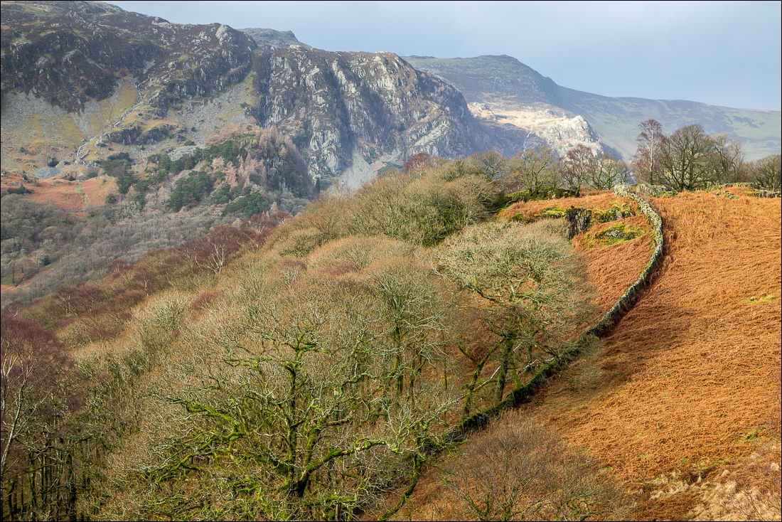
Good light on the crags of High Spy…


Looking back over Rosthwaite and the Borrowdale Valley


The highest point of the walk at about 1,100 feet

Watendlath

Watendlath Tarn

A swollen Watendlath Gill

The famous packhorse bridge was damaged during Storm Desmond, but the National Trust have built a temporary one

I don’t need to cross the bridge and so walk down the valley with the beck on my right


Looking back along Watendlath Beck

I turn left at this footbridge to descend to High Lodore


Descending towards the flooded head of Derwent Water

The Chinese Bridge, cut off by the floods

The last leg is alongside a footpath by the Borrowdale road

Back to the start - the double arched bridge at Grange
