
Route: Muker to Keld and back
Area: Yorkshire Dales
Date of walk: 27th January 2016
Walkers: Andrew
Distance: 7.1 miles
Ascent: 1,500 feet
Weather: heavy rain and showers at first, brighter later, very high winds
I parked in the village of Muker and waited in the car for a while for the torrential rain to stop. Fortunately it did and so I set off out of the village in the direction of the River Swale. The fields were sodden after all the recent rain, and the river was very swollen as I crossed the footbridge to join the path running above its bank
I wasn’t able to take many photos on the outward leg of the walk as there were regular showers, some of them very heavy, combined with a gale force wind which almost blew me over on a couple of occasions
When I reached Keld I walked along the Thwaite road for a short distance, then climbed up a path which runs round the flanks of Kisdon. I wasn’t far off the summit and it was tempting to make a short detour, but the gale force winds put me off
The weather by this time had improved and there were some sunny intervals, showing the glorious countryside in a good light. The last part of the walk was through typical limestone country, with dry stone walls and old barns enhancing the scenery. One fortunate by product of the recent rain was the condition of the various waterfalls in the Keld area – they were roaring with vigour and made a big contribution to a wonderful walk
For other walks here, visit my Find Walks page and enter the name in the ‘Search site’ box
Click on the icon below for the route map (subscribers to OS Maps can view detailed maps of the route, visualise it in aerial 3D, and download the GPX file. Non-subscribers will see a base map)

Scroll down – or click on any photo to enlarge it and you can then view as a slideshow

The start of the walk as I cross the bridge over Straw Beck to walk into Muker

I leave the village just beyond the church

Walking through fields towards the River Swale - the paved path has become a stream here


Looking along the valley

I’ll be following the far bank of the River Swale, and turn right here in order to reach the footbridge across it


I follow the track beside the river

It was raining heavily along this section and it was a case of grabbing the odd photo and trying the keep the lens dry

The path starts to rise above the river


Swinner Gill waterfall, in fine form


The path continues uphill beyond the waterfall…

…with fine retrospective views along the valley


Looking back along the track

Keld comes into view as I round the corner


Catrake Force

Walking into Keld

Old stone barns near Keld

Looking back to Keld as I leave the village

After a short walk along the road I turn off along a track by the barn ahead

Improving weather…

The start of a wonderful path which rises around the flanks of Kisdon

Looking back to Keld

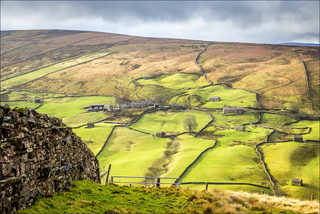
Lovely views across the valley


Looking back along the path towards Keld


Looking along the old Corpse Road…


Looking across to the limestone scar which I’d walked below earlier

The River Swale comes into view again as I start the descent back to Muker

Muker below, right of picture

I follow the path between the dry stone walls


A barn with a view

Muker below

Back in Muker and from here it’s a short stroll back to the car

On the way home I stopped the car a couple of times to admire the waterfalls gushing down the valley


Follow the link for more walks in the Yorkshire Dales (23)
