
Route: Wansfell Pike
Area: Far Eastern Lake District
Date of walk: 1st May 2021
Walkers: Andrew and Gilly
Distance: 7.7 miles
Ascent: 1,900 feet
Weather: Mixed cloud and sun
Today’s walk was a classic circuit which we’ve followed on several occasions before, although not for 4 years or so. There is interest and beauty almost every step of the way. We parked in the main car park in Ambleside and headed towards the centre of town. At a sign pointing ‘To the Waterfalls’ we did as instructed and followed a path along the right bank of Stock Ghyll, leaving the lane at another sign to follow a path which gives good views of the waterfalls. There had been little or no rain for many days, and in consequence the falls were not on top form
We left the woods via a wooden gate next to a revolving metal one and started the climb up to Wansfell Pike. The way is quite steep but has been made much easier in recent years thanks to the provision of a well made and unobtrusive rocky staircase. We were soon at the top of Wansfell Pike enjoying superb views back to Ambleside and across to Windermere. Wansfell Pike is not in fact the summit of Wansfell, as the highest point of the fell lies a short distance away to the north east. As the difference is only 15 feet or so, and since the views from the true summit are inferior, we were content with having climbed the Pike and started the gentle descent towards Troutbeck
We soon reached Nanny Lane, an old drovers’ road set between dry stone walls. This was a beautiful section of the walk with good views in various directions. The lane took us down into the village of Troutbeck, where we had a pot of tea and a bacon butty at the Old Post Office – a perfect half time interval. Suitably refuelled we set off on the homeward leg, turning right immediately after the cafe to join another walled track known as Robin Lane. We followed this around the lower flanks of Wansfell, through Skelghyll Wood and back into Ambleside to complete a superb circuit
For other walks here, visit my Find Walks page and enter the name in the ‘Search site’ box
Click on the icon below for the route map (subscribers to OS Maps can view detailed maps of the route, visualise it in aerial 3D, and download the GPX file. Non-subscribers will see a base map)

Scroll down – or click on any photo to enlarge it and you can then view as a slideshow

The day before the walk, late afternoon sunshine at the head of Buttermere...

...and Crummock Water

The start of today's walk as we leave the car park and walk past 17th century Bridge House, owned by the National Trust

We follow the sign to the waterfalls in Stockghyll Wood

We walk through Stockghyll Wood - the waterfalls were down to a trickle after a very dry month, and I didn't bother with a photo

We exit the wood at this revolving gate

An early view back over Ambleside at the start of the ascent

The ascent has been made easier in recent years by the provision of rock steps in places

Looking back over Ambleside, with the Langdale Pikes in the background on the right

Red Screes and the Kirkstone Pass

More views back to Ambleside...


Windermere from Wansfell Pike

Wray Castle and Blelham Tarn on the far side of Windermere

Gilly contemplates the way ahead - a descent to Troutbeck in the valley below

Looking across to Applethwaite Common, Dubbs Reservoir and Borrans Reservoir

We follow the easy path from Wansfell Pike

Windermere on our right


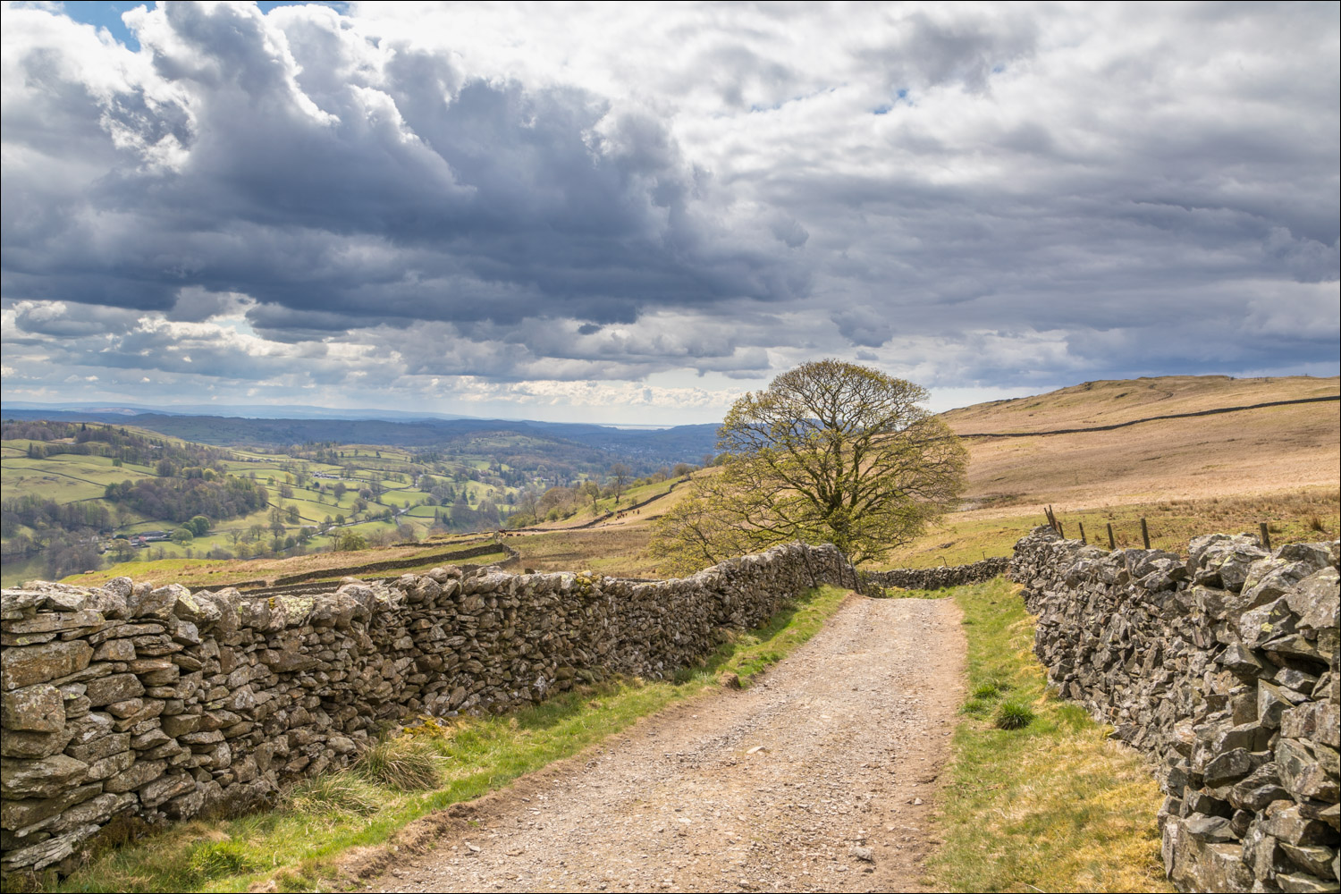
We arrive at ancient Nanny Lane, an old drovers' road which leads down into Troutbeck


Looking across to Yoke and Ill Bell

Morecambe Bay in the far distance...


More photos of the lovely descent into Troutbeck along Nanny Lane


Troutbeck below, where we had a pit stop at the excellent Old Post Office tearoom

We pass by Margaret's Well, one of three roadside wells built in the 18th century, the others being named St James' Well and St John's Well

We climb out of Troutbeck to start the return leg of the walk

We follow another old path, Robin Lane, which contours around the lower slopes of Wansfell...


At a junction with Hundreds Road we keep left and continue along Robin Lane

We're aiming for High Skelghyll, seen between the gap in the dry stone wall

Looking back along our path

Windermere on our left

We enter Skelghyll Wood...


Wild garlic in Skelghyll Wood, not quite yet in flower

We make a small there and back diversion to the viewpoint of Jenkin Crag

Ambleside below

Wetherlam in the background. From Jenkin Crag it's a short stroll into Ambleside and back to the car park

A final glance up to Wansfell Pike from the car park at the end of a very enjoyable walk
