
Route: Pike o’Blisco
Area: Southern Lake District
Date of walk: 28th April 2021
Walkers: Andrew and Gilly
Distance: 5.6 miles
Weather: Cloudy with sunny patches, cold and windy
Pike o’Blisco, described as Pike of Blisco on the Ordnance Survey maps, is a rugged fell near the end of Great Langdale, and its summit cairn can be seen from the valley. As Alfred Wainwwright observes, ‘a mountain has added merit if its highest point can be seen from the valley below, instead of being hidden beyond receding upper slopes, as is often the case’
We parked in the National Trust car park at the Old Dungeon Ghyll Hotel and gazed upwards at today’s objective. As we did so, three girls dressed in leisure wear and trainers asked us if we knew the way up any hills with good views ‘Scafell Pike perhaps’. They didn’t know where they were, where they wanted to go, and had no protective clothing, maps or equipment. I politely pointed out that they shouldn’t be venturing onto the fells without a map, that it would be freezing on the tops, and perhaps a valley walk would be better. They were no doubt disappointed with my unhelpful answer to their question, but it wouldn’t have been right to point them up a mountain
After leaving the car park we followed the valley road uphill, leaving it shortly after passing by Wall End. The path bypasses Kettle Crag and is quite easy going in its early stages, mostly thanks to a pitched path which has been laid by Fix the Fells
Near the top of Pike o’Blisco there are 3 steep scrambles up rock chimneys where walking poles become a hindrance and both hands have to be used. They are all short sections, which could prove awkward for canine companions, but are not unduly difficult
After climbing the final chimney we arrived at the top of the fell and visited both of its summit cairns. The weather had closed in by now and the views, though good, were not seen at their best. We followed the path down towards Red Tarn, which arrives at a col below the path to Crinkle Crags and Bowfell. From here we joined the path into Oxendale, which is steep at times but has been made easier by the addition of another pitched path
Back down at valley level we crossed the wooden footbridge over Oxendale Beck and from here it was a short stroll back to the start
For other walks here, visit my Find Walks page and enter the name in the ‘Search site’ box
Click on the icon below for the route map (subscribers to OS Maps can view detailed maps of the route, visualise it in aerial 3D, and download the GPX file. Non-subscribers will see a base map)

Scroll down – or click on any photo to enlarge it and you can then view as a slideshow

Earlier in the week, a fox by the pond

...and a female mallard with her new brood of 13 ducklings

Preparing for their maiden voyage


The next day, the start of the walk as we leave the Old Dungeon Ghyll car park. Our objective, Pike o'Blisco, is ahead

Looking back to the Langdale Pikes

Wall End Farm and Mickleden, a side valley of Great Langdale

The Langdale Pikes again

We leave the lane and join this track, which passes to the left of a small copse

A view back into Great Langdale, with our start point centre of picture

The path has been improved in places, thanks to Fix the Fells

Great Langdale again, with Side Pike illuminated by a patch of sunlight

Pike o'Stickle and Loft Crag, two of the shapely Langdale Pikes

The gradient steepens and becomes rockier near the top

One of three rock chimneys below the summit which involve a mild scramble and the use of hands

Summit cairn on Pike o'Blisco, looking into Great Langdale. Thick cloud had set in by this point

The Langdale Pikes are well seen from here

A stone shelter on the summit

We follow a path which will bring us down to the right of Red Tarn below

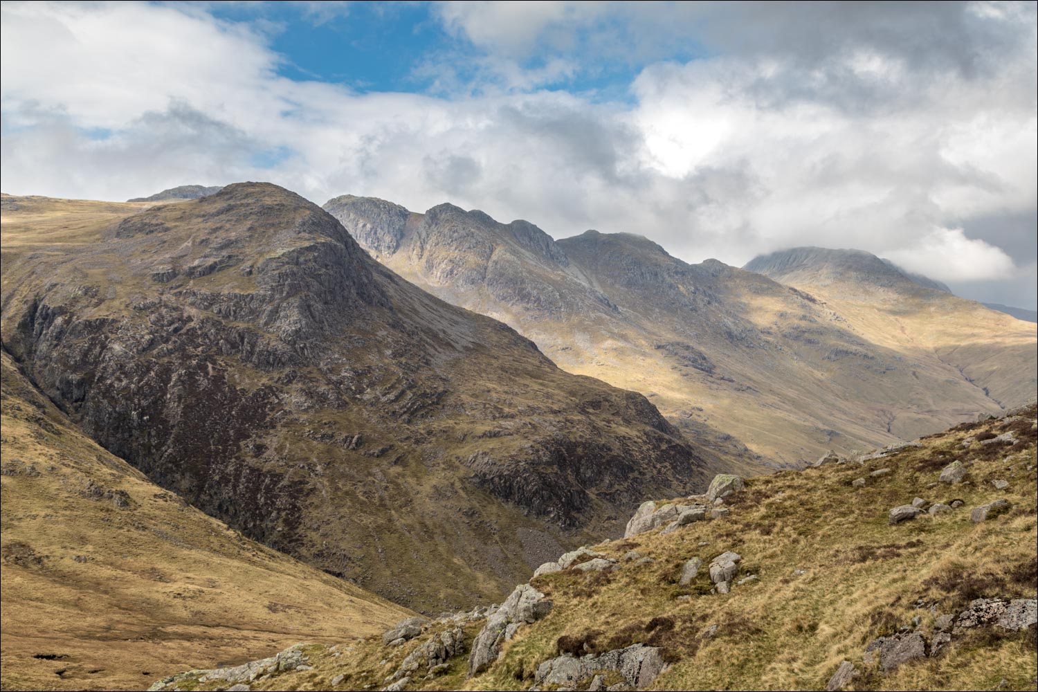
An improvement in the light as Gilly admires the view of Great Knott and Crinkle Crags

We aim for the col below

Swirl How beyond Red Tarn

The imposing face of Great Knott, with Crinkle Crags and Bowfell beyond...


Start of the descent into Oxendale, with some wonderful views ahead as we progress

The Band in shade, leading up to Bowfell

Pike o'Stickle comes into view

As with the ascent, the path has been improved in places

Oxendale Beck below

Good light on the Langdale Pikes as we continue to descend...


We head towards Markeens, with The Band behind it

Bowfell up on the left

The end is in sight - Great Langdale ahead

Oxendale Beck below the Langdale Pikes

Looking back along Oxendale to Bowfell

We reach the valley floor

We cross the footbridge over Oxendale Beck

Oxendale

Entering into Great Langdale

Stool End below

We arrive at the valley road and follow it for a short distance

A final glance back to Pike o'Blisco, left of picture

We cross the bridge over Great Langdale Beck, and the end of the walk is just around the corner

On the way back we stopped the car to admire the view back along Great Langdale
