
Route: Walla Crag
Area: Central Lake District
Date of walk: 16th October 2020
Walkers: Andrew
Distance: 3.6 miles
Ascent: 1,000 feet
Weather: Overcast, some drizzle and rare patches of sun
It’s been over a year since I last visited one of my favourite fells, Walla Crag near Keswick
As on the last occasion, I parked in the National Trust car park at Great Wood and followed the footpath heading south along the wood. I ignored the first sign pointing to Walla Crag, which leads to the summit via a more circuitous route. I carried on a little further and arrived at the ominous sign ‘Cat Gill – very steep!’
The Cat Gill path is indeed steep and rocky (and is much easier to ascend than descend) but there are no dangers. Hands aren’t needed and it provides a very quick way to the top. Much of the path is a rocky staircase, part man made and part natural. There are some attractive waterfalls along the way. Before long I arrived at Lady’s Rake from where it’s a short stroll to the summit. From here there are superb views over Derwent Water and to Bassenthwaite Lake beyond
I retraced my steps to Lady’s Rake and then followed the path which leads up to Bleaberry Fell, but soon branched off that to walk above Falcon Crag in the direction of Borrowdale. There are lovely views into the valley from here, and this section coincided with a rare patch of good light. I descended gently to Ashness Bridge, a popular beauty spot, where I took the obligatory photo to add to the thousands that have been taken from here
This marked the start of the return leg and, from the bridge, I followed a path above the road and below Falcon Crag, with views over Derwent Water all the way. These were not well seen today thanks to grey skies and light rain. The path brought me back to Cat Gill and after crossing the footbridge I retraced my steps to the start
For other walks here, visit my Find Walks page and enter the name in the ‘Search site’ box
Click on the icon below for the route map (subscribers to OS Maps can view detailed maps of the route, visualise it in aerial 3D, and download the GPX file. Non-subscribers will see a base map)

Scroll down – or click on any photo to enlarge it and you can then view as a slideshow

From the National Trust car park I follow a path heading south through Great Wood

I ignore the first sign to Walla Crag, which involves a more circuitous route

This is my preferred route, beside Cat Gill. It is steep but there are no dangers

It's impossible to go astray, as there's a dry stone wall on the left and Cat Gill on the right throughout the ascent

One of several waterfalls in Cat Gill

Looking back down the path

Early autumn colours in Great Wood

I emerge from the wood to this view of Derwent Water and Catbells

I continue beside the dry stone wall

Looking back over a ladder stile which I'd climbed in order to get to the summit

From the summit of Walla Crag, looking north over Derwent Water and Keswick to Bassenthwaite Lake

Keswick, and Skiddaw in the clouds

I descend from Walla Crag and follow the path towards Bleaberry Fell, but will fork off right beyond this point

I pass above Cat Gill

Derwent Water islands

Looking back on the ascent path beside the dry stone wall

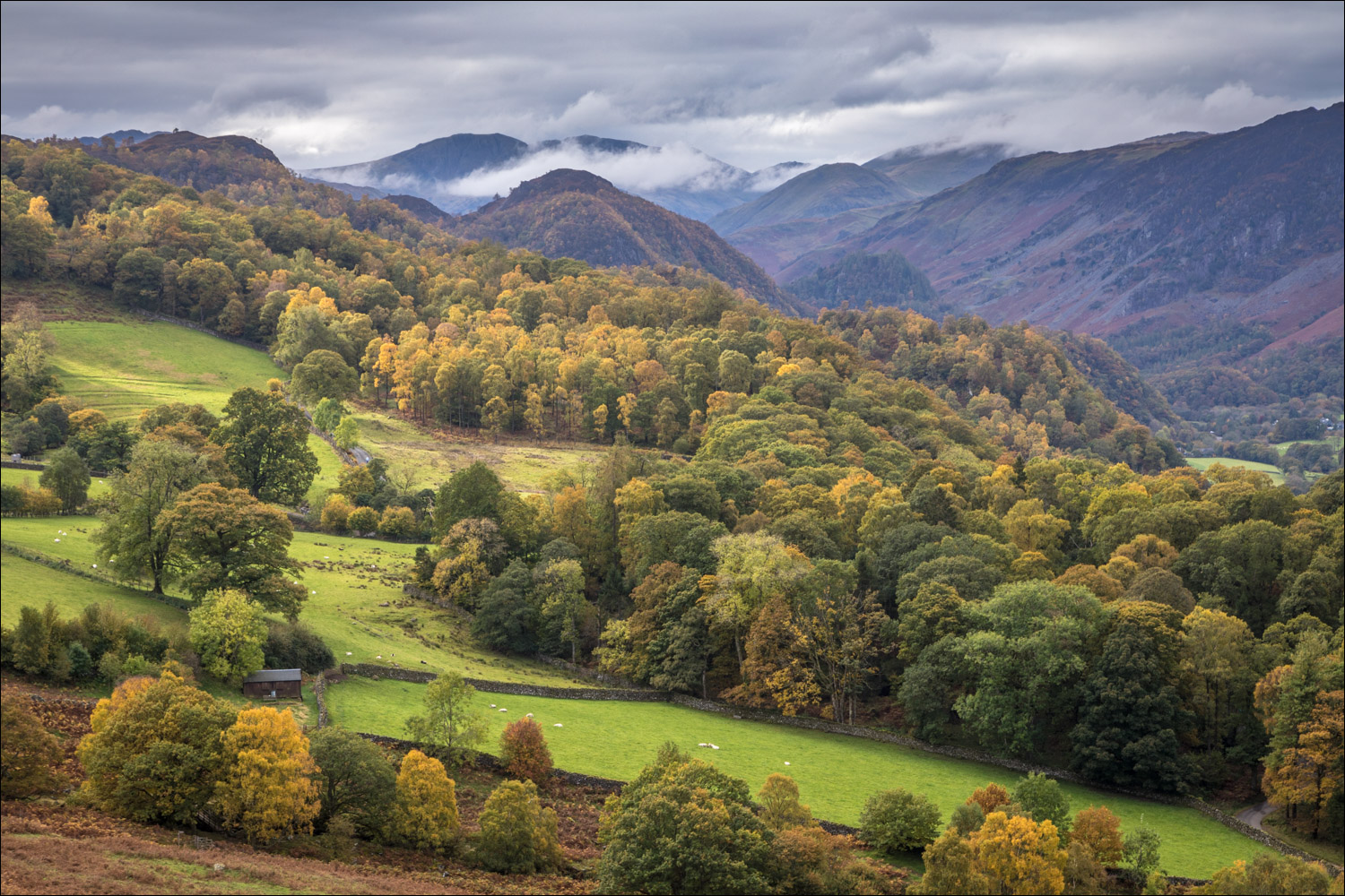
Views of Borrowdale start to command the attention as the path passes above Falcon Crag

Ashness Farm on the left and King's How on the right

One of the Keswick Launches passes by Barrow Bay

The weather was indifferent for most of today's walk, so it was fortunate that a rare patch of sun coincided with the best of the scenery

King's How centre of the picture

Ashness Bridge below

The path descends in the direction of Ashness Farm

I turn right here (there's a choice of two paths, one before the gate and one after it)

For the record, the obligatory photo of Ashness Bridge

Just beyond the bridge, I join a path above the road which I'll follow back to the start

Derwent Water

Looking back to the head of Derwent Water - light rain had set in at this point


Derwent Water islands

Looking back to Falcon Crag

I arrive back at Cat Gill and cross the footbridge by this waterfall

From Cat Gill I retrace my steps through Great Wood back to the start
