
Route: Tarn Hows
Area: South Western Lake District
Date of walk: 14th January 2015
Walkers: Andrew
Distance: 6.5 miles
Weather: Mostly overcast with a few breaks in the cloud. Very cold
Tarn Hows, or The Tarns, is one of the most visited spots in Lakeland, and can be a little too busy at peak times. The tarn is partly artificial, being three tarns joined together in the 19th century, and most of the trees surrounding it are conifers. There is a very easy path around its circumference which is accessible to wheelchairs
I parked in the National Trust car park at Glen Mary Bridge and followed climbed up the path beside Tom Gill. There had been some overnight snow and it was quite slippery underfoot. The waterfalls were in good form as I worked my way up to the iconic beauty spot which is Tarn Hows
The tarn was looking as lovely as ever as I followed the easy path round its eastern shore. It was tempting to do a circuit of the tarn, but instead I headed away from it and onto Oxen Fell on the other side of the A593
The track across Oxen Fell took me past the spectacular slate quarry at Hodge Close, a massive excavation about 150 feet deep
I then walked round the flanks of Holme Fell back to the start. This is a great walk, whatever the weather
For other walks here, visit my Find Walks page and enter the name in the ‘Search site’ box
Click on the icon below for the route map (subscribers to OS Maps can view detailed maps of the route, visualise it in aerial 3D, and download the GPX file. Non-subscribers will see a base map)

Scroll down – or click on any photo to enlarge it and you can then view as a slideshow

At the car park, I cross this footbridge over Tom Gill and follow the left bank of the gill uphill

The first of several waterfalls as I climb up the path


Bonnie


Just before Tarn Hows

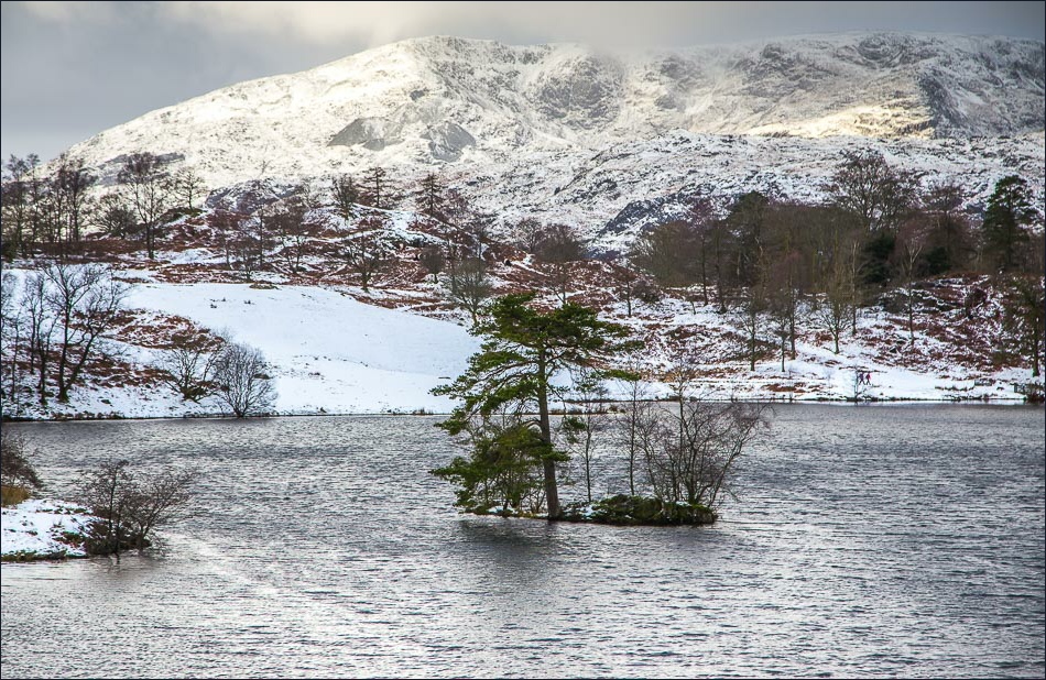
Tarn Hows- I follow the lakeshore path ahead


Footbridge at the far end of the tarn

I join a path running along the feet of High and Low Arnside


Having crossed the A593, I enter onto Oxen Fell


Looking across to the Tilberthwaite Fells

Old barn at High Oxen Fell

High Oxen Fell Farm

Mind how you go - I’ve arrived at Hodge Close Quarry


Walking round Holme Fell

Most of the trees in this wood had their bark stripped - deer I presume


A mono photo of Holme Ground below

Walking by the Yewdale Fells

High Yewdale

Herdwick rams at Yew Tree Farm

The famous Yew Tree Farm - the end of the walk is just around the corner
