
Route: Sale Fell
Area: North Western Lake District
Date of walk: 1st January 2022
Walkers: Andrew and Gilly
Distance: 3.1 miles
Ascent: 800 feet
Weather: Mostly cloudy – blowing a gale on the tops
Standing at a height of 1,170 feet, Sale Fell is one of the lowest lakeland fells as classified by Wainwright, and is also one of the easiest to climb. This makes it a good choice for a walk during the short days of winter. Another bonus of the fell is that it is situated at the very edge of the Lake District and is therefore relatively quiet. Some of the more popular fells are best avoided during holiday periods such as this
We parked by St Margaret’s Church Wythop and followed the public footpath sign at the entrance gate. The path took us through the church grounds, and we exited them via a gate at the rear.
The gentle climb started immediately and before long there were some good views of Bassenthwaite Lake. The path continued beside Wythop Woods, part of which has been felled along this section. We were keen to revisit Lothwaite and the ridge along it, as there are fabulous views from here, superior to those from Sale Fell itself. We followed the grassy path to Lothwaite and walked along the ridge towards the subsidiary hill of Rivings. The views across Bassenthwaite Lake and into the Lake District were good, but many of the fells were obscured by low cloud
We then continued up the grassy slopes, past Rivings, to the summit of Sale Fell. The Skiddaw fells are well seen from here, but nearby Lord’s Seat conceals most of the mountains of the interior.
It was blowing a gale on the top, and difficult to stand up straight, so without ado we started the easy descent, which continues in the same direction of travel, and followed a wide grassy path. This took us down the nose of the fell, where we joined a lower level path which took us back to the start of the walk – a perfect way to celebrate New Year’s Day
For other walks here, visit my Find Walks page and enter the name in the ‘Search site’ box
Click on the icon below for the route map (subscribers to OS Maps can view detailed maps of the route, visualise it in aerial 3D, and download the GPX file. Non-subscribers will see a base map)

Scroll down – or click on any photo to enlarge it and you can then view as a slideshow
The day before the walk, a red squirrel in the garden

Looking back to St Margaret's Church at the beginning of today's walk

The start of the climb up Sale Fell

Looking back to Embleton

We pass through a wall gap

Another view back towards Embleton

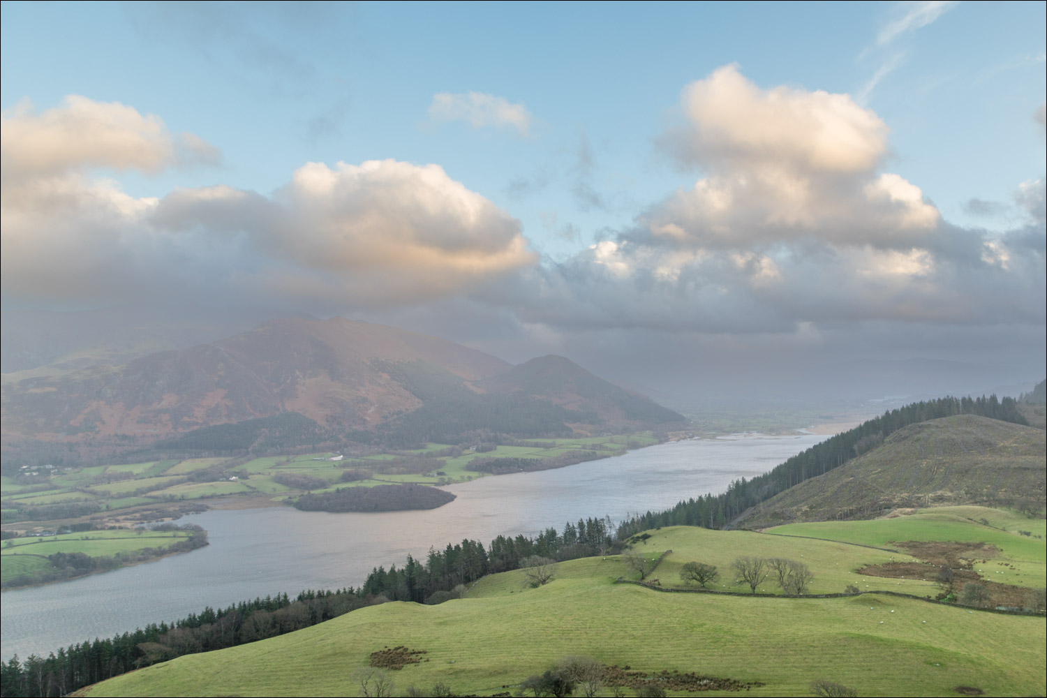
Bassenthwaite Lake

We enter onto open fellside

We ford an unnamed beck

The path curves around to the right to climb up to Lothwaite

Views of Bassenthwaite Lake and Skiddaw as we follow the path around Lothwaite...


Summit of Lothwaite


We head away from Bassenthwaite in the direction of Sale Fell, right of picture

Looking back to Lothwaite

Sale Fell ahead - it's an easy climb up the grassy slopes

Looking back

Summit of Sale Fell, looking back along our route

The start of the descent, heading west

We'd set off quite late in the day and by now the light was fading

Just beyond this point we turn right at a dry stone wall to head back to the start...


Bassenthwaite Lake appears again

The end of the walk, and a great start to the New Year
