
Route: Brackenthwaite Hows
Area: Western Lake District
Date of walk: 2nd January 2022
Walkers: Andrew, Gilly, James and Nicola
Distance: 2.8 miles
Ascent: 800 feet
Weather: Cloudy, strong winds
Brackenthwaite Hows, known locally as Lanthwaite Hill, is one of my favourite places in the Lake District. This place has featured on my site many times, but I take the view that no two walks are ever the same – changing seasons and variations in the light and weather make for an infinite number of possibilities – and there’s always something new to be seen
The hill and surrounding woodland have recently been purchased by the National Trust, which will preserve this place for future generations
We decided to vary our usual route, and this time we parked in one of the free spaces by Lanthwaite Green Farm. We crossed the Buttermere road and headed towards Whin Ben, a ridge which leads up to Whiteside. After crossing the footbridge over Liza Beck we followed the delightful path above Lorton Vale. We kept a sharp lookout for Beck House on our left and when we drew level with it we left the valley path and passed through a gate. The path descended to Liza Beck, which we crossed for the second time and immediately after that we crossed the Buttermere road. We passed by Pickett Howe and started the climb up the slopes of Brackenthwaite Hows, following a faint path not shown on the OS maps
We were soon on the top of the hill admiring the wonderful views in all directions, though we could have wished for better light. We descended towards Crummock Water and entered Lanthwaite Wood via a deer gate. We then followed a path beside a dry stone wall at the edge of the wood. Near the edge of the wood we followed a path out of it back to Lanthwaite Green and the end of an enjoyable short walk
For other walks here, visit my Find Walks page and enter the name in the ‘Search site’ box
Click on the icon below for the route map (subscribers to OS Maps can view detailed maps of the route, visualise it in aerial 3D, and download the GPX file. Non-subscribers will see a base map)

Scroll down – or click on any photo to enlarge it and you can then view as a slideshow
Red squirrel in the garden before we set off on our walk

The start of the walk as we head across Lanthwaite Green in the direction of Whin Ben, with Grasmoor on the right

I'd visited the same spot yesterday and seen Grasmoor in much better light

We cross the footbridge over Liza Beck, which flows down between Whiteside and Grasmoor

Looking back to the start, with Crummock Water and Mellbreak beyond

We follow the path by the dry stone wall, with Lorton Vale on our left...


Looking back along the path

Our target, Brackenthwaite Hows, on the far side of Liza Beck

We leave the valley path here to head towards Brackenthwaite Hows

Looking back after crossing Liza Beck

We walk past Pickett Howe

Start of the climb up Brackenthwaite Hows

Lorton Vale from a rock outcrop along the ridge

We continue along the ridge towards the highest point of the hill...


James, Gilly and Nicola at the top of Brackenthwaite Hows, also known as Lanthwaite Hill

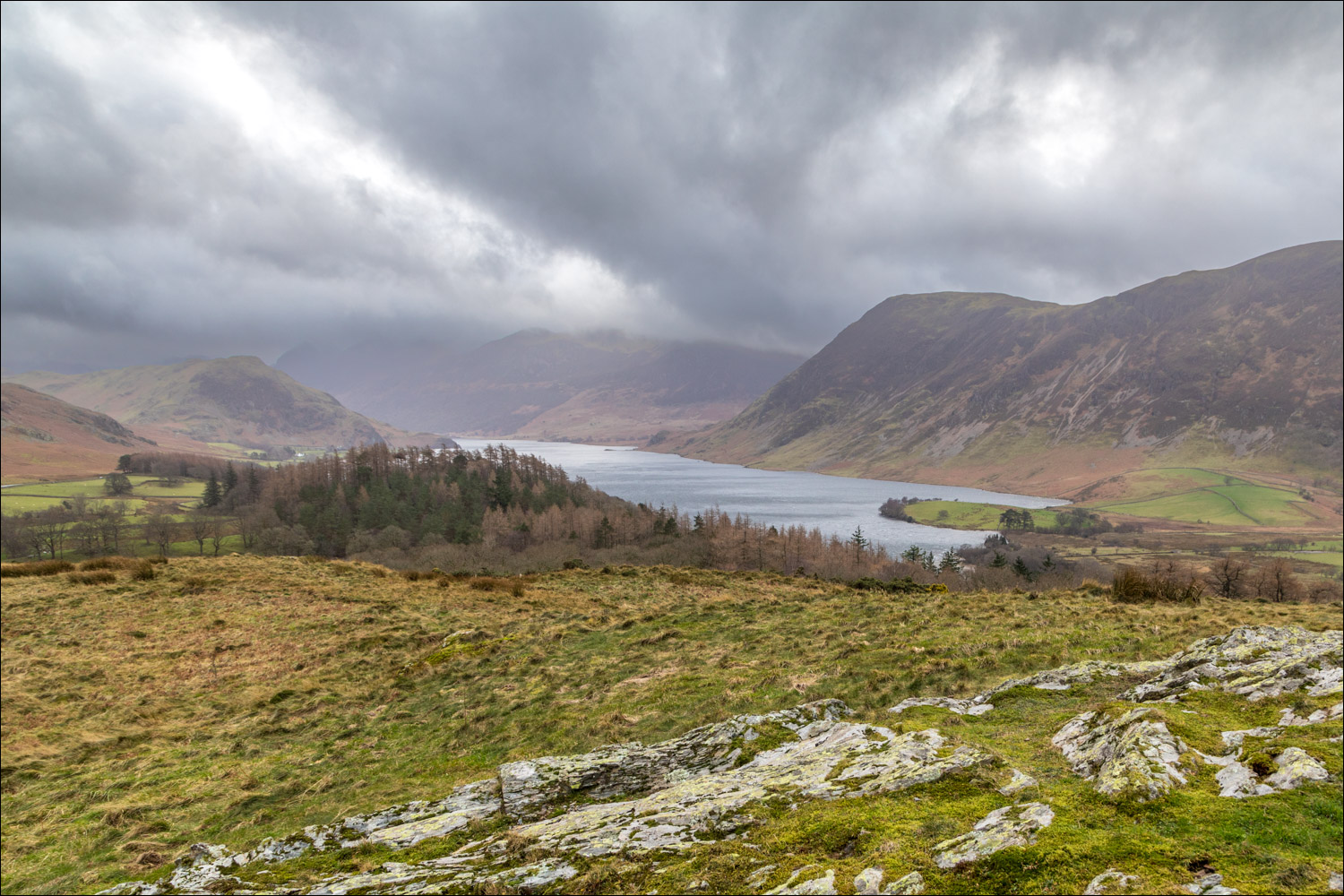
Crummock Water

Loweswater - the lake itself is at the foot of the fells in the background

We descend in the direction of Crummock Water

Lanthwaite Green at the foot of Grasmoor, and Rannerdale Knotts on the right

Lanthwaite Wood ahead

We pass through the deer gate and enter into Lanthwaite Wood...

The foot of Grasmoor

We follow the path by the dry stone wall at the edge of the wood

Looking across to Lanthwaite Green Farm, where we'd started our walk

We leave Lanthwaite Wood and head in the direction of Whiteside

The path to Lanthwaite Green Farm, and the end of the walk
