
Route: Robin Hood’s Bay
Area: North Yorkshire
Date of walk: 14th October 2017
Walkers: Andrew and Gilly
Distance: 7.1 miles
Ascent: 900 feet
Weather: Cloudy at first, turning sunny. Warm
We parked in the main car park above the old fishing village of Robin Hood’s Bay and followed the sign for the Cleveland Way. The path passes a few houses on the outskirts before emerging onto the cliff tops and the start of the coastal path. There were some good views back to the village, though the weather was rather overcast at this point – it would soon improve
Navigation is a simple affair, and it’s just a question of keeping the sea on your right as the path undulates along the cliff tops
The weather gradually improved and it was with some reluctance that we turned inland at Northcliffe Holiday Park to set out on the return leg. After a short road section we arrived at the Cinder Track, which is an old railway track formerly running between Whitby and Scarborough. We’ve walked on the track before, but not this particular section of it, and it made for a superb way back to Robin Hood’s Bay, with views out to sea for much of the way
Fast progress can be made along the Cinder Track and before long we arrived back in Robin Hood’s Bay. We strolled down into the old part of the village, dipped our boots in the sea, and climbed back up to the car park to end a wonderful coastal walk
For other walks here, visit my Find Walks page and enter the name in the ‘Search site’ box
Click on the icon below for the route map (subscribers to OS Maps can view detailed maps of the route, visualise it in aerial 3D, and download the GPX file. Non-subscribers will see a base map)

Scroll down – or click on any photo to enlarge it and you can then view as a slideshow

The start of today's walk - we follow the sign for the Cleveland Way and will return via the cinder Track

Rocket Post Field...

...and the rocket post, once used by the coastguard to practice rescuing shipwrecked sailors

The North Sea

Looking back to Robin Hood's Bay


The ups and downs of the coastal path....


Looking along the coast towards Whitby

Normanby Stye Batts

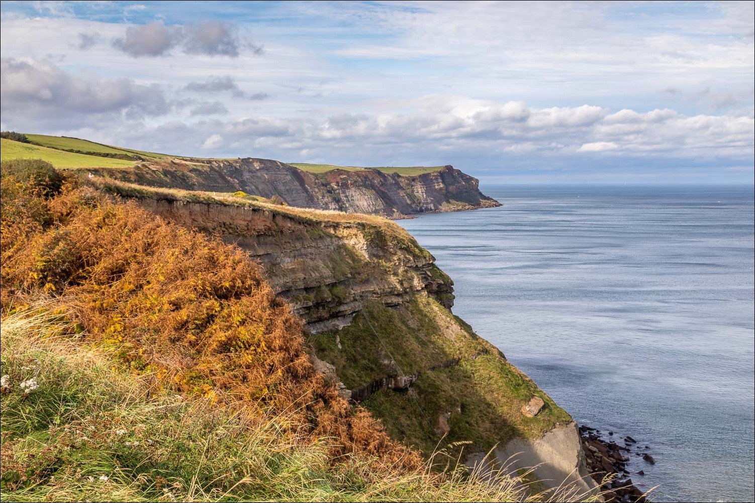
Looking back along our path


Another view back as the weather gradually improves


We leave the Cleveland Way here to climb up to Northcliffe Holiday Park (where refreshments are available)

Looking back

After a short road section, we are now on the Cinder Track back to Robin Hood's Bay


Looking down on the path we'd followed earlier


We pass by an old barn...


We arrive back in Robin Hood's Bay and descend to the old part of the village

The Bay Hotel, and the official end of the Coast to Coast Walk - happy memories

High tide

We retrace our steps back up to the car park

The end of a wonderful walk...

...but not the end of the day. Half an hour later we are in Pickering, where it's World War 2 Weekend

This is a popular annual event, attracting visitors from all over the UK and abroad

A few photos, processed so as to be in keeping with the times...


The end of a day packed full of interest and enjoyment
