
Route: Tarn Hows
Area: Southern Lake District
Date of walk: 18th October 2017
Walkers: Andrew and Gilly
Distance: 6.3 miles
Ascent: 1,000 feet
Weather: Sunny, turning cloudy
Tarn Hows is a well known beauty spot – too well known it might be said – and if you prefer to walk in relative solitude it’s best to arrive early or out of season. The tarn is partly artificial, having been formed in the 19th century by merging three small tarns. I wanted to try out a different route today, and so we parked in the Monk Coniston car park at the head of Coniston Water (Waterhead)
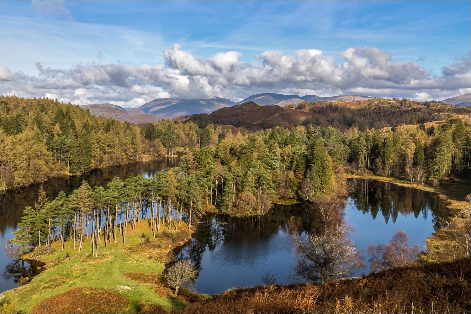
After admiring the view along the lake we crossed the road and walked through rolling parkland, passing through the walled garden of Monk Coniston, owned by the National Trust. There then followed a long uphill walk through woodland which eventually brought us to Tarn Hows. There are two paths along the eastern side of the tarn, and we took the high level one which has vastly superior views, and is also much quieter than the lakeside path. We detoured at one point to walk along a rocky outcrop which enjoys glorious views over the tarn to the Langdale Pikes beyond
We then descended to Rose Castle Plantation and joined the path along the other shore which was rather too busy for our liking, and we were glad to reach the foot of Tarn Hows and start the walk back to Coniston Water. We followed deserted paths through the beautiful scenery of Yewdale, with lovely views of the surrounding Yewdale Fells and in the latter stages along the length of Coniston Water
The path gradually descended to Boon Crag Farm, where we joined the bridleway which leads into Coniston. We followed this as far as the head of the lake and from here it was a short stroll along a path beside the road back to the car park. By now the skies had clouded over but no matter as we’d been privileged to see Tarn Hows looking its best in glorious conditions
For other walks here, visit my Find Walks page and enter the name in the ‘Search site’ box
Click on the icon below for the route map (subscribers to OS Maps can view detailed maps of the route, visualise it in aerial 3D, and download the GPX file. Non-subscribers will see a base map)

Scroll down – or click on any photo to enlarge it and you can then view as a slideshow

Head of Coniston Water from the car park

Looking along the lake


We walk through the parkland towards Monk Coniston Hall,,,


Looking back

A couple of herdies

The path takes us through the walled garden of Monk Coniston Hall

Japanese maple beyond the hall

We follow an easy uphill path through Hill Fell Plantation...


On arriving at the tarn we stay on the higher path

We leave the path for a short distance and head for the rocky outcrop to the left...

...and this is why - the views of Tarn Hows, here with the Langdale Pikes in the background

Looking down to the lower path

More of those wonderful views...


The path gradually descends to the edge of the tarn

Belted Galloways

Reflections in the tarn...


We follow the easy path around the other side of the tarn


We arrive at the foot of the tarn

A final look back before we head back to Coniston Water

We follow a delighful path towards Yewdale and the Yewdale Fells...


We turn right just before this ruined barn


Looking towards Holme Fell

We pass by Tarn Hows Cottage

We follow a path through the fields beyond the cottage

Coniston Water comes into view...

Head of the lake beyond Boon Crag Farm

We follow the bridleway beside the road to end a wonderful walk
