
Route: Nut Wood and Wauldby
Area: East Yorkshire
Date of walk: 1st May 2026
Walkers: Andrew and Gilly
Distance: 4.2 miles
Ascent: 200 feet
Weather: Sunny
Nut Wood is owned and managed by the Woodland Trust. Parts of the wood date back to the 13th century. It is surrounded by rolling agricultural land typical of the East Yorkshire Wolds. I’ve visited the wood in years gone by, as there is a good display of bluebells here – the wood is known as ‘Bluebell Wood’ locally. I wasn’t aware of the carpets of wild garlic which appear in early May – thanks to a friend for tipping me off that this would be a good time to visit
We parked opposite Raywell House, where the roadside parking spaces have recently been extended to include a laid out parking area. After crossing the road we entered into Nut Wood. Public footpaths run along both edges of the wood, but at this time of year it’s better to follow the permissive paths which run through the middle of it, as this is where the flora flourishes. We could smell the wild garlic, also known as ransoms, before we could see it. As we walked through Nut Wood there were swathes of the plant carpeting the floor, a wonderful sight. Other wildflowers, including, bluebells, stitchwort and red campion enhanced the scene
At the end of the wood we descended into Wauldby Scrogs, an area of wood pasture, and followed a path along Wauldby Green where I used to go tobogganing as a child. We continued up to Turtle Hill and then turned left to join the Yorkshire Wolds Way, a long distance route which we walked ten years ago. We headed south, leaving the Wolds Way at Wauldby Dam to walk through agricultural land to Little Wauldby Farm, turning left here to return to Nut Wood. This completed our circuit and gave us another chance to enjoy the wild garlic again as we followed paths through Nut Wood back to the start
For other walks here, visit my Find Walks page and enter the name in the ‘Search site’ box
Click on the icon below for the route map (subscribers to OS Maps can view detailed maps of the route, visualise it in aerial 3D, and download the GPX file. Non-subscribers will see a base map)

Scroll down – or click on any photo to enlarge it and you can then view as a slideshow

Entrance to Nut Wood. Public footpaths are to the left and right, but we follow the permissive path leading directly into the wood

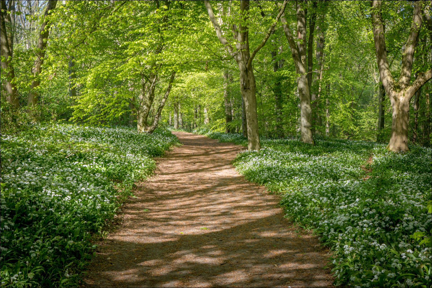
The sight and scent of wild garlic as we follow the paths through the heart of Nut Wood...


Other wildflowers to be found here at this time of the year are red campion...

Bluebells...

...and stitchwort

Approaching the end of Nut Wood

We leave the wood and follow the path downhill

Path through Wauldby Scrogs, an area of wood pasture

Fresh foliage and blossom lining the way...


Cherry blossom

We pass by Fox Covert on the left

We turn off here and join the Yorkshire Wolds Way for a short distance...


Looking back over Wauldby Green

We continue along the Wolds Way

Wauldby Green

Having turned off the Wolds Way at Waulby Dam we head over the wold on the return leg

We follow the path across agricultural land, with views of the Humber Bridge on our right

Just beyond Little Wauldby Farm we turn left

A vivid yellow field of rapeseed

We turn right at the sign to re-enter Nut Wood

We retrace our steps through the wood, with a couple of minor variations along the way...


We arrive back at the end of a perfect spring woodland walk
