
Route: Loweswater from Maggie’s Bridge
Area: Western Lake District
Date of walk: 1st August 2015
Walkers: Andrew and Gilly
Distance: 5.8 miles
Weather: Perfect
This is one of our favourite local walks which, in the space of 6 miles, manages to cram in a huge variety of scenery including farmland, ancient woodland, a lake, a tarn, open moorland and a lonely valley. Along the way there are wonderful views over the Solway Plain looking north (including Scotland in clear weather) and to the high lakeland fells looking south
We parked as usual at Maggie’s Bridge and walked along the track through High Nook Farm. Beyond the farm the terraced path (which is an ancient coffin road from Loweswater to St Bees) gains height and passes above Holme Wood, with wonderful views of Lorton Vale
After reaching the end of the lake, the path heads away from the fells towards gentler rolling countryside, before turning back at the half way point towards Loweswater
We walked through Holme Wood along the side of the lake and then across fields back to Maggie’s Bridge
The weather today was superlative, making a great walk even greater
For other walks here, visit my Find Walks page and enter the name in the ‘Search site’ box
Click on the icon below for the route map (subscribers to OS Maps can view detailed maps of the route, visualise it in aerial 3D, and download the GPX file. Non-subscribers will see a base map)

Scroll down – or click on any photo to enlarge it and you can then view as a slideshow

Red squirrels in the garden before we set off this morning


Later that morning, we parked at Maggie’s Bridge and crossed over Dubs Beck

Holme Wood and Carling Knott - our path will take us above the wood

Meadow before High Nook Farm

Dry stone walling in progress near the farm

After passing through the farm we enter onto open fellside

Looking back towards Low Fell, Whiteside and sweet Lorton Vale

Low Fell, which punches above its weight - the view from the top is one of the best in lakeland

Approaching the head of the valley, where we will turn sharp right

The delightful path which rises up along the flank of Carling Knott, with amazing views to the right…

Whiteside and Grasmoor

Crummock Water

The edge of Holme Wood

Looking back along the path to Highnook Tarn and Gavel Fell

Looking across to Whiteside and Grasmoor

Mellbreak on the right - we tried without success to spot our son James who was on a fell run up there

Crummock Water

Hen Comb

Walking above Holme Wood

Bonnie is enjoying the walk as much as we are

Looking back along the path

As we gain height, and again looking back, Crummock Water comes into view

Loweswater below and Scotland in the distance

Loweswater again from this wonderful elevated path

Looking back along Loweswater to Crummock Water

Holme Wood


The Solway Firth and Scotland in the distance as we reach the north western edge of lakeland

Another view back to the fells

The half way point near Fangs Brow as we head back in the direction of Hudson Place

Walking towards Iredale Place

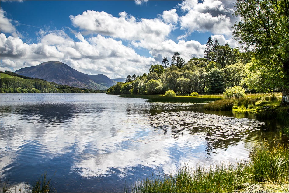
Loweswater comes into view again

We follow the heavenly path along the shore of the lake…


Darling Fell

Grasmoor

The path through Holme Wood - we fork left in order to keep to the shore of Loweswater

Holme Wood - a magical place

We walk past the bothy on the edge of the lake

Crossing Holme Beck

Looking back along Loweswater from the edge of Holme Wood

Walking away from Loweswater and looking towards Whiteside and Grasmoor

Almost back to the start
