
Route: Lorton Vale
Area: Western Lake District
Date of walk: 21st April 2023
Walkers: Andrew and Gilly
Distance: 3.0 miles
Ascent: 800 feet
Weather: Sunny
Apologies to regular visitors for the lack of recent posts. Two months ago I underwent a partial knee replacement operation. The recovery has been going well and I decided to take the new knee for its first proper outing. I chose one of my favourite places, Lorton Vale.
Brackenthwaite Hows, otherwise known as Lanthwaite Hill, is situated near the head of the vale. This place has featured on my site many times, but I take the view that no two walks are ever the same – changing seasons and variations in the light and weather make for an infinite number of possibilities – and there’s always something new to be seen
As on the last occasion here we parked in one of the free spaces by Lanthwaite Green Farm. We crossed the Buttermere road and headed towards Whin Ben, a ridge which leads up to Whiteside. After crossing the footbridge over Liza Beck we followed the delightful path above Lorton Vale. It felt wonderful to be striding out along this familiar path, with lovely views along the valley. We kept a sharp lookout for Beck House on our left and when we drew level with it we left the valley path and passed through a gate. The path descended to a very boggy area before Liza Beck, which we crossed for the second time and immediately after that crossed the Buttermere road. We passed by Pickett Howe and started the easy climb up the slopes of Brackenthwaite Hows, following a faint path not shown on the OS maps. There will be a profusion of bluebells growing on these slopes in May
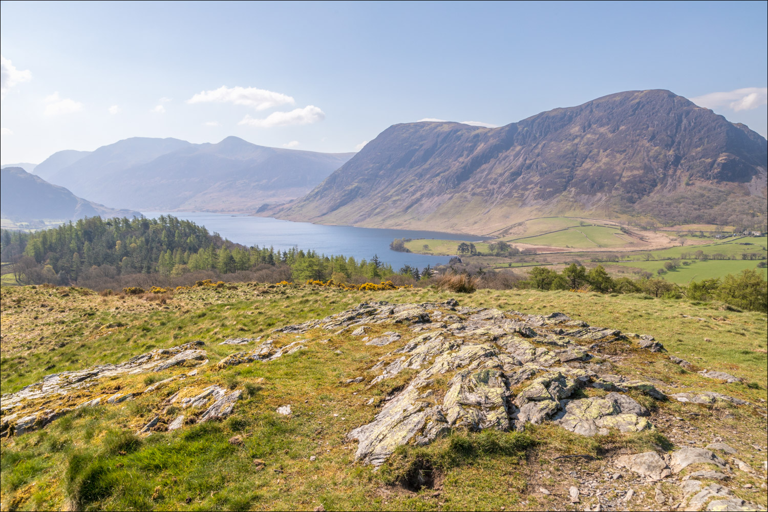
We were soon on the top of the hill admiring the views in all directions – Crummock Water and the western fells ahead, Loweswater on the right, Lorton Vale stretching out behind us and Whiteside and Grasmoor on the left. It was blowing a gale on the top so we didn’t linger despite the glorious views
We descended towards Crummock Water and entered Lanthwaite Wood via a deer gate. We then followed a path beside a dry stone wall at the edge of the wood. Near the edge of the wood we followed a path out of it back to Lanthwaite Green and to the end of the walk. My new knee had been struggling in the latter stages and for the rest of the day I could hardly move it. I’d clearly done too much too soon and it will be some time yet before I can get back onto the fells. I had no regrets though, the pleasure of the walk exceeded the pain which followed
For other walks here, visit my Find Walks page and enter the name in the ‘Search site’ box
Click on the icon below for the route map (subscribers to OS Maps can view detailed maps of the route, visualise it in aerial 3D, and download the GPX file. Non-subscribers will see a base map)

Scroll down – or click on any photo to enlarge it and you can then view as a slideshow

Some garden wildlife spotted while I recovered from my knee operation - heron (with frog) in February

A robin in the snow in March - this year's Christmas card sorted

...and plenty of red squirrel activity during April

The start of my first walk in three months, and a view of Mellbreak from the car park at Lanthwaite Green

We cross the Buttermere road and head towards the Whin Ben ridge which leads up to Whiteside

Looking back to the start, with Crummock Water appearing below Mellbreak

We cross the footbridge over Liza Beck, which tumbles down the Gasgale Gill valley

We join the path beside a dry stone wall which continues for several miles along Lorton Vale

Looking back to Mellbreak

Further along Lorton Vale

Another view back along the path

We continue along the valley path until we draw level with the white house on the left, mid picture

Looking across to our destination, Lanthwaite Hill, with the Loweswater fells beyond

We leave the valley path here and walk across the field

We cross Liza Beck for the second time

After crossing the Buttermere road we pass by Pickett Howe, and then follow a faint path up the hillside

Grasmoor in the background as we climb up Brackenthwaite Hows

Looking back along the ridge, with our earlier path by the dry stone wall on the right

We arrive at the top of the hill, here looking towards the Loweswater fells

Crummock Water and Mellbreak

We descend into Lanthwaite Wood

We follow a path around the edge of the wood

We leave the wood to follow this path back to the start
