
A guest entry by son James
Route: Braithwaite to Loweswater via Crag Hill
Area: North Western Lake District
Date of walk: 9th April 2023
Walkers: James and David
Distance: 11.2 miles
Ascent: 3,700 feet
Weather: Sunny
Firstly I would like to thank my dad for the opportunity to write a guest post on his website. I’ve always been a huge fan of his site and am very proud of what he’s achieved on here, and hope this entry doesn’t detract too much from the experience! Secondly, I want to wish him a speedy recovery from his recent knee operation, not least because he’s spending far too much time around the house, but more importantly so that he can get back to what I know he loves doing most.
Click on the icon below for the route map (subscribers to OS Maps can view detailed maps of the route, visualise it in aerial 3D, and download the GPX file. Non-subscribers will see a base map)

Scroll down – or click on any photo to enlarge it and you can then view as a slideshow

The start of the walk as we leave the village of Braithwaite and head towards Braithwaite Lodge

Beyond Braithwaite Lodge, the start of the climb up Barrow

Looking back to Braithwaite with the Skiddaw range in the background

David walking ahead on the slopes of Barrow

Summit of Barrow looking back towards Derwent Water and Keswick

We head towards the next fell, Outerside, on the right. The three fells in the centre of the photo also form part of our route.

We head for Scar Crags (on the left)

We follow the narrow path up the side of Scar Crags, with Sail on our right

Looking back to Outerside

Looking back to Causey Pike from the summit of Scar Crags

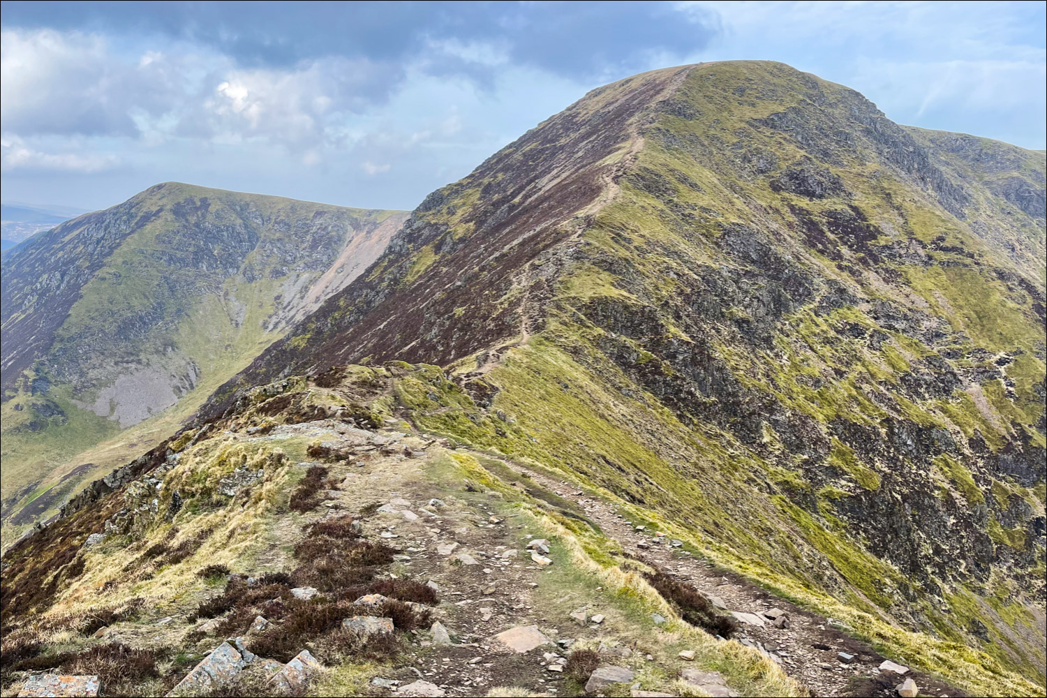
We aim for the obvious path up Sail

The high point of the walk, Crag Hill (Eel Crag) ahead

Summit of Crag Hill

David walking down to Wandope...


Looking back to Crag Hill

Small cairn on the summit of Wandope

The seventh and last fell, Whiteless Pike, with Buttermere below

Continuing the descent along Whiteless Breast to Whiteless Pike...


Looking back to Wandope from the summit of Whiteless Pike

We descend towards Buttermere...

High Stile and Red Pike ahead

Haystacks and Great Gable in the distance

Instead of descending directly to Buttermere (on our left), we decide to extend the walk towards Loweswater through Rannerdale.

Looking back up to Whiteless Pike

Leaving Rannerdale

We cross the Buttermere road and pass through the gate

Along the wooded shores of Crummock Water...


A short road section follows as we look to Mellbreak

We turn left at the red phone box

Rehydrating at the Kirkstile Inn
