
Route: Lanthwaite Hill
Area: Western Lake District
Date of walk: 2nd April 2019
Walkers: Andrew
Distance: 3.0 miles
Ascent: 400 feet
Weather: Sunny patches
Lanthwaite Hill, shown on the OS map as Brackenthwaite Hows, is one of my favourite places in the Lake District. This walk has featured on my site many times, but I take the view that no two walks are ever the same – changing seasons and variations in the light and weather make for an infinite number of possibilities – and there’s always something new to be seen
I parked as usual in the National Trust car park at Scale Hill. Instead of taking the obvious track ahead, which leads directly to the north shore of Crummock Water, I turned left up a steepish path through Lanthwaite Wood. At a junction I turned left again to continue uphill, climbing a steep rocky staircase along the way
After leaving the woods via a deer gate I was soon at the top of the hill, admiring the superb views in all directions over Lorton Vale, Loweswater, Crummock Water and towards the Western Fells. The light was good and I lingered here for a while as the clouds scudded across the sky, watching patches of sunshine illuminate the surrounding fells
I then followed the easy path back down into Lanthwaite Wood, following a path which hugs the edge of the woods, giving good views across to Lanthwaite Green
The path descends to the eastern shore of Crummock Water, and when I arrived at the lakeshore I followed the path to the foot of the lake. From here I made a short diversion (not shown on the Maps Page) by continuing around the lakeshore as far as the Pump House. From here I retraced my steps to the foot of the lake, where are are two choices – a path which follows the bank of the River Cocker, or the wide track leading through Lanthwaite Wood. I opted for the track today, and 5 minutes later was back to the car park to end a short but very sweet walk
For other walks here, visit my Find Walks page and enter the name in the ‘Search site’ box
Click on the icon below for the route map (subscribers to OS Maps can view detailed maps of the route, visualise it in aerial 3D, and download the GPX file. Non-subscribers will see a base map)

Scroll down – or click on any photo to enlarge it and you can then view as a slideshow

Spring flowers in the garden earlier in the week

Mellbreak beyond the River Cocker at the start of the walk

The track to Crummock Water - I'll return this way, but turn left uphill here

Another turn off to the left as I continue the climb up to Lanthwaite Hill

Bonnie pauses for breath on one of the the rocky sections near the top

I reach the edge of Lanthwaite Wood and pass through the deer gate

Lanthwaite Hill ahead, with Whiteside left and Grasmoor right

Looking back towards Loweswater and its fells

Loweswater village

From the top of Lanthwaite Hill, views in all directions - Lorton Vale looking north...

...Crummock Water to the south....

...Grasmoor looking east...

....and Loweswater to the west

West shore of Crummock Water at the foot of Mellbreak

Looking back down the path towards Loweswater

Rannerdale Knotts and the High Stile Range as I start the descent back into Lanthwaite Wood


Lanthwaite Green

I follow a path which hugs the edge of Lanthwaite Wood, here looking towards Grasmoor...


Grasmoor again...

...and to its left, Whiteside

I fork left here, keeping to the edge of the woodland

The path brings me down to the boathouse on the eastern shore of Crummock Water

I follow the shoreline path to the foot of the lake

Foot of Crummock Water

Red Pike top left

Looking back to the boathouse

Low Ling Crag

I make a short 'there and back' detour along the shoreline path

Pine trees at the foot of Mellbreak

Red Pike and the foot of Mellbreak

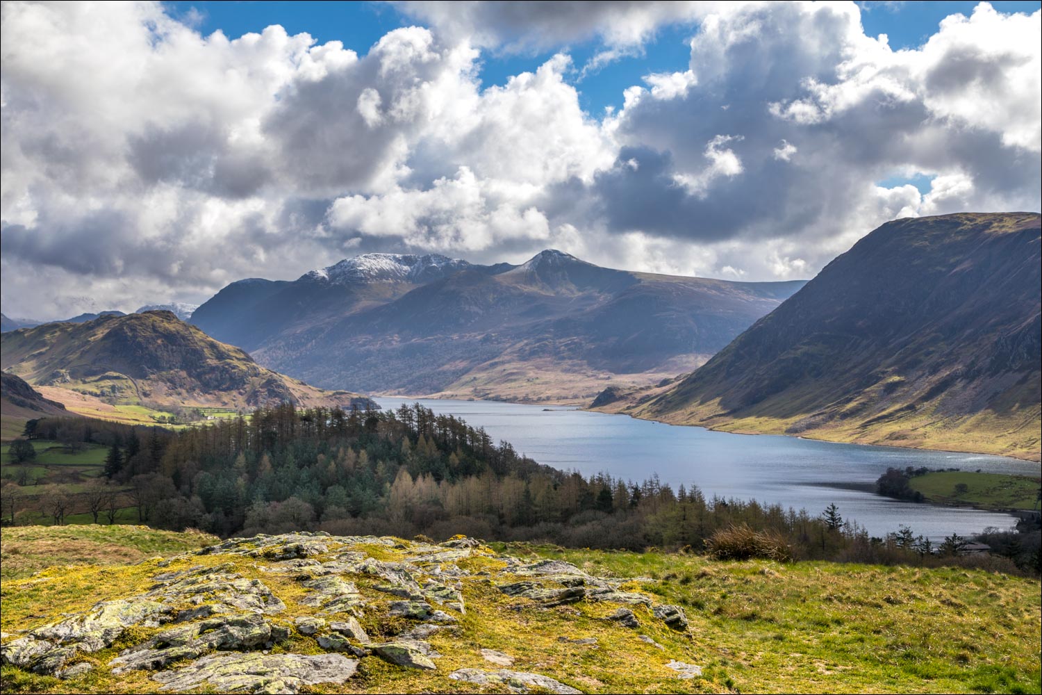
Haystacks and Great Gable at the head of Buttermere (which is unseen from here)

View to the head of Crummock Water, and from here I retrace my steps

The track back to the car park, and the end of a perfect short walk
