
Route: Castle Crag
Area: North Western Lake District
Date of walk: 3rd April 2019
Walkers: Andrew
Distance: 5.1 miles
Weather: Sunny patches, snow on the higher fells
Last week I’d climbed King’s How on Grange Fell, one of the ‘Jaws of Borrowdale‘. Today I decided to visit the other jaw, Castle Crag. I’ve been up the fell several times before, and usually approach it from the south starting at Rosthwaite. For a change, I started today’s walk in the small village of Grange which lies to the north of the fell
I parked in the small car park next to the double bridge over the River Derwent. I walked out of the village along a quiet lane which joins the path beside the River Derwent. The river was to be my constant companion for the outward leg of the walk as I passed through Low How Woods and High How Woods. Shortly after emerging from the wood I joined a grassy path up Lingy Bank. As I gained height there were some wonderful retrospective views over Borrowdale, and I was fortunate that this section of the walk coincided with some good light
At the top of the bank I joined the Cumbria Way and the delightful terraced path took me to the foot of Castle Crag. The fell has the distinction of being the only fell in Wainwright’s Guides with an altitude below 1,000 feet – it stands at 985 feet – but such is its rugged character that Wainwright made an exception and conferred on it what he termed ‘the full treatment’
It was a short but steep climb to the top via a zig zagging path which passes by some old slate quarries. The views of the surrounding fells were superb as usual, and enhanced by last night’s dusting of snow
I descended back to the Cumbria Way, and near Bowder Dub I rejoined my original path and retraced my steps back to the start of a great little fell walk
For other walks here, visit my Find Walks page and enter the name in the ‘Search site’ box
Click on the icon below for the route map (subscribers to OS Maps can view detailed maps of the route, visualise it in aerial 3D, and download the GPX file. Non-subscribers will see a base map)

Scroll down – or click on any photo to enlarge it and you can then view as a slideshow

The start of today's walk from the small car park by the bridge over the River Derwent

Looking along the Derwent towards High Spy

I pass between these cottages as I walk out of Grange

Holy Trinity Church

Leaving Grange

I follow this quiet lane (very quiet as it's a no through road)...


I turn left at a sign for Castle Crag

Dalt Wood ahead

Looking back

I arrive at the bank of the River Derwent and carry on, keeping the river to my left...


Looking back

Castle Crag ahead

Low Hows Wood


Caves in High Hows Wood

I emerge from the woods

There's a possible shortcut here on my right, but I'm in no hurry and carry on the main path for a short distance...


Tongue Gill, and an unusual combination of spring blossom and fresh snow

I leave the riverbank path here to start the climb up the grassy slopes of Lingy Bank below High Spy

An early view back into the heart of Borrowdale

Bonnie leads the way as we continue up Lingy Bank

Ever improving views back into Borrowdale...

Eagle Crag above Stonethwaite

Looking towards Grey Knotts

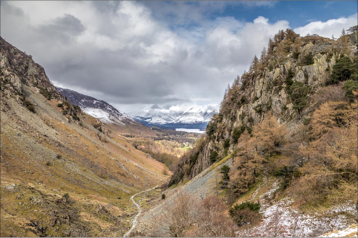
Borrowdale in all its glory

Walkers below High Scawdell

High Scawdell

I descend and turn right along the path below

Castle Crag on the right, and Derwent Water and the Skiddaw Fells beyond. I branch off to the right by the dry stone wall to start the ascent

Castle Crag, which I'll ascend and then descend to follow the path below

Eagle Crag to my right

I follow the zig zagging path up through the old slate quarries

Crags below High Spy

Looking back down the path...


Borrowdale, from a cairn below the summit

From the summit of Castle Crag, the view north to Derwent Water, Keswick and the Skiddaw fells

Windswept trees on the summit

The Great War memorial tablet

Descending Castle Crag...

I descend in the direction of Derwent Water

Having passed through the woods again I retrace my steps back into Grange

The circuit is complete as I arrive back in Grange at the end of a short but superb fell walk
