
Route: Derwent Water – Nichol End to Lodore
Area: North Western Lake District
Date of walk: 10th January 2020
Walkers: Andrew, Gilly, Phil and Denise
Distance: 4.7 miles
Ascent: 200 feet
Weather: Cloudy with sunny patches
A full circuit of Derwent Water is about 10 miles, and suffers from the defect that the Keswick road runs along much of the shore line on the eastern side. The road can be avoided in several places, but its presence is intrusive. It’s possible to overcome this issue by using the services of the Keswick Launch, which we’ve often done before. This enables a route to be followed along the quiet western shore without having to retrace your steps.
We arrived at Nichol End in good time to catch the morning launch to Lodore, but on arrival it became apparent that my plan had a fatal flaw – there’s no service between 16th December and 31st January. I hadn’t noticed this when quickly checking the timetable. Once the curses had died down, we soon came up with a revised plan, and decided to walk to Lodore, from where we could catch the bus into Keswick, thus omitting the road section. From there we could walk back to Nichol End.
From the marina we joined a path, part of the long distance Cumbria Way, which passes by Lingholm before descending to the lakeshore just beyond Hawes End Outdoor Centre. This is the finest part of the route, passing through ancient woodland and around several attractive bays before reaching the head of Derwent Water. We followed the boardwalk across the head of the lake, crossed the Chinese Bridge, and arrived at Lodore. There is a regular bus service opposite the hotel and from here we caught the bus back into the centre of Keswick.
This left us with a 2 mile walk back to Nichol End which I’ve not shown on the map, since anyone following this route is recommended to check that the launch is operating and to follow the walk from Lodore back to Nichol End, as we’d originally planned to do.
Despite the bad start, it had been a wonderful walk
For other walks here, visit my Find Walks page and enter the name in the ‘Search site’ box
Click on the icon below for the route map (subscribers to OS Maps can view detailed maps of the route, visualise it in aerial 3D, and download the GPX file. Non-subscribers will see a base map)

Scroll down – or click on any photo to enlarge it and you can then view as a slideshow

Derwent Water and Skiddaw from the jetty at Nichol End at the start of today's walk

The initial section of the walk is through mixed woodland

It's good to emerge into The Park - the scenery beyond this point is outstanding

Causey Pike on our right as we walk through The Park

Another short woodland section as we head towards Derwent Water

Heading towards Hawes End

We pass by an old barn at the foot of Catbells

We arrive at the shore of Derwent Water, and take a brief detour around Otterbield Bay...


The landing stage at Low Brandelhow, with Blencathra mid picture

Victoria Bay

The hands sculpture 'Entrust', perhaps in need of a manicure. It commemorates the centenary of the National Trust’s first land purchase in the Lake District, 108 acres of the Brandelhow estate

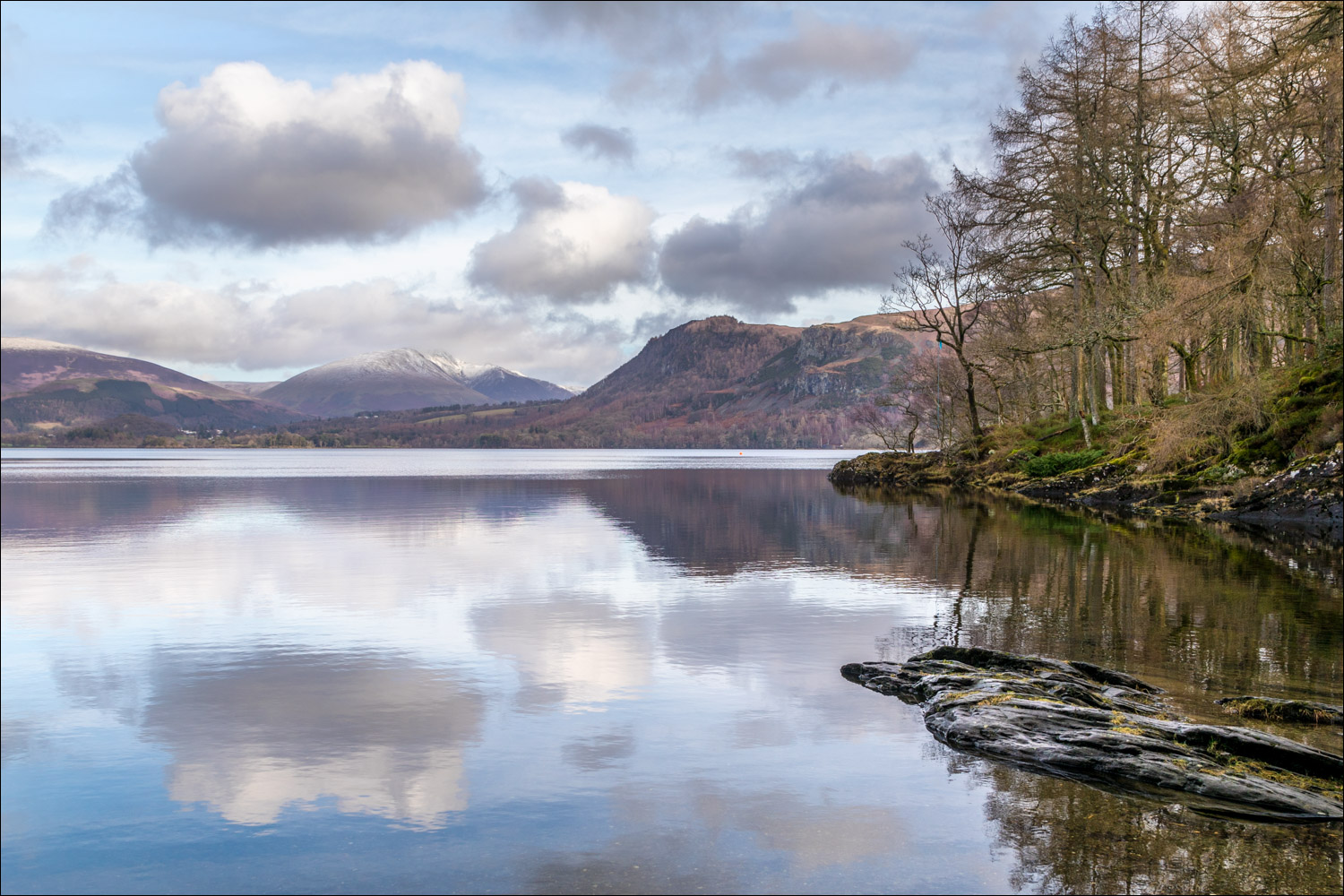
Derwent Water reflections

We continue through Brandelhow Park


We pass by an old shed, plastered with letters from around the world...

...addressed to the teddy in the window, who is now a local celebrity

Otter Island in Abbot's Bay

Derwent Water reflections in Abbot's Bay


We arrive at Great Bay - the head of Derwent Water...


Ghostly birch trees in Manesty...


Heading towards Borrowdale

The distinctive outline of Castle Crag

Looking back along the boardwalk, which keeps our boots dry along a boggy section at the head of the lake

Walla Crag beyond Great Bay

Looking back along the boardwalk to Maiden Moor

We cross the Chinese Bridge over Cannon Dub

Looking towards Derwent Water from the bridge...

...and now towards Borrowdale

A final look back to the bridge - the bus stop at Lodore is just around the corner

A bus ride to Keswick and a two mile walk bring us back to Nichol End
