
Route: Silver How
Area: Central Lake District
Date of walk: 8th January 2020
Walkers: Andrew and Gilly
Distance: 4.1 miles
Ascent: 900 feet
Weather: Cloudy with sunny patches, windy on the tops
Silver How is the first lakeland fell we climbed, more years ago than I can remember, though I do recall that it seemed like a grand adventure at the time. It’s a modest fell in height by lakeland standards, but is set in a wonderful position between Langdale and Easedale and commands lovely views over both valleys and their surrounding fells
We parked in the Red Bank car park near St Oswald’s Church Grasmere and walked out of the village along the private road to Allan Bank, the former home of Wordsworth – ‘the loveliest spot that man hath ever found’. We followed the lane around the house, eventually emerging onto open fellside. After crossing Wray Gill we were soon at the top of Silver How. There were wonderful views of the Langdale Pikes, Grasmere, Rydal Water, Windermere and much else besides, and these were enhanced by some good light at times
We carried on down the undulating ridge for a short distance and at the foot of a rocky section we headed back north and followed a delightful path beside a dry stone wall. There were more good views over Grasmere and Rydal Water for much of the way down. We eventually arrived at Red Bank by the shore of Grasmere, and we followed this back into the village
For other walks here, visit my Find Walks page and enter the name in the ‘Search site’ box
Click on the icon below for the route map (subscribers to OS Maps can view detailed maps of the route, visualise it in aerial 3D, and download the GPX file. Non-subscribers will see a base map)

Scroll down – or click on any photo to enlarge it and you can then view as a slideshow

The start of the walk as we follow the lane out of Grasmere and enter the grounds of Allan Bank

The house itself was closed but there is a public right of way around it

Looking back to Grasmere

We turn left here to follow the sign to Silver How

Good light as we continue uphill

We follow a rocky path by the dry stone wall

Looking back to Grasmere below Great Rigg

Waterfall in Blindtarn Gill

Grasmere again

Helm Crag left and Seat Sandal centre

Wray Gill

A little further along we descend to Wray Gill and ford it, then climb steeply up the other bank

We reach a flat area known as Brigstone Moss

Blencathra can just be seen in the far distance beyond Steel Fell

First glimpse of the Langdale Pikes on the left

Looking back along our path

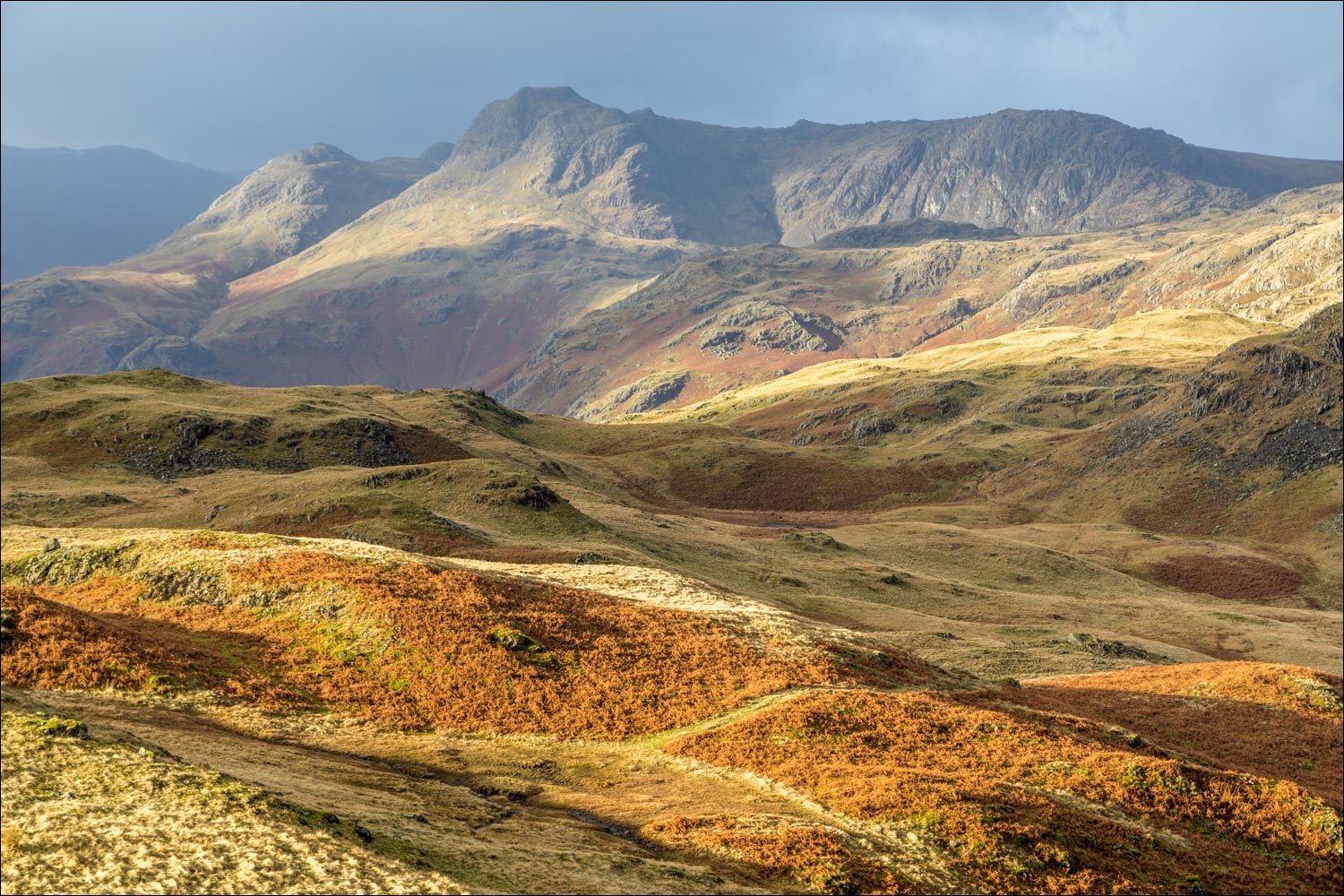
Good light on the Langdale Pikes

Summit cairn on Silver How, looking towards Grasmere and Rydal Water...

...and now towards the Langdale Pikes


Grasmere and Rydal Water from Silver How

Looking along Dow Bank, with Windermere left and Elter Water right

Grasmere village below

We descend along the knobbly ridge, heading south


Herdwick, with Loughrigg Fell in the background

Grasmere and Rydal Water

Four bodies of water as we look along Dow Bank - the walk may be extended by continuing along the ridge, but we turn left after a short but steep descent down the rocks in the foreground


A rainbow over Grasmere village

Views of Grasmere and Rydal Water accompany us for much of the descent...


Grasmere village below

We continue along the lovely path...


St Oswald's Church below

We arrive on the lane leading into Grasmere

Sarah Nelson's famous Gingerbread Shop in Grasmere
