
Route: Brothers Water
Area: North Eastern Lake District
Date of walk: 17th January 2020
Walkers: Andrew
Distance: 5.1 miles
Weather: Cloudy, grey skies
I arrived in the east of the Lake District with two possible routes in mind. Plan A was to climb Angletarn Pikes, one of my favourite fells in the area, and Plan B was a lower level walk around Brothers Water in case of inclement weather. Although the weather wasn’t poor it was indifferent, with low light and featureless skies. I decided to save Plan A for tomorrow, when better weather is forecast (Postscript: this proved to be a good decision – click here to see why)
Brothers Water is one of the less well known lakes in the district, but is worth a visit. The lake was once known as Broad Water but was renamed in the 19th century after two brothers drowned in it
I parked at Cow Bridge car park and followed the beck for a short distance before reaching the shore of Brothers Water. This body of water may be regarded as one of the district’s smallest lakes or one of its largest tarns
After passing by the head of the lake I walked as far as ancient Hartsop Hall, and then headed over to the other side of the valley along a path directly adjacent to the hall. This is easily missed and not to be confused with a nearby path leading to the Kirkstone Pass. After walking through Sykeside campsite on the far side of the valley I joined a path just below the road. This took me back along the other shore of Brothers Water. At the foot of the lake I crossed the road and joined a path leading into the picture postcard village of Hartsop.
After leaving Hartsop the path climbs up the fellside and along the feet of Brock Crags and Angletarn Pikes. From this elevated path there are great views back to Brothers Water, across to surrounding fells, and into lovely Deepdale. This is a delightful part of the walk. I left the path to cross over Deepdale Bridge and back to the other side of the valley. There was a short road section, about 100 yards, before a path branched off to the right. This took me through Low Wood and back to the start. Despite the indifferent weather it had been an enjoyable walk
For other walks here, visit my Find Walks page and enter the name in the ‘Search site’ box
Click on the icon below for the route map (subscribers to OS Maps can view detailed maps of the route, visualise it in aerial 3D, and download the GPX file. Non-subscribers will see a base map)

Scroll down – or click on any photo to enlarge it and you can then view as a slideshow

The start of the walk from the free car park at Grade II listed Cow Bridge Patterdale

I walk beside Goldrill Beck for a short distance

The foot of a very full Brothers Water, with Hartsop Dodd on the right

I pass by these sheep, who outnumbered by four the people I passed during the entire walk

It's not long before I arrive at the head of the lake...


I continue beyond the head of the lake

Hartsop Hall, a 16th Century Grade I listed building owned by the National Trust and one of the oldest buildings in Patterdale

At Hartsop Hall I turn sharp left to walk across the head of Patterdale

Looking into Dovedale, a side valley

I cross the bridge over Kirkstone Beck

Having passed through Sykeside I join a path leading to the east shore of Brothers Water

Dove Crag and Hart Crag towering above Hartsop Hall

Looking back to the head of Brothers Water, with Hart Crag on the right

At the foot of the lake I cross the road on my right and follow a public footpath to Hartsop

Hartsop ahead

I walk through the unspoilt village, consisting of 17th-century grey stone cottages

Looking back over Hartsop and Brothers Water as I climb out of the village

St Sunday Crag, Cow Bridge, where I'd started the walk, is bottom left

St Sunday Crag again as I pass by one of several old barns along the way

Looking back to Brothers Water, with High Hartsop Dodd at its head

Hartsop and Hartsop Dodd through a wall gap

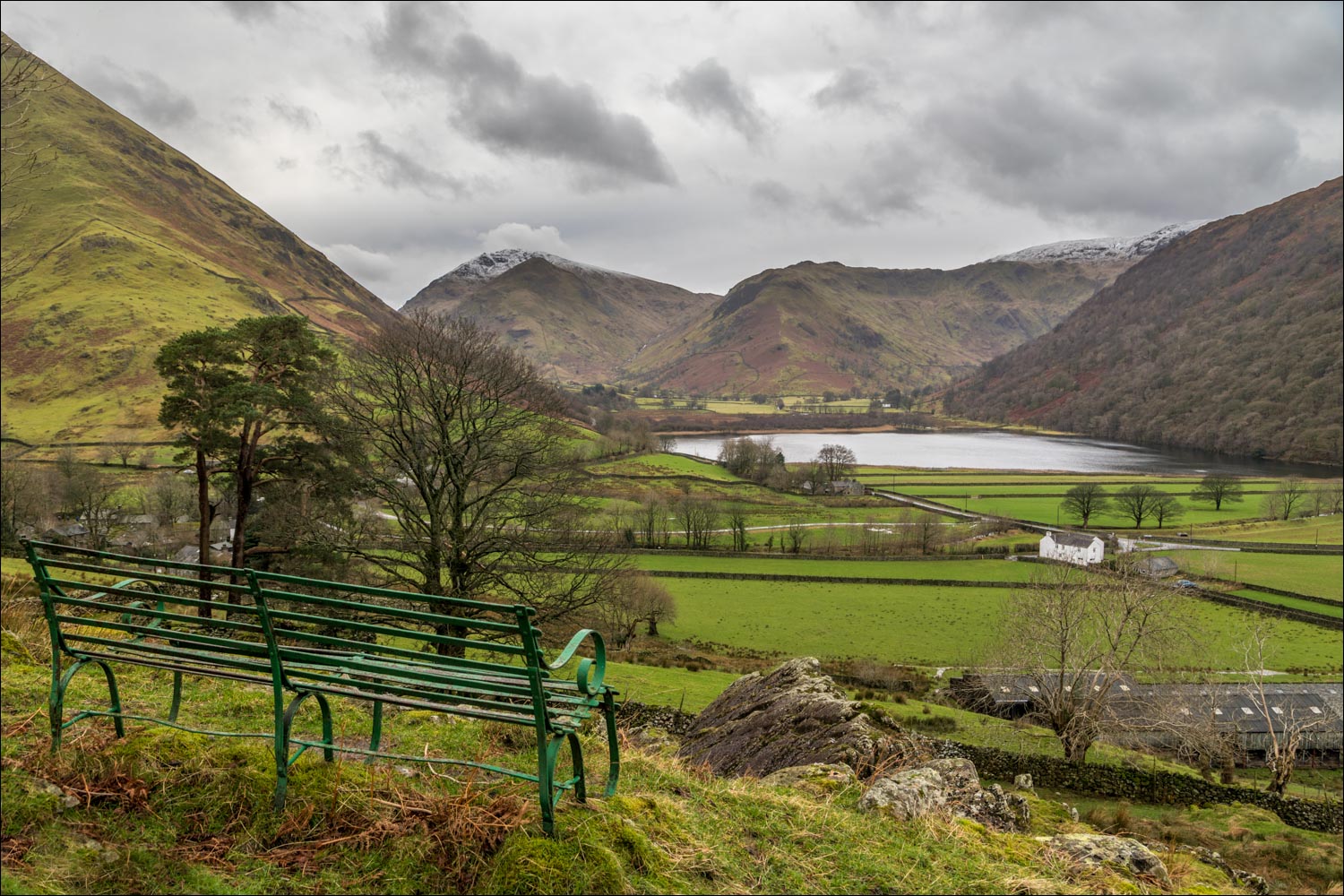
Brothers Water from one of the green metal benches in the Ullswater area

Angletarn Pikes on my right - if all goes to plan I'll be up there tomorrow

I continue to walk along Patterdale...


I pass by a waterfall in Angletarn Beck - the beck flows from Angle Tarn below the summit of Angletarn Pikes

Looking over another old barn across Patterdale towards Fairfield

Zooming in on Fairfield

Looking back to Brothers Water...

...and again, with Angletarn Beck on the left

The path continues along the valley into Patterdale village and along the shore of Ullswater, but this is as far as I follow it. I descend to the bridge over Goldrill Beck below

I follow the track below, here looking into Deepdale. Left to right are Hartsop above How, Hart Crag, Fairfield and St Sunday Crag...


Zooming in on Hart Crag and Fairfield

Looking back to a house in a wonderful location above Hartsop

After passing by another old barn I join a path beside the road on the left of the picture

A few minutes later I arrive back at Cow Bridge and Goldrill Beck - the end of a wonderful walk, despite the grey skies
