
Route: Crummock Water
Area: Western Lake District
Date of walk: 18th July 2019
Walkers: Andrew
Distance: 3.0 miles
Ascent: 350 feet
Weather: Cloudy with some rain, brighter at the end
Another day of mixed weather made route planning difficult, so I decided to head over to Crummock Water and check out the conditions. If good, then I’d circuit the lake but if not I’d shorten the walk. I parked as usual in the National Trust car park at Scalehill Bridge and followed the track through Lanthwaite Wood to the foot of the lake. It’s always a thrill to emerge from the woodland to the wonderful view from here. I then set off in an anti clockwise direction along the lakeshore path, crossing the bridges over the River Cocker at its source
On reaching the foot of Mellbreak it was decision time. A circuit of the lake is quite lengthy – about 8 miles – and once committed to this there’s no way back apart from returning the same way. A heavy shower and dark clouds made my mind up. With some reluctance I turned away from the lake and climbed up to Green Wood at the north end of Mellbreak. From here I followed the path through the small settlement of Low Park. As I did so the weather improved and I wished I’d persevered with the full circuit of the lake
Beyond Lowpark the rest of the return journey is along tarmac, but these are quiet and unfrequented lanes and there’s little or no traffic. An easy stroll brought me onto the Buttermere road, which I followed for a few yards before arriving back at the car park to end an enjoyable little outing
For other walks here, visit my Find Walks page and enter the name in the ‘Search site’ box
Click on the icon below for the route map (subscribers to OS Maps can view detailed maps of the route, visualise it in aerial 3D, and download the GPX file. Non-subscribers will see a base map)

Scroll down – or click on any photo to enlarge it and you can then view as a slideshow

Red squirrel earlier today

The start of the walk as I follow the track through Lanthwaite Wood

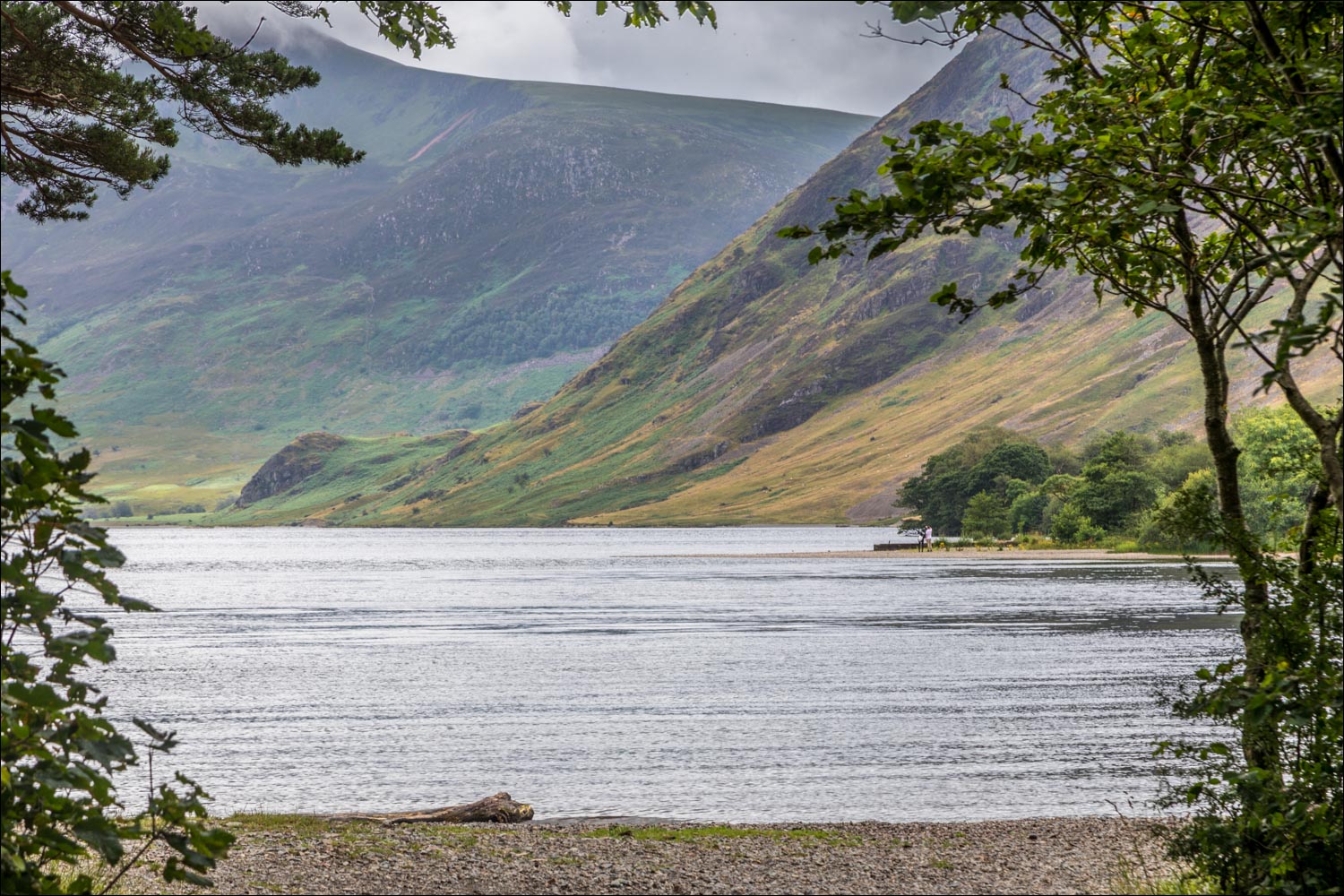
I arrive at the foot of Crummock Water

Red Pike and the foot of Mellbreak

View to the head of the lake

The boathouse on the eastern shore of Crummock Water

Rannerdale Knotts

...and again

I cross one of the two bridges over the River Cocker as it starts its journey

A stony beach seen as I follow the lakeshore path

I cross over Park Beck, here looking towards the Loweswater Fells

Foot of Mellbreak - the path will take me around the grassy headland

A small stand of wind battered pines trees which always catches my eye

Looking across the fields to Low Fell

I pass by the pine trees and walk around the headland

The path turns towards Mellbreak...


Looking back

Looking across to Whiteside

By now the weather had deteriorated and rain set in - I decided to abandon the circuit of the lake and climbed up the nursery slopes of Mellbreak

Looking along the lakeshore path as the rain obscures the fells - Haystacks is in the centre of the picture

I head in the direction of Low Fell, where the weather seems to be better

I pass by Highpark...

...and through Lowpark

After crossing Park Bridge, the remainder of the walk is along deserted country lanes...


Low Fell as the weather suddenly improves

Lorton Vale beyond the gate

Looking back to Hencomb

I pass by Muncaster House

Dappled sunlight on Low Fell

Looking back to Mellbreak

Rannerdale Knotts

I arrive at the Buttermere road and from here it's a short walk back to the start - Low Fell on the left...

...and the High Stile Range (in the clouds) and Mellbreak on the right

Scalehill Bridge - the car park and the end of the walk is ahead on the right

On the way back I made a short detour to Crummock Water Cottages, which has a wonderful elevated view of Crummock Water from its front garden...

