
Route: The Bridestones
Area: North Yorkshire
Date of walk: 23rd February 2022
Walkers: Andrew and Gilly
Distance: 2.0 miles
Ascent: 300 feet
Weather: Cloudy with sunny intervals, very strong winds
The Bridestones are a fascinating group of oddly shaped sandstone rocks which have been eroded by wind, frost and rain over thousands of years. The rocks are the remains of a sandstone ‘cap’ that was originally much higher and was deposited some 150 million years ago. The surrounding nature reserve, home to some rare wildlife, is owned and managed by the National Trust and is a designated Site of Special Scientific Interest
We parked in the Bridestones car park in Dalby Forest – charges apply but there are numerous activities on offer in the forest and the place is well worth a visit in its own right. After leaving the car park we walked uphill through woodland and before long emerged onto the moorland. Our path took us past the Low Bride Stones, which include ‘The Pepperpot’, so named for obvious reasons. Beyond this group we descended into Dove Dale, which separates the lower stones from another group – The High Bride Stones – on the other side of the valley. This is a popular picnic spot but not today, as a bitterly cold wind was sweeping across the moors
We descended back into Dove Dale and at the end of the valley turned left into Staindale to walk back to the end of a short but sweet walk
For other walks here, visit my Find Walks page and enter the name in the ‘Search site’ box
Click on the icon below for the route map (subscribers to OS Maps can view detailed maps of the route, visualise it in aerial 3D, and download the GPX file. Non-subscribers will see a base map)

Scroll down – or click on any photo to enlarge it and you can then view as a slideshow

First signs of spring - crocus in the garden earlier in the week

From the Bridestones car park in Dalby Forest, we follow a path into the nature reserve, owned and managed by the National Trust

Looking along Staindale - we'll be returning via the dale later

We climb uphill through woodland...


We enter onto Bridestones Moor

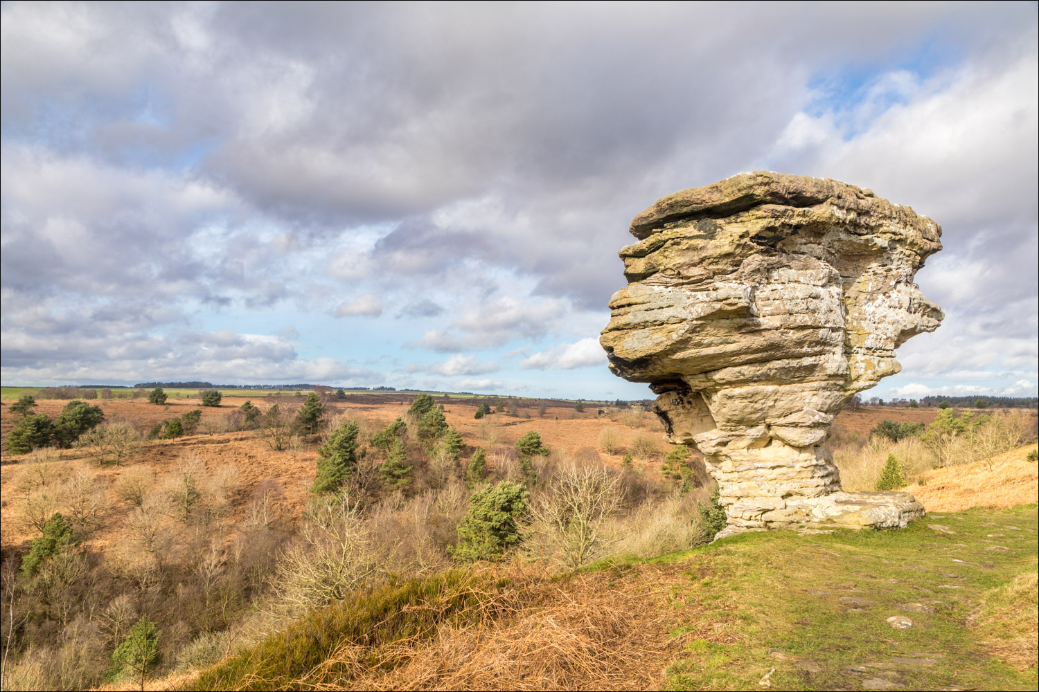
First of the Low Bridestones. The name 'Bridestones' is thought to derive from the norse for 'brinkstones' or 'edgestones'

Looking across Dovedale...


We contine along the cobbled path, passing more of the Low Bridestones...


We walk along the ridge to the best known of the group - The Pepperpot

The Pepperpot...


We continue along the ridge above Dove Dale….

The High Bridestones on the far side of the valley

A down and an up to the High Bridestones

We ford a small stream and start the climb back up the side of Dove Dale

The High Bridestones...


Looking back across to the Low Bridestones as we descend into the valley

We follow a path through woodland

We cross a footbridge and enter into Dove Dale

Looking back along Dove Dale

We cross another footbridge, marking the end of Dove Dale and the start of the return along Staindale

A last look back along Dove Dale

We enter into Staindale to return to the start

We follow a path beside the woodland in Dalby Forest

Looking back

The end of the walk is just beyond the gate ahead
Follow the link for more walks in North Yorkshire (152)
