
Route: The Bridestones
Area: North Yorkshire
Date of walk: 6th January 2018
Walkers: Andrew and Gilly
Distance: 4.8 miles
Ascent: 500 feet
Weather: Sunny intervals, a couple of hail showers
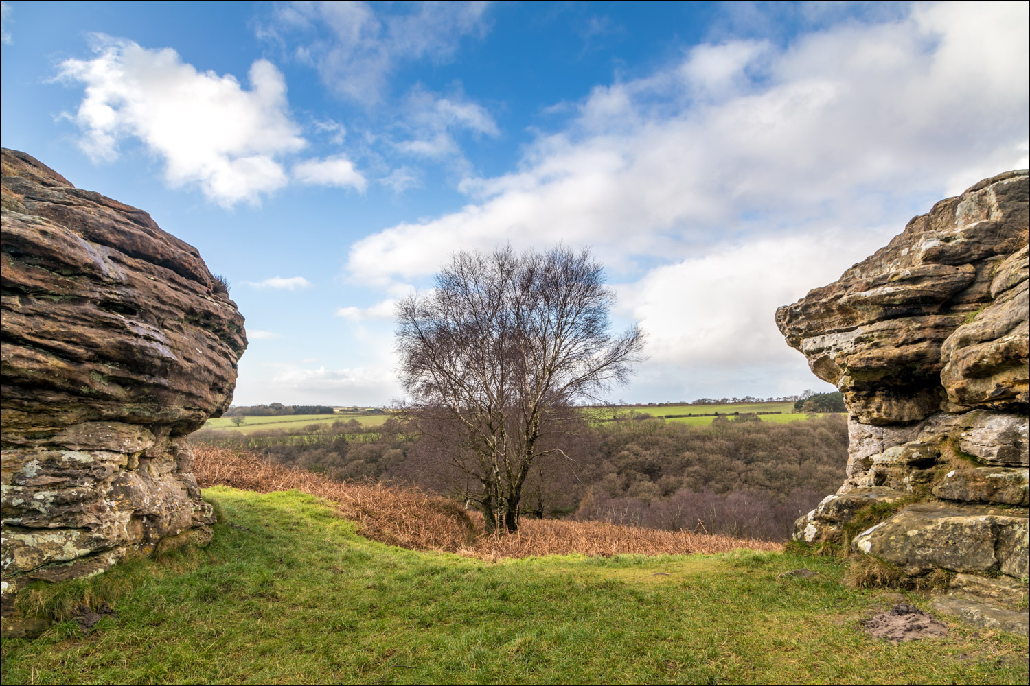
The Bridestones are a fascinating group of oddly shaped sandstone rocks which have been eroded by wind, frost and rain over thousands of years. The stones are set in a nature reserve owned and managed by the National Trust and the area is a designated Site of Special Scientific Interest. We’ve not been here for a few years and looked forward to today’s return visit
We parked in the Bridestones car park in Dalby Forest – charges apply but there are numerous activities on offer in the forest and the place is well worth a visit in its own right. After leaving the car park we walked uphill through woodland and before long emerged onto the moorland. Our path took us past the Low Bride Stones, and then onto open moorland at the edge of the forest. Another group of stones – the High Bride Stones – was not on our route today, but a short diversion could easily be made to explore these interesting formations
We turned left at an obvious junction and walked past an attractive pond onto Grime Moor, which is more scenic then its name suggests. A fierce hailstorm overtook us at this point, but luckily was blowing into our backs rather than our faces. As the storm abated we left the muddy track at High Pastures to walk through the fields and join Pasture Road. This quiet road leads to Low Pasture Farm and from here it was a pleasant stroll back into Staindale and the end of an enjoyable walk
For other walks here, visit my Find Walks page and enter the name in the ‘Search site’ box
Click on the icon below for the route map (subscribers to OS Maps can view detailed maps of the route, visualise it in aerial 3D, and download the GPX file. Non-subscribers will see a base map)

Scroll down – or click on any photo to enlarge it and you can then view as a slideshow

Birdwatcher's car park in Forge Valley

A short while later, the path to the Bridestones seen from Bridestones car park in Dalby Forest...


We follow this path uphill through the woods

Looking back along the path

We emerge onto the moorland

The first of the Bridestones


Looking across Dove Dale...


We continue along the cobbled path


The Pepperpot

Another view over Dove Dale

We reach the last of the Low Bride Stones

A path to the left leads to the High Bride Stones, but tempting as this is we keep to the higher ground

Looking across to the High Bride Stones

A boggy section as we turn towards Dalby Forest

Views across the moorland...


We follow this track beside the forest

We arrive at the edge of the moor

Moorland turns into grazing land, and here we turn left to follow a path beside the fence

We pass by a small pond, unnamed on the OS maps...


A sudden hailstorm as we walk towards High Pastures...


Just before High Pastures we leave the track to walk through the fields

Interesting cloud formations...


At the end of this small valley we reach Pasture Road...


We follow the road and pass through Low Pasture Farm

Incoming hailstorm, and the camera has to be stowed away

The path takes us around Low Staindale

We follow this path beside the woodland and retrace our steps back to the start

On the way to Dalby Forest we stopped off at Birdwatcher's car park in Forge Valley, a good place to see a variety of woodland birds at close quarters
