
Route: Bampton Grange and the River Lowther
Area: Eden Valley
Date of walk: 15th April 2022
Walkers: Andrew and Gilly
Distance: 5.9 miles
Ascent: 300 feet
Weather: Warm, but cloudy
The Eden Valley is a wonderful walking area, and would be far more popular but for its close proximity to the Lake District. Today’s walk is a repeat of one I followed six years ago, which was sourced from ‘Walking in Cumbria’s Eden Valley’ by Vivienne Crow.
We parked in one of the roadside spaces next to St Patrick’s Church Bampton Grange. Following the description in Vivienne’s book we walked out of the village via a path opposite the church and next to the Crown and Mitre, formerly a pub but now converted into holiday accommodation. Beyond the village we walked across the fields to join a quiet road which took us along Knipe Moor, with the limestone escarpment of Knipe Scar above.
As we approached Howgate Foot we kept a lookout for a faint path on our left which isn’t shown on the OS map and which is located just before a rectangualr stone construction. Having found the path we followed it gently downhill to a wooden suspension bridge over the River Lowther. Beyond the bridge we turned left and followed the delightful path along the bank of the River Lowther. On reaching the edge of Bampton Grange we followed a minor road towards Swindale and Rosgill. I’d mention that about half of this walk is along lanes, but this is not an issue. This is quiet and remote countryside and we only encountered a couple of cars along the way
We ignored a road on the right leading up to Swindale and a little further along crossed the bridge over the River Lowther near the small settlement of Rosgill. We turned left just after the bridge to follow a track past Hegdale. Beyond Hegdale, the remaining mile or so was through meadows. Eventually Bampton Grange came into view and we followed a faint path aiming for St Patrick’s Church. We passed through a gate and the church grounds and this brought us back to the start
Despite the uninspiring weather it had been a lovely walk in unspoilt countryside
Click on the icon below for the route map (subscribers to OS Maps can view detailed maps of the route, visualise it in aerial 3D, and download the GPX file. Non-subscribers will see a base map)

Scroll down – or click on any photo to enlarge it and you can then view as a slideshow

The start of the walk from a roadside space by St Patrick's Church Bampton Grange

Just before the Crown and Mitre, almost opposite the church, we join a path which leads us out of the village

Knipe Scar ahead as we pass through a couple of fields

We cross this stile in a wall gap to join a quiet country lane

Looking back along our path to Bampton Grange

We enter onto Knipe Moor, part of the Lowther Estate

Looking east towards the Lake District

The River Lowther is below on our left and we keep a lookout for a faint path leading down to it

The path isn't shown on the OS maps, but is just before this stone construction

Having located the path we follow it down to the river - Butterwick on the far side of the valley

The wooden suspension bridge over the River Lowther

We cross the bridge, which is quite wobbly in the middle. Last time we were here our golden retriever Bonnie found it rather unnerving and crawled across it on all four paws

A delightful section along the bank of the River Lowther, where otters may be seen (though not by us today)


A fleeting pool of sunlight on The Howes above Brampton

The end of the riverside section as we approach the road which links Bampton and nearby Bampton Grange

We pass by Bampton Grange but don't walk into it. Anyone looking to shorten the walk could end it here, but this is the halfway mark for us

The second leg of the walk as we follow a quiet lane past Bomby

Further along the lane, the far point of the walk comes into view - the bridge over the River Lowther and the small settlement of Rosgill


Looking along the River Lowther, with the lane we'd followed on the left

Just after crossing the bridge we turn left and join another deserted lane, which ends at Hegdale...


The lane peters out into a track and we continue in the same direction...

The River Lowther is close by on our left, and from here we follow its course through a succession of meadows

We cross this small bridge over a stream

Bampton Grange in the distance

Lambing time


We pass through this pair of gates near a barn

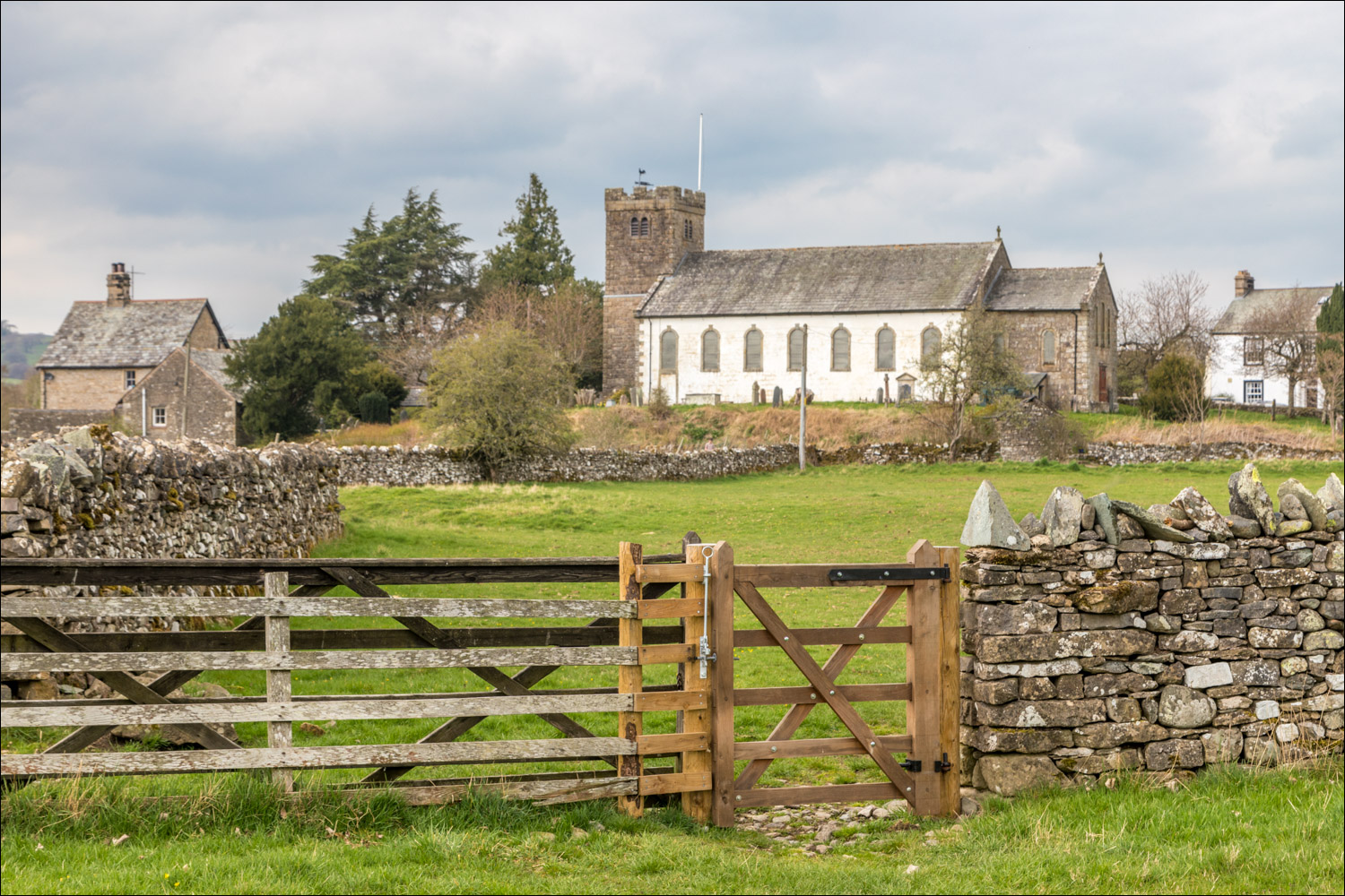
Bampton Grange ahead

We aim for St Patrick's Church - the path takes us through its grounds and back to the start....


Follow the link for more walks in the Eden Valley (18)
