
Route: A Walk from Wetwang
Area: East Yorkshire
Date of walk: 9th November 2013
Walkers: Andrew and Gilly
Distance: 9.6 miles
Ascent: 300 feet
We parked by the village hall in Wetwang. The blue skies which we’d seen from the car had by now turned to black and a thunderstorm threatened. As it was, we escaped the worst, but it rained for the first half of the walk, which was across rolling farmland
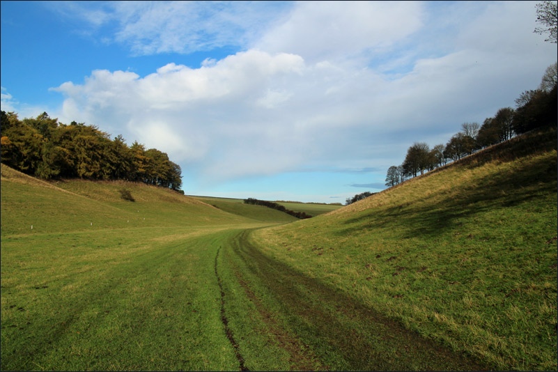
When we reached the Chalkland Way – the second half of our walk – the rain stopped at last and we were treated to some blue sky and sun
This was a beautiful section of the walk following the bottom of a chalk valley. We eventually emerged out of the valley back onto farmland and thence back into Wetwang
Click on the icon below for the route map (subscribers to OS Maps can view detailed maps of the route, visualise it in aerial 3D, and download the GPX file. Non-subscribers will see a base map)

Scroll down – or click on any photo to enlarge it and you can then view as a slideshow

A rainbow as we arrive in Wetwang

St Nicholas Church Wetwang

We head out of Wetwang over well cultivated fields

Looking back to Wetwang


We descend into a lovely chalk valley

Bonnie


On the way back to Wetwang


Back in Wetwang, we join the queue at Harpers. People come here from miles around, and it’s popular with the locals too


Nearby Wetwang village pond - no ducks to be seen, they’re all at Harpers!
Follow the link for more walks in East Yorkshire (117)
