
Route: Wetherlam
Area: Southern Lake District
Date of walk: 11th September 2013
Walkers: Andrew
Distance: 5.4 miles
Ascent: 1,800 feet
Unfortunately it was a case of ‘bad Wetherlam’ today – indifferent at the start, misty at the top, and rain all the way down. But I can’t complain, it’s been a glorious summer for walking
I parked near High Tilberthwaite and almost at once came across a massive quarry, evidence of the mining activities that once took place on this fell. Elsewhere along the route there were caves, shafts and old mine buildings
I climbed up via Steel Edge, pathless at first, and then getting much steeper near the top, so that hands as well as feet were needed
There were no views from the summit, which was above the cloud base. By now it was raining, and I had to put the camera away for most of the time. I came down via Wetherlam Edge, another steep section which needed extra care due to the wet rocks
By the time I got down I was soaking – but happy, as Wetherlam is a beautiful fell in all conditions
Click on the icon below for the route map (subscribers to OS Maps can view detailed maps of the route, visualise it in aerial 3D, and download the GPX file. Non-subscribers will see a base map)

Scroll down – or click on any photo to enlarge it and you can then view as a slideshow

The start of the path up to Wetherlam

To the left of the path, I spot the entrance to an old quarry

Inside the quarry, it is vast

Looking back down to the quarry

Wetherlam is up there in the clouds

Looking back along the path

And again, from the lower section of Steel Edge

It doesn’t look too promising up there

A view back towards my eventual descent route

Further along Steel Edge, the going gets tougher in a minute

Looking back down the edge

...and looking up

Bonnie finds a tarn and enjoys a bathe

But 5 minutes later she’s filthy again

Nearly at the summit now, but nothing to see

Summit of Wetherlam, you’ll have to take my word for it

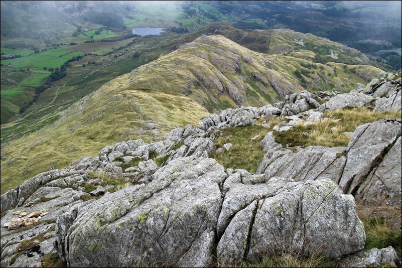
Below the cloud base now, and on the way down Wetherlam Edge

Further down the edge

Looking back up towards Wetherlam

The path down

Almost back to the car park - it’s pouring with rain by now
