
Route: The Ullswater Way Stage 2
Area: North Eastern Lake District
Date of walk: 20th May 2016
Walkers: Andrew and Gilly
Distance: 6.1 miles
Ascent: 600 feet
Weather: Rain at first but this soon gave way to sunny intervals
The Ullswater Way is a new 20 mile long walking route which circumnavigates Ullswater using existing rights of way and quiet public roads. Walkers are encouraged to start from any point, travel in any direction, and break the route down into sections. What an excellent idea, and congratulations to the partnership which promoted this, including the Lake District National Park Authority, See More Cumbria and the Lake District, The National Trust, Eden District Council, Ullswater Steamers and the Ullswater Association
Click here for Stage 1 of our journey. We decided to take advantage of the Ullswater Steamers again and caught the 10.45am boat from Howtown. We were aware that there is no parking at the pier so drove past it and parked at the bottom of Martindale Hause. The walk back from the hause takes 5-10 minutes
After an enjoyable boat ride we disembarked at the landing stage just outside Pooley Bridge and walked into the village. As it was raining, we took shelter in the excellent Granny Dowbekin’s Cafe. We usually have our treats at the end of a walk, but today it was at the start, in the shape of highly calorific but delicious flapjack and rocky road
We then started out along the shoreline path, which was a joy every step of the way. The route is well waymarked, though this is still a work in progress and it’s worth taking a good map on the walk
I strongly recommend that anyone following this route walks in the direction we did today (and as we did on Stage 1) – from the foot of Ullswater to its head. In this way, the best scenery is ahead of you as you walk, and the best is kept until last
The final stage of our walk round Ullswater will be from Howtown to Glenridding, a walk we’ve done many times before, but as it’s one of the best in lakeland we are full of anticipation
Click on the icon below for the route map (subscribers to OS Maps can view detailed maps of the route, visualise it in aerial 3D, and download the GPX file. Non-subscribers will see a base map)

Scroll down – or click on any photo to enlarge it and you can then view as a slideshow

The day before the walk, a yellowhammer in the garden

The next day at Howtown our boat comes in - Raven, first launched in 1889

We leave the pier to sail along Ullswater to Pooley Bridge

Our car is parked at the foot of the hause on the right of the picture


After disembarking we crossed the recently opened temporary bridge leading into Pooley Bridge - the original was destroyed during the December floods

After sheltering from the rain in Granny Dowbekin’s cafe we resume the walk

The driveway leading to the lake


We pass by the Lady Wakefield, part of the fleet of the Ullswater Steamers, which was beached during the December floods

Looking along Ullswater

A short road section

We leave the road to pass to the right of Cross Dormont…


Arthur’s Pike ahead


Near Thwaitehill


View across Ullswater

Sharrow Cottages


Swarthbeck

We join the alternative higher level path leading down from The Cockpit

Looking across to The Knotts

Hallin Fell in the background


Geordie’s Crag at the foot of Hallin Fell


We pass by a ruined old cottage

Hallin Fell again


Zooming in on Martindale Hause

Waternook


Howtown Pier below, but we continue to walk above it to get back to the car

Fusedale…


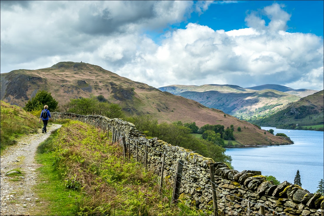
A final look back along Ullswater as we reach the end of Stage 2 of the Ullswater Way
