
Route: Tarn Hows
Area: South Western Lake District
Date of walk: 13th October 2016
Walkers: Andrew and Gilly
Distance: 5.1 miles
Weather: Mostly cloudy with some bright spells, some rain at the end
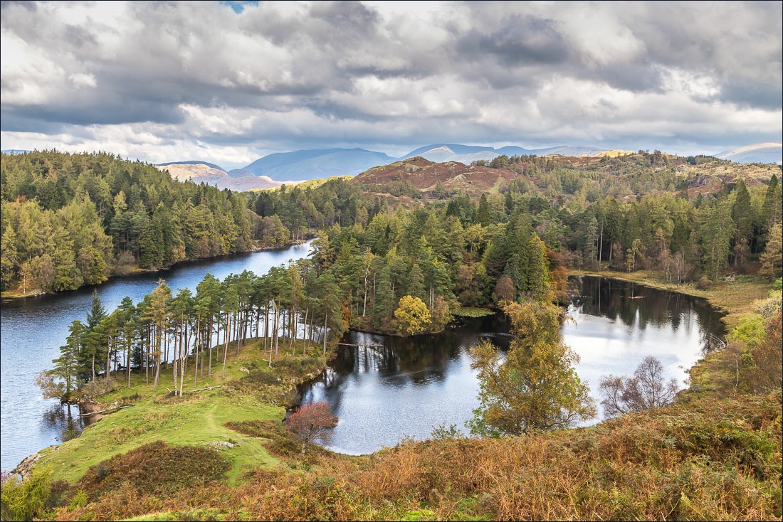
We parked at Glen Mary car park and climbed up through the woods alongside Tom Gill, enjoying the waterfalls as we did so. After 15 minutes or so we arrived at Tarn Hows. The tarn is artificial, and was formed in the 19C when three smaller tarns were united, but it now blends seamlessly into the landscape
This is one of the most visited spots in the Lake District. Its beauty and accessibility are a magnet for all and if you like to walk in relative solitude, as we do, arrive early and avoid the school holidays
We set off around the easy path in a clockwise direction, passing through Rose Castle Plantation, and then took the higher of two paths above the tarn leading into Hill Fell Plantation
After walking into the woods for a while we took another path heading back to Tarn Hows and on reaching the shore we retraced our steps back to the start via Tom Gill
For other walks here, visit my Find Walks page and enter the name in the ‘Search site’ box
Click on the icon below for the route map (subscribers to OS Maps can view detailed maps of the route, visualise it in aerial 3D, and download the GPX file. Non-subscribers will see a base map)

Scroll down – or click on any photo to enlarge it and you can then view as a slideshow

The start of the walk as we cross the footbridge at Glen Mary

We climb up through Lane Head Coppice with Tom Gill on our right


Tom Gill waterfalls…


We emerge from the woods

Tarn Hows - we follow the shoreline path in a clockwise direction


A coin log


Belted Galloways, or ‘Belties’

View from the far end of The Tarns


At the end of Rose Castle Plantation there’s a choice of paths, both tempting. We take the higher one through the gate, but make a quick detour along the lower one

View from the lower path…


From the upper path now, Wetherlam


The Old Man of Coniston


Wetherlam

Langdale Pikes in the distance

Beyond Tarn Hows we walk through Hill Fell Plantation for a short distance…

…and then follow another path back to the tarn


Just before arriving back at the tarn we enjoy a picnic with some rather splendid views…


We then retrace our steps back to the start through Lane Head Coppice


The way home

Later that day, a red squirrel in the garden
