
Route: Rannerdale Knotts
Area: Western Lake District
Date of walk: 26th January 2018
Walkers: Andrew and Gilly
Distance: 3.0 miles
Ascent: 1,100 feet
Weather: Sun and blue skies
Rannerdale Knotts is relatively short in stature at 1,160 feet, but what it lacks in height it more than makes up for in its rugged mountainous character and the beauty of its surroundings
This is a fell we’ve climbed numerous times and we could never tire of it
On a glorious morning we parked in the National Trust car park at Hause Point and from here the ascent starts almost immediately. Within a few minutes there were lovely views over Crummock Water and Buttermere. After a steep section up a rocky staircase we were soon on the north top enjoying some lovely views. We carried on along the knobbly summit ridge known as Low Bank and as we did so decided that instead of our usual return route along Rannerdale (which is in shade for most of the day during the winter months) we’d descend towards Buttermere and walk back along the flanks of Rannerdale Knotts. This would be unthinkable in May, when the famous Rannerdale bluebells are a spectacular sight, but it was a good choice today
As we descended towards Buttermere we joined a narrow path which runs at mid-level above Great Wood, giving good views over Crummock Water along the way. Near Hause Point we met up with our original ascent path and from here retraced our steps back to the start of a wonderful short walk
I’ve added a postscript to this walk, with a few photos of an event which took place on the following day. A planning application has been submitted for 8 zip wires to be strung across Thirlmere, together with associated infrastructure. Click here for details of this awful proposal – in the centre of a National Park and a World Heritage Site. Gilly and I attended a very well organised rally in protest against the scheme, where we listened to several moving speeches by people who care passionately about the Lake District. Let us hope that the application will be refused by the planning authority
For other walks here, visit my Find Walks page and enter the name in the ‘Search site’ box
Click on the icon below for the route map (subscribers to OS Maps can view detailed maps of the route, visualise it in aerial 3D, and download the GPX file. Non-subscribers will see a base map)

Scroll down – or click on any photo to enlarge it and you can then view as a slideshow

Dawn on the day of the walk, and a quick visit to Crummock Water to catch the light....


Later that morning the start of the walk from nearby Hause Point at the foot of Rannerdale Knotts

An early view back over Crummock Water

A few wispy clouds up there, but they soon disappeared

I hadn't decided at the time, but this would be turn out to be our return path

Looking back to Hause Point, and Mellbreak beyond

The Buttermere road below

A steep section, which has become easier to climb now thanks to the addition of pitched steps

Looking across to Grasmoor

Loweswater and Scotland are visible in the distance

A view back down the path to the foot of Mellbreak

The ridge of Rannerdale Knotts, which we will follow as far as the hause

Looking down to Woodhouse Islands in Crummock Water, the subject of the earlier dawn photos

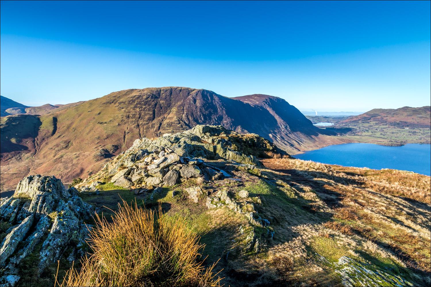
North top of Rannerdale Knotts, looking towards Mellbreak

We set off along the knobbly summit ridge

Buttermere

Bonnie enjoys the view

Further along the ridge

Whiteless Pike and Grasmoor on the far side of Rannerdale

The end of the rocky section of the ridge, and it's easy progress now along a grassy path...


Turn sharp left if returning via Rannerdale, but we decide instead to fork off to the right

We descend towards Buttermere

We turn right at the hollow below to start the return leg of the walk

A narrow track takes us above Great Wood

The head of Crummock Water behind the trees

The path continues to contour around the flanks of Rannerdale Knotts

Crummock Water

We keep to the higher path here

Woodhouse Islands again

Mellbreak

Fleetwith Pike and Haystacks in the background

Mellbreak again...


We join our original ascent path and retrace our steps back to the start of a superb little walk

The next day, contrasting weather as we join our fellow marchers in protest at the zip wire proposal


We walk across the head of the Thirlmere dam and assemble to listen to the speeches, all of which were heartfelt and moving

Douglas Chalmers, chief executive of Friends of the Lake District, introduces the speakers


Film maker Terry Abraham delivers a passionate speech

Two brothers aged 7 and 10 tell the audience what the Lake District means to them

Looking along Thirlmere, and even on a miserable day such as this the thought of zip wires being strung across here seems inconceivable
