
Route: Circuit of Punta del Pacino
Area: Spanish Pyrenees
Date of walk: 22nd June 2016
Walkers: Andrew and Gilly
Distance: 6.9 miles
Ascent: 1,900 feet
Weather: Sunny and very hot
We left our base in Biescas and drove along the Valle de Tena along the A136. Just before Formigal, and thanks to a tip by Phil of Hike Pyrenees, we found the location of the extremely rare Lady’s Slipper Orchid – so rare that it’s guarded when in flower. After taking a few photos of this lovely flower we drove back along the road for a short distance and parked up a dirt track near Sallent to start our walk
After a short initial road section we followed a path, very faint in places, up through the meadows and above some cliffs. Despite some useful wooden marker posts, route finding needed some concentration as there were numerous cattle tracks leading in the wrong direction. We eventually arrived at a col with amazing views of the cliffs of the Sierra de Partacua
A little later on and after more climbing we arrived at another col where we had to decide whether or not to make the ‘there and back’ ascent of Punta del Pacino. This would have added another 45 minutes or so to the walk plus some strenuous climbing. By now we were parched, having almost run out of water in the sweltering heat, and so decided to pass on the ascent even though the summit looked temptingly close
There followed a long but easy descent back to the start with superb views all the way to complete a hat trick of great walks in this area
Click on the icon below for the route map
![]()
Scroll down – or click on any photo to enlarge it and you can then view as a slideshow

Growing close to the roadside near the start of today’s walk, the extremely rare Lady’s Slipper Orchid

When in flower this small group is guarded continuously

As we walked back to the car, we heard the high pitched screech of a marmot

The start of the walk from the nearby parking space overlooking Sallent de Gállego

After a 10 minute walk along the road we join this footpath which heads uphill through the meadow

Sallent de Gállego again, and the Embalse de Lanuza

The path takes us uphill and above the cliffs top right of picture


Griffon Vulture

Looking back to Sallent de Gállego at the foot of Pena Foratata


We follow the white and yellow path markers, which take us above the rocks on the left

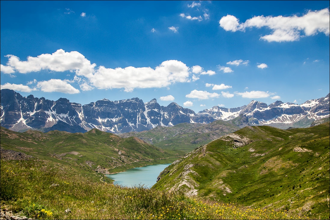
Looking across the Tena Valley to Lanuza and its reservoir


We walk above the Barranco de Escarrilla

The Sierra de Partacua comes into view

Punta del Pacino ahead - we hadn’t decided at this point whether we’d make the detour to climb it

We continue to follow the path above the Barranco de Escarrilla

The dam wall of the Embalse de Escarra

The Sierra de Partacua

We follow the sign for the col

Looking back along our path

Marsh Orchid

Viola

The Sierra de Partacua again as we climb up to the col in sweltering heat


We arrive at the Collado del Pacino

The Punta del Pacino looks temptingly close, but it’s a false summit and the return journey would add 45 minutes to our walk. The heat is too much and we decide to give it a miss

Looking down to Formigal as we start the descent back into the valley

Walking towards the French border, which is just past Formigal

Our path will take us past the watertower below left - the town beyond is Sallent de Gállego

The path zigzags back and forth down the mountainside, with great views in both directions


Fritillary


Meadows full of wildflowers…


Viper’s Bugloss

Vetch

The path leads to this track, which we follow back to the start


Zooming in on the Sierra de Tendenera at the end of another great walk
Follow the link for more walks in Spain (17)
