
Route: Pike o’Blisco and Blea Tarn
Area: Southern Lake District
Date of walk: 8th September 2014
Walkers: Andrew and Gilly
Distance: 5.6 miles
Weather: Sunny with increasing cloud cover. Warm
We parked in the National Trust car park near Blea Tarn and followed the path which runs above the shore, with its classic view towards the Langdale Pikes. It was tempting to lie down and gaze at the view all day, but there was a mountain to climb – Pike o’Blisco
We walked along the west shore of the tarn and shortly after that we departed from the main track to take a faint grassy path leading up the fellside. This was a new route for us, suggested by Bob Allen in one of his excellent guidebooks, but – sorry Bob – this part of the walk was rather confusing. The so called path didn’t seem to exist and is not shown on the OS map so we were in some doubt as to whether we were on course. We knew the correct line of travel however and fumbled our way along until we eventually joined up with the main path leading from the foot of Side Pike. For anyone following this walk, it might be better to carry on along the main path from the tarn and start the climb later on, though this would make the walk a little longer. At least our route had the advantage of cutting the corner
Once we were on the main path, it was a straightforward climb to the summit of Pike o’Blisco, though there were three or four short scrambly sections when hands were needed. The views from the top were lovely but by now it had started to cloud over a little
The route down was along a vague path which would be hard to follow in mist. We made it back down to the bridge on the Wrynose Pass, then followed the steep road down for a short distance before joining an attractive path back to the start
For other walks here, visit my Find Walks page and enter the name in the ‘Search site’ box
Click on the icon below for the route map (subscribers to OS Maps can view detailed maps of the route, visualise it in aerial 3D, and download the GPX file. Non-subscribers will see a base map)

Scroll down – or click on any photo to enlarge it and you can then view as a slideshow

Nuthatch in the garden before we set off this morning

Start of the walk from the car park by Blea Tarn

Blea Tarn, with the Langdale Pikes in the background

Gilly and Bonnie walking beside the tarn


Following the path along the west shore of the tarn

The distinctive outline of Side Pike

Having left the main path and struck a pathless course up the fellside, we are rewarded with a view into Micklelden

The way ahead, with Pike o’ Blisco in the distance

Looking back to Side Pike

The Langdale Pikes

Another view back to Side Pike on the left of the picture

Gilly has a breather and I wait for her (either gallantry or the fact that the sandwiches are in her backpack)


Rockier terrain as we get closer to the top

Looking across to the Langdale Pikes

One of the short scrambly sections just below the summit, but quite straightforward

Summit of Pike o’ Blisco

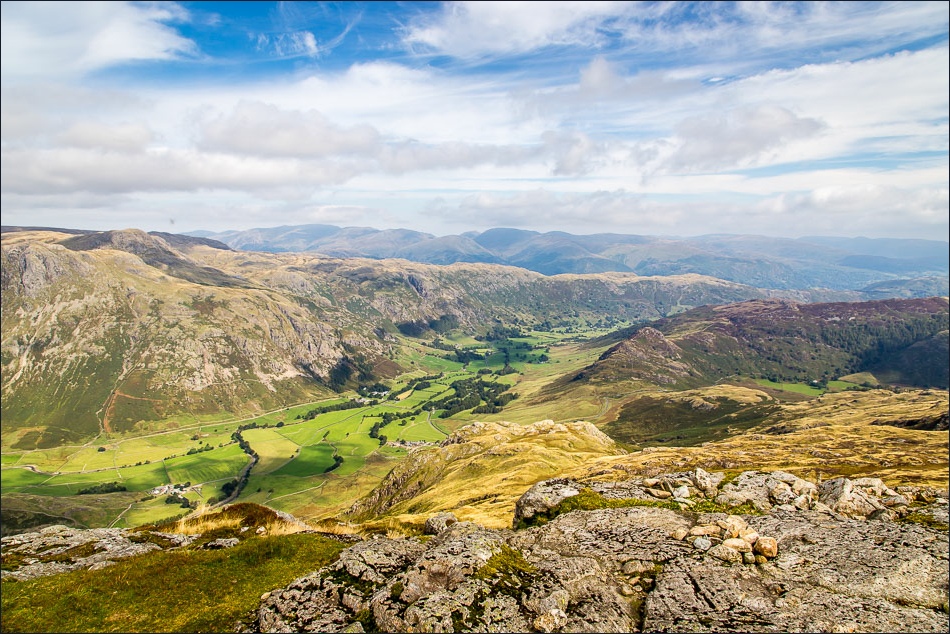
Great Langdale from the summit

Crinkle Crags and Bowfell

Windermere in the distance

Start of the descent along a vague path - navigation becomes easier once we reach Wrynose Beck further down

Wrynose Beck on the left, which we follow down to the Wrynose Pass

We follow the road down for a short distance, stepping aside from time to time to let ashen faced motorists pass by


We leave the road at a small sign which points in the direction of Blea Tarn

The Langdale Pikes come into view again

Crossing Bleamoss Beck, which runs into Blea Tarn

I can’t resist a parting shot of Blea Tarn and the Langdale Pikes just before we arrive back at the start

Later that day, a hedgehog in the garden
