
Route: Middle Fell
Area: Western Lake District
Date of walk: 18th December 2019
Walkers: Andrew
Distance: 4.2 miles
Ascent: 1,700 feet
Weather: gale force winds where exposed, mostly cloudy and overcast
It’s been almost two years since I last visited Middle Fell, which enjoys some of the best views of the Scafells. As on that occasion, I parked on the roadside verge just beyond the small hamlet of Greendale in Wasdale and followed the grassy path leading gently uphill. After a short distance I passed a fork in the path to the right, which would be my return route at the end of the walk
I continued to follow the path, which stays close the the bank of Greendale Gill. The gill tumbles down the fellside from Greendale Tarn in a succession of small cascades. The path is sometimes rocky, and sometimes disappears, but the way is never in doubt as long as the gill is kept on the left
Eventually I reached Greendale Tarn and followed a faint path around its right hand side. Beyond the tarn I continued climbing, and after a short distance I turned sharp right to climb up the ridge to the summit of Middle Fell. It was easy going all the way. A few patches of snow hid the path at times, but the way ahead was obvious. Once on the ridge, I was exposed to a fierce wind which brought me to a standstill once or twice. The summit was no place to linger, and after a couple of obligatory photos it was time to be heading down
I followed the easy path down the ridge, enjoying good views of the Wastwater Screes along the way. I made my way across to Greendale Gill, where I picked up my original ascent path and retraced my steps back to the start
The weather was a little disappointing, but it was still a superb short walk – one that seems much longer than it is, and which is ideal for anyone who visits Wasdale with insufficient time or energy to tackle one of the nearby giants
For other walks here, visit my Find Walks page and enter the name in the ‘Search site’ box
Click on the icon below for the route map (subscribers to OS Maps can view detailed maps of the route, visualise it in aerial 3D, and download the GPX file. Non-subscribers will see a base map)

Scroll down – or click on any photo to enlarge it and you can then view as a slideshow

The day before the walk, a visit to Lanthwaite Hill with views north, south, east and west

Next morning, the start of the walk from Greendale on the road to Wasdale Head

Greendale, with Buckbarrow towering above it

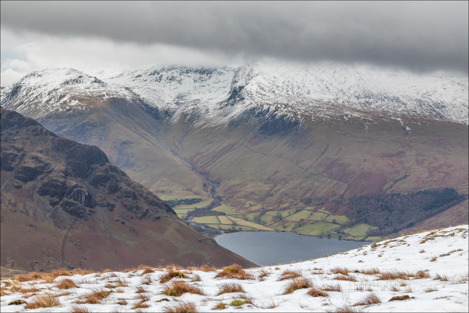
Looking across to Lingmell, Scafell, and Scafell Pike beyond the head of Wast Water

Zooming in

Looking back down to Greendale

I continue to the left here, and will return via the path on the right

Greendale Gill, which will be my constant companion for much of the ascent

There are hundreds of cascades along the way...


The gradient levels out below Greendale Tarn

I follow a faint and sometimes rocky path to the right of Greendale Tarn

Looking back to the tarn as I gain height

Bleak and remote terrain, with Seatallan on my left, and Haycock and Scoat Fell ahead

The trio of Haycock, Scoat Fell and Red Pike are perhaps the hardest in lakeland to access, requiring a long walk in from whatever starting point is chosen

Kirk Fell and Great Gable beyond Yewbarrow

Looking back to Haycock and Scoat Fell as I make for the summit ridge...

...and now looking back down to Greendale Tarn

A herdwick - such tough creatures - with Seatallan in the background

I gain the summit ridge and look across to the head of Wast Water, with Lingmell and the Scafells beyond

An otherwise easy walk to the summit was made arduous by a howling gale

Summit cairn on Middle Fell - it was hard to stand up, so I started the descent without delay

Wast Water

I descend in the direction of Greendale Gill

Looking down to Greendale where I'd started the walk

The Wasdale Screes, which plunge into Wast Water from Illgill Head and Whin Rigg

Buckbarrow ahead, and the Irish Sea in the distance

The Wasdale Screes again

Tongues Gill, flowing steeply into Greendale Gill

A lone yew tree, Wast Water and the Screes

Looking across to the Scafells

I reach Greendale and the valley road to end a wonderful walk

It would be unthinkable to visit Wasdale without admiring the classic view to its head...

