
Route: Lorton Vale
Area: Western Lake District
Date of walk: 27th August 2017
Walkers: Andrew and Gilly
Distance: 4.1 miles
Ascent: 500 feet
Weather: Light cloud
Lorton Vale is a chain of valleys stretching from Cockermouth in the north to Buttermere in the south. The middle section, with the villages of High Lorton and Low Lorton at its centre, may lack the drama of the Buttermere area but is full of rural charm and is an ideal place for a quiet walk, especially on a bank holiday such as today
We parked in High Lorton and set off in a clockwise direction so as to have the best views ahead of us as we progressed. We climbed out of the village via Boonbeck and Scales and joined the mid level path which runs along much the valley. The section near High Swinside is beautiful, with wonderful views along and across the valley
Beyond High Swinside we joined the gated road for a short distance and then rejoined the path, which curves round the foot of Lorton Dodd. After some dithering we managed to ford Hope Beck, which was very full after recent heavy rain, and then carried on round the foot of Dodd along a path which is juicy at the best of times, and was even more so today
It’s hard to leave such an enchanting path, but we had to do so at Miller Place in order to start the return leg. We walked down the outgang from the fellside and followed the quiet lane through Hopebeck. Just beyond Hopebeck we took a path across the fields back into High Lorton. It was two hours well spent in sylvan surroundings
For other walks here, visit my Find Walks page and enter the name in the ‘Search site’ box
Click on the icon below for the route map (subscribers to OS Maps can view detailed maps of the route, visualise it in aerial 3D, and download the GPX file. Non-subscribers will see a base map)

Scroll down – or click on any photo to enlarge it and you can then view as a slideshow

The Lorton Yew at the start of the walk - the tree immortalised by Wordsworth in his poem 'Yew Trees' has been halved in size by storms

Looking back over High Lorton as we climb up the lane to Boonbeck

We leave the lane to walk through the field to Scales

We pass through the farm buildings in Scales

Looking back over Lorton towards Cockermouth, and beyond it the Solway Firth

The path to High Swinside

The track leading from High Swinside holiday cottages...

The track leads to a gated road which we follow for a short distance

Looking along Lorton Vale to Mellbreak and the Lorton fells

Zooming in on heather clad Mellbreak

We leave the gated road to follow a path towards Hope Gill

A view back to Lorton

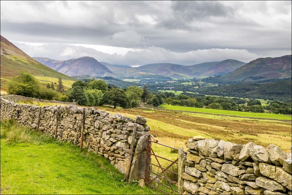
We follow the path by the dry stone wall...


Hope Beck


This section is always wet underfoot, whatever the weather

Low Fell and Fellbarrow on the far side of Lorton Vale

Herdy on the path

Mellbreak again

We leave the valley path at the outgang near Miller Place

The track from Miller Place

Gilly admires the view across the vale as we join the lane leading to Lorton

Low Fell

Heather on the lower slopes of Ladyside Pike

Further along the lane

Fellbarrow on the far side of the vale


Ladyside Pike and Hopegill Head

We leave the lane here to walk across the fields

Ladyside Pike and Hopegill Head again

High Swinside, which we'd passed through earlier in the walk

Dodd, which looks like a separate fell seen from here, but which is an extension of the ridge leading to Whiteside

Ladyside Pike

Looking across the vale

Lorton comes into view beyond the old barn

We pass by the barn...


High Lorton

Bonnie climbs the steps in the wall

Whit Beck, and the Lorton Yew again

Cottages in High Lorton at the end of today's walk

Back home, a red squirrel in the garden
