
Route: Lingmoor Fell
Area: Southern Lake District
Date of walk: 7th July 2013
Walkers: Andrew and Gilly
Distance: 5.4 miles
Ascent: 1,300 feet
We parked at Elterwater and crossed the bridge to start the climb up to Lingmoor Fell. The weather was hot – about 23c – and we were soon puffing and panting
The climbing was easy though, and it wasn’t long before we reached the main ridge leading to the summit
From here there were wonderful views, and the Langdale Pikes could be seen in all their glory. Just below the summit cairn we feasted on the view – and on our cheese and pickle sandwiches
We retraced our steps for a short distance and then headed back down an alternative path to Elterwater, from which we had good views over the Langdale valley
By the time we got back to Elterwater we were parched, but were able to slake our thirst at the Britannia Inn – a great end to a great walk
For other walks here, visit my Find Walks page and enter the name in the ‘Search site’ box
Click on the icon below for the route map (subscribers to OS Maps can view detailed maps of the route, visualise it in aerial 3D, and download the GPX file. Non-subscribers will see a base map)

Scroll down – or click on any photo to enlarge it and you can then view as a slideshow

Immediately after leaving the car park, we cross the bridge over Langdale Beck

The stony path heads up through Sawrey’s Wood

After leaving the wood, we emerge onto open fellside, with a view of Wetherlam ahead

Little Langdale Tarn

Looking back over Little Langdale, after leaving the main path to head up the flanks of Lingmoor Fell

A view of Great Langdale emerges higher up

Looking back to Elter Water and Windermere

A handy sofa, though not well sprung

The top of Lingmoor Fell lies ahead, with Bowfell and the Langdale Pikes in the distance

Cotton grass

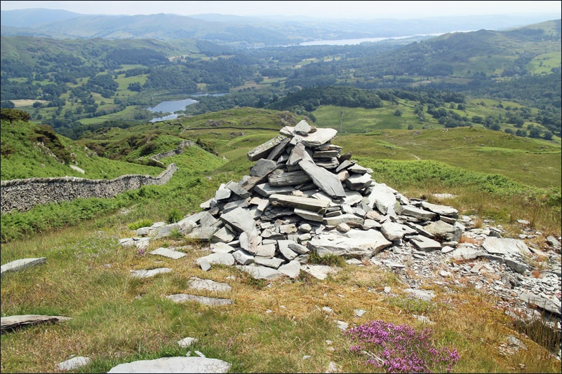
Summit cairn of Lingmoor Fell

From the same spot, the Langdale Pikes

Our picnic place, on the way back down from the top

Looking down to Langdale and Chapel Stile

A rescue helicopter, thankfully not on a mission, but part of the Chapel Stile Gala being held in the village below

Elterwater Quarry below

Before we reach the quarry, we go through Sawrey’s Wood again

The path takes us through Elterwater quarry - the foreground and the background contrast oddly

The quarry is an impressive sight, and though it scars the landscape it is part of the history of the valley

What a welcome sight - the Britannia Inn at Elterwater
