
Route: Crummock Water and Lanthwaite Hill
Area: Western Lake District
Date of walk: 26th March 2015
Walkers: Andrew and Gilly
Distance: 2.1 miles
Weather: Mixture of cloud and sun, cold wind
If there were a competition for the hill with the best view for the least effort in ascent, Lanthwaite Hill (or Brackenthwaite Hows as the OS calls it) would be a strong contender
From the National Trust car park at Scale Hill it takes about 10 minutes to reach the top from where a view along Lorton Vale can be enjoyed in one direction, and Crummock Water and the North West Fells in the other. It’s a wonderful spot, and we never see anyone else here. We had a special bonus today when a rainbow shone like a halo over the top of Whiteside
Having savoured the views for a while, we walked down into Lanthwaite Wood and along a path which skirts round the edge of the wood, and then down to the shore of Crummock Water
We followed the lakeshore path to the foot of the lake before joining the wide track back to the start. It was a short walk but packed full of beautiful scenery
For other walks here, visit my Find Walks page and enter the name in the ‘Search site’ box
Click on the icon below for the route map (subscribers to OS Maps can view detailed maps of the route, visualise it in aerial 3D, and download the GPX file. Non-subscribers will see a base map)

Scroll down – or click on any photo to enlarge it and you can then view as a slideshow

Earlier today, a wren in the garden…

… and a red squirrel


The start of the walk - looking across the River Cocker to Mellbreak

Entering Lanthwaite Wood - the wide track leads directly to Crummock Water, but we take a narrower path uphill to the left

Higher up, we take another left fork

The start of a short rocky section

Stairway to heaven

Deer gate at the edge of Lanthwaite Wood (I’ve seen deer at both sides so I don’t know if it’s supposed to keep them in or out!)

Lanthwaite Hill, with Grasmoor beyond

Looking north, sweet Lorton Vale

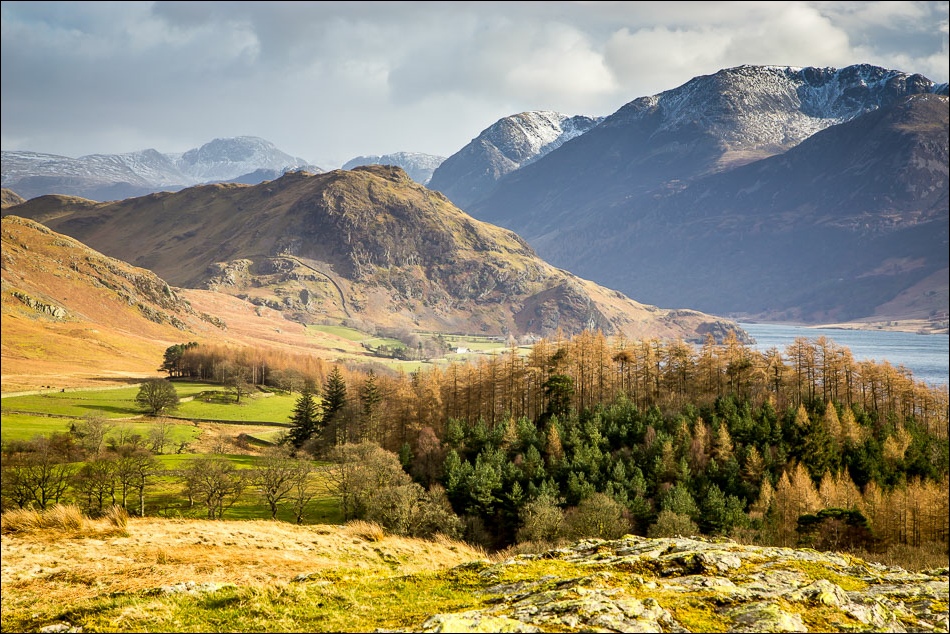
And now looking south, Rannerdale Knotts in the foreground, Great Gable beyond and High Stile to the right (and Crummock Water)

Loweswater - the Kirkstile Inn, which we’d visit later for ‘refreshments’, is top left

Red Pike, Mellbreak and Crummock Water from Lanthwaite Hill

We were about to descend from Lanthwaite Hill when I turned back and noticed a rainbow

Rainbow over Whiteside

Whiteside and Grasmoor

A last look back over Lorton Vale

Heading down to Crummock Water

The lower slopes of Grasmoor dominate the background

Lanthwaite Green, between Whiteside and Grasmoor

Following the path down to the lake

The boathouse at Crummock Water, looking across to the Loweswater Fells

Low Fell

We follow the path along the shore of the lake

The glorious view along Crummock Water to Rannerdale Knotts and the High Stile Range

…and again, from the point where the lake flows into the River Cocker

The track through Lanthwaite Wood back to the start

A good walk in these parts is best celebrated at the famous Kirkstile Inn

A perfect end to a perfect afternoon
