
Route: High Rigg
Area: Central Lake District
Date of walk: 18th July 2018
Walkers: Andrew and Gilly
Distance: 5.8 miles
Ascent: 1,300 feet
Weather: Cloudy with sunny spells, very warm
This is a walk we’ve followed many times and is one of our favourites. We parked as usual in one of the roadside spaces on the A591 near Legburthwaite and after crossing the nearby ladder stile made our way up Wren Crag towards the ridge. The flanks of the crag are adorned by some fine old pine trees and it was a great shame to see that a number of these – perhaps 20 or 30 – had fallen victim to the gales earlier in the year. The so-called ‘Beast from the East’, which was followed by a couple of other gales from the same direction, was the obvious culprit, since the trees were all lying on an east/west axis. This wind direction is highly unusual for the Lake District, and so the root systems of the trees had not grown to cope with it
When we reached the knobbly summit ridge we followed the undulating path up and down and after about 1.5 miles we arrived at the summit of High Rigg, from where there are lovely views, particularly those looking towards Blencathra
We then descended in the same direction as the ridge to reach the hause between High Rigg and Low Rigg. From here we followed a narrow lane for a few yards, passing by tiny St John’s Church, before joining a recently repaired path which hugs the lower flanks of High Rigg, and from which there are good views across St John’s in the Vale
Near the end of the vale we treated ourselves to tea and delicious home made scones at Low Bridge End Farm before continuing along the valley path, which rises above St John’s Beck before descending back to the start of a walk which never fails to please
For other walks here, visit my Find Walks page and enter the name in the ‘Search site’ box
Click on the icon below for the route map (subscribers to OS Maps can view detailed maps of the route, visualise it in aerial 3D, and download the GPX file. Non-subscribers will see a base map)

Scroll down – or click on any photo to enlarge it and you can then view as a slideshow

The start of today's walk as we leave the roadside car parking space and climb the ladder stile

The recent gales have blown this old pine tree across the path, and have felled an oak tree too

An early view back to the A591 and to tree clad Great How

Looking ahead, we're sad to see several more fallen pine trees pointing west - the root balls are quite shallow and were clearly unable to withstand the easterly gales

We follow the path towards the trees

Castle Rock

We follow the path through the pines

Looking back at more fallen trees covering the path in places

Castle Rock again

Looking back as Thirlmere comes into view, with a distinct tide line thanks to a lack of rain for two months

We gain the ridge - the summit cairn is at its far end

Great How and Thirlmere from a small col on the ridge...

...Blencathra and Clough Head from the same spot

Looking across St John's in the Vale to Clough Head

Great How and Thirlmere again

We follow the obvious path along the summit ridge

Looking down into St John's in the Vale, our return route

We arrive at a small unnamed tarn, an opportunity for Bonnie to cool down...

...it's mostly mud, but that doesn't bother her

Bonnie emerges, bearing a faint resemblance to a pint of Guinness


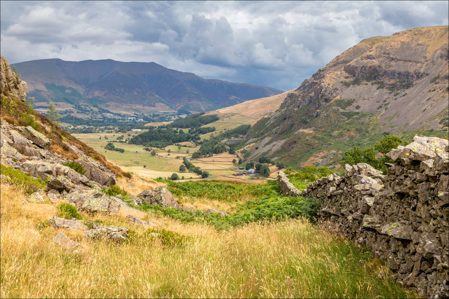
We follow the path beside the dry stone wall...


Looking back

The summit of High Rigg comes into view

Looking across to Dodd Crag

Summit cairn on High Rigg, with the Blencathra range in the background

A view back towards Thirlmere

Clough Head

Start of the descent in the direction of Low Rigg and Tewet Tarn

Blencathra

St John's in the Vale below

We descend to the Youth Centre

At the hause between High Rigg and Low Rigg we follow the lane past the Youth Centre

Nearby St John's Church

We leave the lane here to take the path on the right, although it's possible to continue a little further along the lane and take the alternative path along the valley floor

Looking down to Bridge House and St John's Beck

We follow the recently repaired path around the lower flanks of High Rigg

We pass by a ruined stone barn

St John's in the Vale is on our left as we follow the delightful path...


We head towards Low Bridge End Farm, where we enjoy some guilt free tea and scones

Beyond the farm, the path rises above St John's Beck to contour around the foot of High Rigg

We arrive back at the A591 and the end of a great little walk
