
Route: Haystacks
Area: Western Lake District
Date of walk: 4th August 2021
Walkers: Andrew
Distance: 5.6 miles
Ascent: 1,900 feet
Weather: Sunny
Haystacks was the favourite fell of Alfred Wainwright and it’s one of mine too – it’s a fascinating place and there’s always something new to see. Today would make it my 20th time up here, and I could never tire of it. I made an early start and parked in the car park at Gatesgarth Farm just after 7am (note the parking fee is currently £4, cash only). I walked through the farm and crossed Peggy’s Bridge at the head of Buttermere. The climbing starts below a small triangular shaped copse, and from here I followed the easy path up to Scarth Gap
Beyond Scarth Gap the going gets much steeper and rockier, and there are are five or six scrambly sections where hands are needed. There are no dangers though, and it’s an enjoyable clamber. A final steep section brought me to the summit area, which is full of interest. I wandered around here for a while and visited a couple of unnamed tarns which were shown in good light. It’s a fascinating place full of bumps and hollows, with different views from each
A direct descent from the summit is impossible and it’s necessary to walk across some complicated knobbly terrain – Haystacks is a bad place to be if lost in mist. I soon arrived at the contradiction in terms which is Innominate Tarn and continued to follow the path in the direction of Dubs Quarry. Eventually I arrived at the first of the two possible descent paths to Warnscale Bottom, and chose this for the descent. The alternative path is a little further on and follows the far side of Warnscale Beck. Both paths meet up at valley level, and both provide an easy way down, with wonderful views ahead along Warnscale Bottom and Buttermere for most of the way
It was another wonderful visit to this special place and thanks to my early start I didn’t pass another walker until almost back to the start
For other walks here, visit my Find Walks page and enter the name in the ‘Search site’ box
Click on the icon below for the route map (subscribers to OS Maps can view detailed maps of the route, visualise it in aerial 3D, and download the GPX file. Non-subscribers will see a base map)

Scroll down – or click on any photo to enlarge it and you can then view as a slideshow

The start of the walk as I leave Gatesgarth and follow the track in the direction of High Crag

Today's objective - Haystacks

From Peggy's Bridge, looking along Warnscale Beck to Green Crag and Haystacks

From the same place, looking the other way towards Buttermere

For the circuit of Buttermere, turn right here. My path leads uphill and around the small copse above

Haystacks, and a newly shorn herdwick

The head of Buttermere

The 'White Hut' bothy

Haystacks and Scarth Gap ahead - it's an easy climb so far but gets much steeper beyond the gap

My start point, Gatesgarth Farm, on the right

The path becomes rougher as it passes below Seat

Another view back to Gatesgarth Farm

Scarth Gap, which is an important junction as it provides access to both Ennerdale and Wasdale

Buttermere and Crummock Water

The terrain changes to bare rock at the foot of Haystacks

There are several short scrambly sections where hands are needed and although it’s steep there's no sense of exposure

A rocky plateau below the summit

An unnamed tarn on the summit area

Summit of Haystacks, a place which is full of interest and considered by Alfred Wainwright to be 'the best fell-top of all - a place of great charm and fairyland attractiveness'

Looking south to Great Gable and Kirk Fell

A view west to Pillar

Ennerdale

After spending half an hour or so wandering around the summit area, in total solitude, it was time to start the descent. It's a very confusing area, but Innominate Tarn holds the key - the path passes to the left of it

Looking back to Pillar

An unnamed tarn, with Great Gable beyond it and Innominate Tarn to its left

Green Gable, Great Gable and Kirk Fell from the first tarn, a heavenly spot....


The contradiction in terms that is Innominate Tarn

I continue along the ridge towards Green Crag

Looking across a fearsome gully to Fleetwith Pike

Buttermere and Crummock Water

Looking back to Innominate Tarn and Haystacks

I arrive at the descent path, which is to the left of Warnscale Beck. An alternative path is a little further along and follows the other bank. I prefer the first path, as it's quieter. This proved to be the case today, and I didn't pass another walker

This view accompanies me for much of the descent - Warnscale Beck flowing into Buttermere, with Crummock Water beyond

The alternative path on the right

Almost back to valley level

I cross the footbridge over Warnscale Beck, and just beyond it the two descent paths will merge

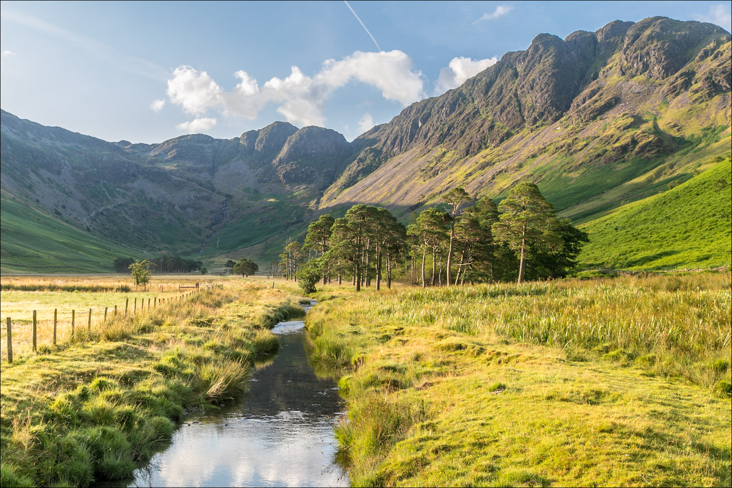
Looking back over the Buttermere pines to Haystacks

The High Stile Range, which runs along the west shore of Buttermere and comprises High Crag, High Stile and Red Pike

A final glance back to Haystacks at the end of a fantastic walk
