
Route: Grindsbrook
Area: Derbyshire, Peak District
Date of walk: 12th August 2016
Walkers: Andrew and Gilly
Distance: 4.9 miles
Ascent: 1,300 feet
Weather: Sun and blue skies – very windy on the tops
Today was the Glorious Twelfth, and a glorious day it was too as we parked in the little village of Edale for our first walk in the High Peak. Our intended route was up The Nab and along the edge of the Grindsbrook skyline, but our hearts sank as we started the climb only to be confronted by a sign on a gate announcing that the path was closed on account of shooting – the first day of the season
After looking at the OS map and chatting with another walker we soon came up with a Plan B and headed up the valley following the route of Grinds Brook. A delightful path through the heather took us gradually uphill until we reached Grindsbrook Clough, where the walk became a clamber over innumerable rocks and boulders. Some hand work was needed but it was easy going and there were no dangers or difficulties
We emerged onto open upland and followed a path along the edge to Grindslow Knoll, the high point of the walk at 1,960 feet. We didn’t linger here as there was a gale force wind that almost blew us off our feet. There followed an easy descent back down to the start, with stunning views of the Vale of Edale all the way down
It hadn’t been the walk we’d planned but it was a superb one all the same
Click on the icon below for the route map (subscribers to OS Maps can view detailed maps of the route, visualise it in aerial 3D, and download the GPX file. Non-subscribers will see a base map)

Scroll down – or click on any photo to enlarge it and you can then view as a slideshow

Walking into Edale from the car park near the railway station

The start of the 268 mile long Pennine Way - we’ll be returning along this track at the end of the walk

We’re aiming for Heardman’s Plantation on the right


Looking back along the path - a perfect day, and we are full of anticipation, but…

…’the best laid plans of mice and men’. My words at the time were rather less poetic - time to come up with a Plan B

Instead of traversing the skyline above, we descended to the path below and followed the valley trail between the trees

We cross this attractive wooden footbridge

We follow a lovely path through the heather


Looking back

We follow the course of Grinds Brook, which has numerous small waterfalls…


Beyond the gate the going gets rockier


A clamber rather than a scramble

We gain the ridge and look along the path we’d have taken had our plan not been thwarted by the first day of the shooting season

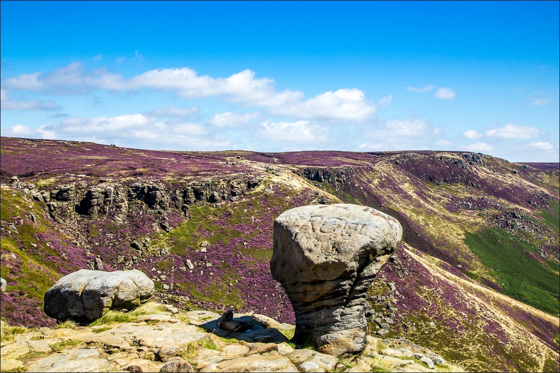
Gritstone rock formations at the head of Grindsbrook Clough


We follow the path towards Grindslow Knoll

Looking back to Edale Moor. Kinder Scout, the highest point in the Peak District, is beyond


The top of Grindslow Knoll, where it was so windy that we could hardly stand up

We descend into the Vale of Edale

We look across the the route we’d planned - up the ridge of The Nab from the triangular plantation

Zooming in on the plantation where we’d encountered the warning sign, we could see other walkers replotting their routes - and some ignoring the sign


Edale…


Looking back along our path

We join the Pennine Way here, and this takes us back into Edale

Back in Edale and the end of a wonderful walk, even though it wasn’t the one we’d originally planned
Follow the link for more walks in the Peak District (14)
