
Route: Grange Fell
Area: Central Lake District
Date of walk: 15th February 2018
Walkers: Andrew, Gilly and David
Distance: 3.5 miles
Ascent: 1,100 feet
Weather: Cloudy, cold and windy
Our nephew David was keen to tick off another Wainwright, and as Grange Fell was on his to do list we decided that it would be today’s target. We parked in the National Trust Bowderstone car park and from here followed a path which goes through woodland and then bracken, gradually curving around the steep crags above
A rocky staircase then leads to Long Moss near the summit of the fell. Grange Fell has 3 separate tops, King’s How being the loveliest, though slightly lower than nearby Brund Fell. Today we visited King’s How. From the summit there is a superb view over Derwent Water looking one way and Borrowdale looking the other
A direct descent from here is out of the question thanks to the crags on the west side of the fell, so we followed a narrow path which snakes round the other side of the fell and which eventually brought us down to the Borrowdale road. We followed the road for a short distance – there’s a narrow footpath most of the way – then crossed over at the sign indicating the Bowderstone. We followed this path through the woods, past the massive Bowderstone and back to the car park
What Grange Fell lacks in height it more than makes up for in beauty – it had been a great little walk and, despite it being half term, we didn’t see another walker until we were almost back to the start
For other walks here, visit my Find Walks page and enter the name in the ‘Search site’ box
Click on the icon below for the route map (subscribers to OS Maps can view detailed maps of the route, visualise it in aerial 3D, and download the GPX file. Non-subscribers will see a base map)

Scroll down – or click on any photo to enlarge it and you can then view as a slideshow

Horizontal sleet yesterday, and not a day for walking

Better weather today, and off we go

The start of the walk as we leave the Bowderstone car park

We cross a small beck which flows down into the River Derwent


Looking across the valley to the flanks of Maiden Moor

Looking up to Grange Fell - our route will take us up via the left hand side

Looking back to Castle Crag

We continue to make our way through the woodland

Crossing another small beck before we start the ascent

Progress is made easier by a series of rock steps

Derwent Water and the Skiddaw Fells come into view

Not far to go now

Summit of King's How on Grange Fell, and David and Gilly admire the view towards Helvellyn and the eastern fells

Looking across Borrowdale

Borrowdale - more views of this beautiful valley await us on our descent

Derwent Water and Skiddaw again

Castle Crag

Start of the descent in the direction of Borrowdale

Lone birch tree looking towards the Borrowdale Fells


The snowy flanks of High Spy

The River Derwent below

Stonethwaite

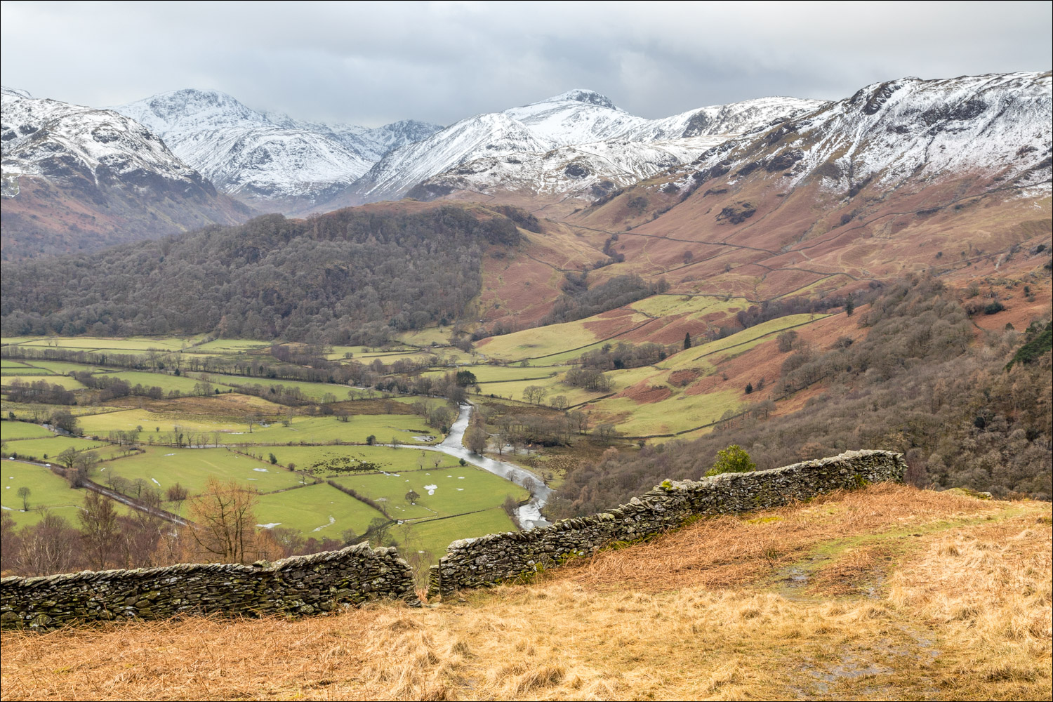
Borrowdale

Rosthwaite below

We pass through the gap in the dry stone wall...


Borrowdale Fells

A ray of sunshine as we descend...


We join the path from Watendlath and head back in the direction of the start

We follow a path above the valley road

The path takes us over Red Brow

A short section along the path by the Borrowdale road

We leave the road to join the path to the Bowderstone

The Bowderstone...

...and back at the car park a notice board describing it
