
Route: Fellbarrow
Area: Western Lake District
Date of walk: 31st March 2013
Walkers: Andrew
Distance: 6 miles
Ascent: 1,200 feet
I parked near the bridge over the River Cocker in Low Lorton. After crossing the bridge I followed the old Mosser road which is unfit for cars. There were great views to Scotland over the Solway Firth
I left the Mosser road at its highest point and followed a track for a short distance before turning uphill to reach the top of Fellbarrow
I descended to join the lovely path, with its classic view of Crummock Water, which leads down into Thackthwaite
I then walked back into Low Lorton along the quiet lane
A hat trick of great walks in the last three days
For other walks here, visit my Find Walks page and enter the name in the ‘Search site’ box
Click on the icon below for the route map (subscribers to OS Maps can view detailed maps of the route, visualise it in aerial 3D, and download the GPX file. Non-subscribers will see a base map)

Scroll down – or click on any photo to enlarge it and you can then view as a slideshow

Crossing the River Cocker at Low Lorton

The Mosser road leads uphill out of Low Lorton

Looking towards Whiteside from the Mosser road

Looking north across the coastal plain, Scotland is in the distance

Another view over the Solway Firth to Criffel in Scotland

At the highest point of the Mosser road, a track can be joined which heads towards Fellbarrow

Looking towards Whiteside

A glimpse of Crummock Water

Bonnie contemplates the stile

OS trig point on the summit of Fellbarrow looking south east

...and this time looking north to Scotland

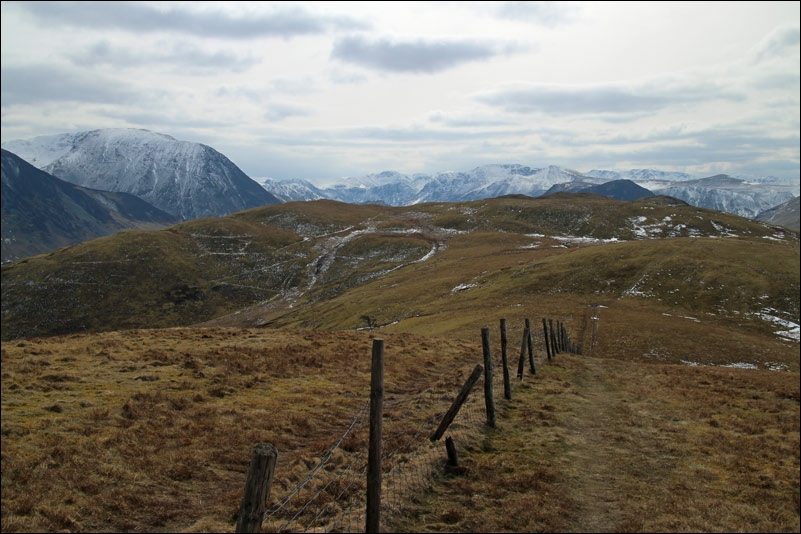
Low Fell ahead, but my route is downhill to the left

Lorton Vale

On the path down to Thackthwaite

This wonderful view of Crummock Water appears round the corner

Millbeck in the middle of the picture

Nearly back down to Thackthwaite, the fells are Whiteside and Grasmoor

At Thackthwaite I joined the quiet lane which leads back into Low Lorton, completing the circuit
