
Route: East shore of Crummock Water
Area: North Western Lake District
Date of walk: 5th February 2014
Walkers: Andrew and Gilly
Distance: 5.3 miles
Ascent: 800 feet
In view of a dire weather forecast the night before, we’d not planned to go walking today, but in the morning there was some sun and blue sky. Without ado we set off and parked at the National Trust car park at Scalehill Bridge
The plan was to walk round Crummock Water, though we had it in mind that we’d cut the walk short if the threatened rain and gales materialised
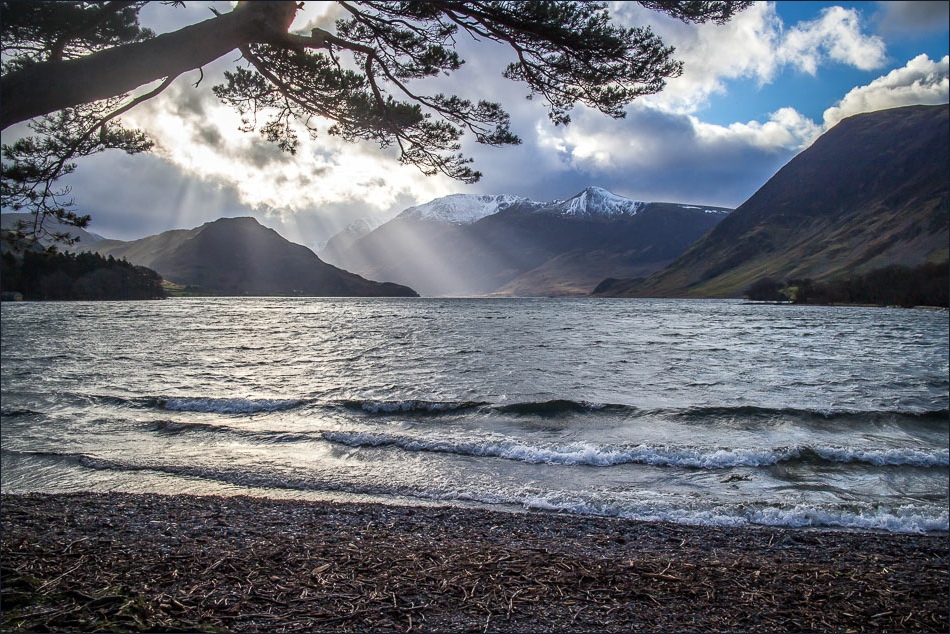
We set off along the track and soon reached the head of Crummock Water – always a glorious sight whatever the weather. We followed the path along the east shore which ends about half way along the lake, then walked over Cinderdale Common aiming for Low Bank. The plan was to follow the valley uphill, then descending to Buttermere village with a view to completing the circuit of the lake
By this time the weather had closed in and it started to rain quite heavily. It seemed that the weatherman had been right all along. We decided to return back along the east shore – a good choice as it continued to rain for the rest of the day. We weren’t disappointed as we’d had a great couple of hours in beautiful surroundings
Click on the icon below for the route map (subscribers to OS Maps can view detailed maps of the route, visualise it in aerial 3D, and download the GPX file. Non-subscribers will see a base map)

Scroll down – or click on any photo to enlarge it and you can then view as a slideshow

Looking back towards Loweswater

Bonnie has a final paddle in the lake before we get back to the car


Hause Point, a popular place for scuba divers

The famous Rannerdale bluebells are a wonderful sight in May

Walking under the foot of Rannerdale Knotts, it was raining by now and at this point we decided to return to base

On the other side of the beck now

We follow Low Bank for a short while before crossing the footbridge over Squat Beck

Closer to Rannerdale Knotts

Rannerdale Knotts on the left

Weather approaching from the south


Grasmoor End

A chaffinch in the garden before we set off

Mellbreak again

Snow on the High Stile Range

Looking back to Low Fell, the subject of yesterday’s walk

Mellbreak

The boathouse

Loweswater Fells

The start of the path along the east shore of Crummock Water

If we’d heeded the weather forecast, we’d have missed this

Lanthwaite Wood

The weir next to the car park, with Mellbreak in the background

The tables at the breakfast bar are all fully booked
