
Route: Crummock Water and Lanthwaite Hill
Area: Western Lake District
Date of walk: 12th May 2019
Walkers: Andrew
Distance: 3.0 miles
Ascent: 400 feet
Weather: Sunny
There was only time for a short walk this morning, so I chose one of our favourite local spots – Lanthwaite Hill (shown on the OS map as Brackenthwaite Hows). It’s a superb vantage point and hardly any effort is required to get to the top. It’s a walk which has featured many times on these pages (click here for my last visit 5 weeks ago) but I make no apology for that. An infinite variety of seasons, weather and times of the day, combined with the wonderful scenery, ensures that there’s always something new to see. This proved to be the case today
I parked in the National Trust car park near Scale Bridge and instead of heading along the obvious path ahead I turned steeply uphill to climb up through Lanthwaite Wood. There are a couple of short rocky sections to add interest, though they are very easy, and are best described as an enjoyable clamber. Near the top of the hill I was greeted by a sea of bluebells. I wasn’t expecting this, as the woodland bluebells have now all but gone, but then remembered that their cousins on the open fellside flower a little later. It was a wonderful sight – and scent
The view from the top of Lanthwaite Hill was as beautiful as ever, with Lorton Vale, Loweswater, Crummock Water and the Buttermere fells displayed in all their splendour
I descended through Lanthwaite Wood along a path which hugs the edge of the wood with views out onto the adjoining fells. This eventually brought me down to the boathouse on the shore of Crummock Water. From here I followed the path to the foot of the lake, pausing to admire the wonderful view back to its head. There’s a choice of paths back to the start – either follow the obvious main track back through Lanthwaite Wood, or take a more meandering path beside the River Cocker – I chose the latter today. It had been a wonderful short walk, one which never fails to please
For other walks here, visit my Find Walks page and enter the name in the ‘Search site’ box
Click on the icon below for the route map (subscribers to OS Maps can view detailed maps of the route, visualise it in aerial 3D, and download the GPX file. Non-subscribers will see a base map)

Scroll down – or click on any photo to enlarge it and you can then view as a slideshow

Looking across the River Cocker to Mellbreak from the National Trust car park at Scalehill Bridge

Instead of taking the obvious track to the foot of Crummock Water I turn sharp left here for the short rocky climb up Lanthwaite Hill...


Bluebells on Lanthwaite Hill

I leave Lanthwaite Wood via this deer gate


Looking across to Red Pike on far side of Buttermere, which is unseen from here

A sea of bluebells lower down on Lanthwaite Hill

Sweet Lorton Vale

I make a short there and back diversion for a closer look at the bluebells

Foot of Grasmoor, with Rannerdale Knotts beyond, and Great Gable in the distance

Bluebells on Lanthwaite Hill

I retrace my steps and climb to the top of the hill, here looking over Crummock Water

Mellbreak and Loweswater village

More bluebells as I descend towards Crummock Water...


I re-enter Lanthwaite Wood and follow a path around its edge....


The path descends to the boathouse on the eastern shore of Crummock Water

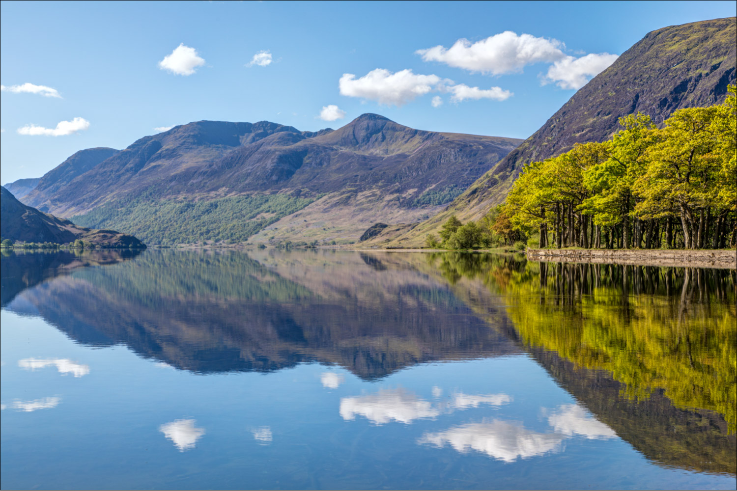
Early morning reflections looking across to Mellbreak...


...and now from the foot of the lake


A glorious scene as I wander across the foot of Crummock Water


It was hard to tear myself away from here, but wanted to cheer on son James who is taking part in the Fred Whitton challenge, so headed back to the car park

I followed the path beside the River Cocker rather than the main track through the wood...

The end of a wonderful short walk

A short while later in High Lorton, here comes James - about half way through the Fred Whitton Challenge, a 112 mile ride around the high lakeland passes, and one of the hardest rides in the UK.

James and pal Ben - the Hardknott Pass will soon wipe those smiles from their faces
