
Route: Circuit of Crummock Water
Area: Western Lake District
Date of walk: 4th April 2019
Walkers: Andrew
Distance: 8.4 miles
Ascent: 800 feet
Weather: Sunny patches
Crummock Water is often overlooked by its sister lake Buttermere – so much the better as it’s equal to Buttermere in beauty, yet the paths are far quieter. It is however a much longer circuit, taking 4 hours or so to complete, almost double the time it takes to walk round Buttermere
I parked as usual in the National Trust car park at Scale Hill and followed the track to the foot of the lake. There was no-one else about, as I’d made an early start. I set off in an anti-clockwise direction as the views down the lake are more extensive in that direction
After reaching the foot of the lake I followed the easy lakeshore path which turns towards Mellbreak and then follows its eastern foot. This section is very juicy in all but the driest weather, and was so today. When I reached Scale Bridge I crossed over Buttermere Dubs and followed the path into Buttermere village. Beyond the village there’s a short road section, and to minimise contact with tarmac I took the path over Hause Point below Rannerdale Knotts. This has the added benefit of offering some superb retrospective views
When I reached the hause I descended and rejoined the Buttermere road. This road section may be avoided by diverting into Rannerdale and taking the path to Cinderdale Common (it would be unthinkable not to visit Rannerdale in May, follow the link to see why). Today I decided instead to carry on along the road
At Cinderdale Common I turned off the road to join a path leading down to the eastern shore of Crummock Water which I followed back to the foot of the lake. From here I retraced my steps along the track through Lanthwaite Wood back to the start of a wonderful circuit
For other walks here, visit my Find Walks page and enter the name in the ‘Search site’ box
Click on the icon below for the route map (subscribers to OS Maps can view detailed maps of the route, visualise it in aerial 3D, and download the GPX file. Non-subscribers will see a base map)

Scroll down – or click on any photo to enlarge it and you can then view as a slideshow

Looking across the River Cocker to Mellbreak from Scale Hill car park

I follow the wide track through Lanthwaite Wood

The foot of Crummock Water, with Mellbreak on the right

Mellbreak again ...


I follow the lakeshore path between the trees

Park Beck, looking towards Blake Fell

Red Pike beyond Mellbreak

I pass by this stand of pine trees...


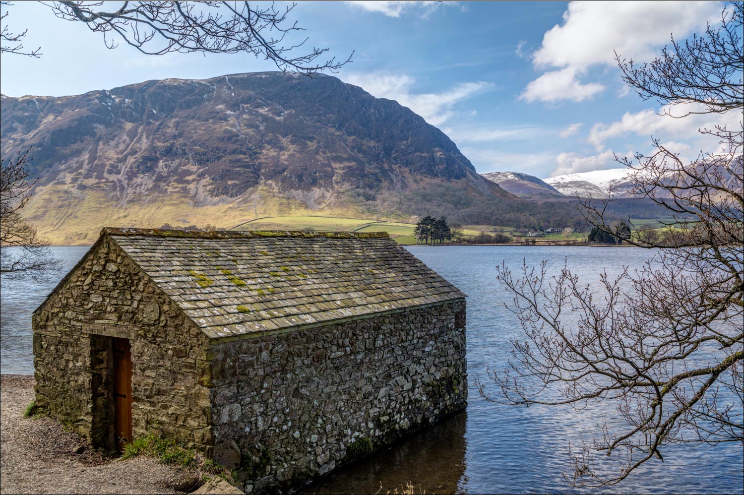
Looking across Crummock Water to the boathouse, and Whiteside beyond

I walk around the shingle beach below Mellbreak

The path hugs the shore of the lake, with Mellbreak on the right...


Whiteside again

Low Ling Crag jutting out into the lake

Rannerdale Farm, which I'll pass by later, and Whiteless Pike towering over it

Low Ling Crag and Rannerdale Knotts...


Grasmoor

Grasmoor and Rannerdale Knotts

A juicy section, where Scale Beck and various tributaries flow into the lake from higher ground

Looking back along Crummock Water

Grasmoor beyond Scale Island

High Snockrigg above Buttermere

Holme Islands

Fleetwith Pike at the head of Buttermere, unseen from here

I pass by an old sheepfold

Fleetwith Pike

Looking across Buttermere Dubs to Buttermere

This tempting path leads to Buttermere lake, but I turn left here...

....and cross Scale Bridge

The path into Buttermere village, with High Snockrigg above

Looking back

Approaching Buttermere

Looking across to Fleetwith Pike

Having walked through the village, I pass by Cragg House Farm

A short road section beyond Buttermere

The road could be followed, but it's preferable to follow this gently ascending path, which has wonderful retrospective views

Head of Crummock Water

High Ling Crag, which I'd passed by earlier

Wood House, set in a wonderful position, with Haystacks beyond

The head of Crummock Water

Wood House again, with Fleetwith Pike and Haystacks at the head of Buttermere

Having reached Buttermere Hause, I descend to the road (the road section may be avoided by turning right into Rannerdale below the hause)

Whiteless Pike from the fields near Rannerdale Farm

Having left the road, I follow this path down to the shore of Crummock Water

Looking back along the lake

Bonnie

Looking across to Mellbreak

A view across the lake from Lanthwaite Wood

I arrive at the boathouse, and from here I walk back to the foot of Crummock Water to complete a wonderful circuit
