
Route: Grisedale Pike, Hopegill Head and Whiteside
Area: North Western Lake District
Date of walk: 6th April 2019
Walkers: Andrew and James
Distance: 6.2 miles
Ascent: 2,800 feet
Weather: sunny, rather hazy, still some lingering snow on the tops
Today’s walk was a linear one linking two valleys, the Vale of Keswick and Lorton Vale. In order to make that possible James and I drove in separate cars to the small car park near High Swinside. I left my car there and we then drove over the Whinlatter Pass, parking in a small car park just above the village of Braithwaite. The climb up the subsidiary hill of Kinn starts immediately and before long we were enjoying views back towards the Skiddaw fells and Keswick, although it was very hazy
It was easy going most of the way, although there is a steeper rockier section at the end of Sleet How, just below the summit of Grisedale Pike. There were still some snow patches lingering about on the tops, following the unseasonal weather earlier in the week
From the summit we followed the path above the awe inspiring chasm of Hobcarton Crag, which took us to the next fell, Hopegill Head
From the small summit on Hopegill Head we followed the thrilling narrow ridge to Whiteside east top, one of my favourite miles in lakeland. We made a short there and back detour to the west top to admire the view over Crummock Water (I’ve not shown this on the Maps Page, but the way is obvious and it’s only a 5 minute stroll). Having retraced our steps to the east top we descended the northern flank of the fell in the direction of Lorton Dodd. At the col in front of Dodd we turned right to follow the valley path, crossing Hope Beck to return to the car park at High Swinside
It had been a wonderful outing in perfect walking weather
For other walks here, visit my Find Walks page and enter the name in the ‘Search site’ box
Click on the icon below for the route map (subscribers to OS Maps can view detailed maps of the route, visualise it in aerial 3D, and download the GPX file. Non-subscribers will see a base map)

Scroll down – or click on any photo to enlarge it and you can then view as a slideshow

The start of the walk as we leave the car park - someone will be hopping mad when they realise they've left a walking boot behind

The climb up the initial slopes of Kinn starts immediately

James admires an early view back to Bassenthwaite Lake and Skiddaw


Coledale on our left

Grisedale Pike comes into view top right

Looking back to Skiddaw...

...and a hazy glimpse of Derwent Water

The gradient becomes steeper as we set out along the long summit ridge of Sleet How

Grisedale Pike ahead

Looking down to Force Crag Mine at the head of Coledale

Onwards and upwards...

Looking back along the curving ridge of Sleet How

Snowy patches near the summit, here looking back to Derwent Water

Not far to go now

James on the summit of Grisedale Pike, looking towards our next objective - Hopegill Head on the right

Skiddaw from Grisedale Pike

We follow the undulating ridge to Hopegill Head on the right

Hazy views into lakeland, including the pointed outline of Pike o'Stickle in Langdale

Layers of fells, with Helvellyn dominating the scene

A down and an up as we walk towards Hopegill Head...


Looking back to Grisedale Pike

Hopegill Head right of picture

Coledale Hause and Grasmoor on our left

We reach the imposing face of Hobcarton Crags...

...there are two paths beside the chasm, the one on the left being wider - for obvious reasons

Views back to Grisedale Pike,..


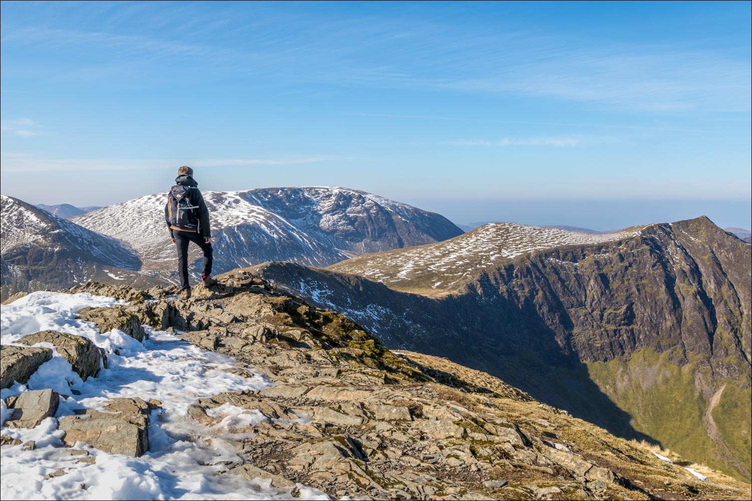
We arrive at the small summit of Hopegill Head - the ridge from here to Whiteside is one of my favourite miles in lakeland

Off we go - Crummock Water is below on the left

Whiteside ahead

Looking across to Grasmoor above Gasgale Gill

Approaching the summit of Whiteside

A view back along the heavenly ridge

James reaches the east top of Whiteside, but we make a there and back visit to the west top, which has better views

Grasmoor and Dove Crags

West summit of Whiteside, with the pointed top of Hopegill Head at the end of the ridge

Looking down to Gasgale Gill

Crummock Water and Mellbreak, and from here we retrace our steps to the east top of Whiteside and start the descent

We follow the easy path down the Dodd ridge, and will turn right at the col below Dodd

One for the family album as Gilly joins us, having parked at High Swinside and walked up to Dodd

We arrive at the col below Dodd and head towards Hope Gill

Looking back up the Hope Gill valley to Hopegill Head

Lorton Vale

We descend to the dry stone wall and turn right here

We follow the line of the dry stone wall to High Swinside, and the end of a wonderful walk
