
Route: Brantingham
Area: East Yorkshire
Date of walk: 10th March 2013
Walkers: Andrew and Gilly
Distance: 6.0 miles
Ascnet: 800 feet
We parked in the village hall car park in the unspoilt and picturesque village of Brantingham
We left the village via Spout Hill and about half way up the hill we turned right along a path through a strip of woodland
Our circular route followed parts of the High Hunsley Way and the Yorkshire Wolds Way, through woodland and alongside chalk farmland
The weather was very cold, made even colder by a bitter wind at times, and occasional snow showers
For other walks here, visit my Find Walks page and enter the name in the ‘Search site’ box
Click on the icon below for the route map (subscribers to OS Maps can view detailed maps of the route, visualise it in aerial 3D, and download the GPX file. Non-subscribers will see a base map)

Scroll down – or click on any photo to enlarge it and you can then view as a slideshow

The village pond at Brantingham

Spout Hill, leaving the village

Looking back down Spout Hill towards the Humber

Another view back to the Humber

Approaching Elloughton Dale

Wauldby

Just past Wauldby

Chalk farmland

The Wolds Way is superbly waymarked along the whole route

Along the Wolds Way

Another sign along the Wolds Way, Brantingham is straight ahead down the hill

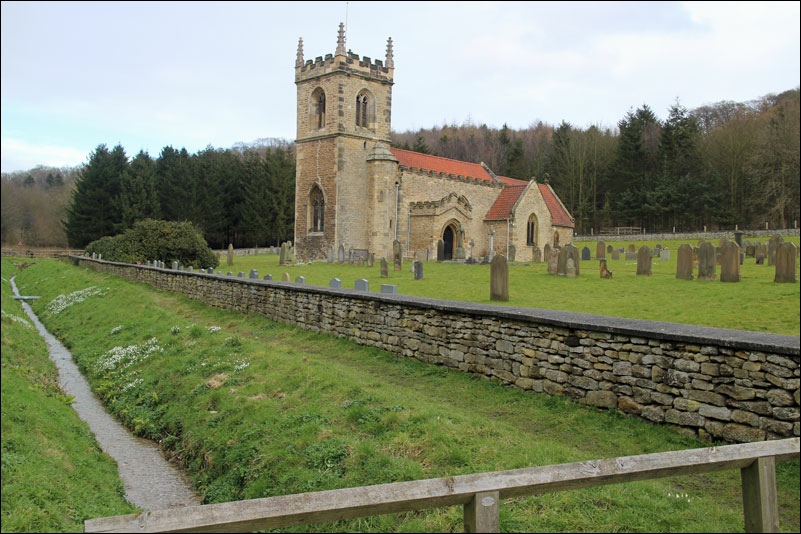
We took a short detour to see Brantingham Church

Almost back to Brantingham
Follow the link for more walks in East Yorkshire (117)
