
Route: Birks and Arnison Crag
Area: Eastern Lake District
Date of walk: 27th September 2016
Walkers: Andrew
Distance: 5.0 miles
Ascent: 1,900 feet
Weather: Mixed cloud and sun
It rained heavily all morning but just as forecast there was an improvement at lunchtime so without ado I set off to Patterdale and on arrival parked in one of the spaces outside the George Starkey hut
I walked past the church and followed the lane to Grisedale. After walking along the valley path for a short distance I turned off to start the steep climb up Thornhow End, made easier by a series of rocky steps. At the top of this section the gradient eased – and the path got wetter
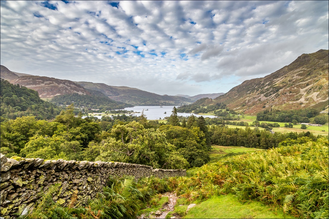
I was soon at the summit of Birks, which is marked by an insignificant cairn, and after taking in the views I made my way down to Trough Head following an indistinct path beside a ruined dry stone wall
From there it was an easy ascent to Arnison Crag, which enjoys better views of Ullswater than its higher neighbour. I made my way down to Patterdale via Oxford Crag with the lake in view most of the way down – a good way to end a very enjoyable walk
For other walks here, visit my Find Walks page and enter the name in the ‘Search site’ box
Click on the icon below for the route map (subscribers to OS Maps can view detailed maps of the route, visualise it in aerial 3D, and download the GPX file. Non-subscribers will see a base map)

Scroll down – or click on any photo to enlarge it and you can then view as a slideshow

Red squirrel in the garden before I set off this morning

…and a stoat

I pass by St Patrick’s Church Patterdale at the start of the walk

The lane to Grisedale

I turn off the lane here to start the climb up Thornhow End

The OS names this as Glenamara Park, Wainwright calls it ‘Glemara’. Beyond is Arnison Crag, which I’ll be walking along later

Shapely Keldas, and Sheffield Pike in the background

Looking back to Ullswater

Arnison Crag again

Looking down into Grisedale

Place Fell

Arnison Crag - my return route will be along the ridge to the knobbly summit, then down a path by the dry stone wall

Ullswater

Grisedale and Nethermost Pike

Looking back to Patterdale and Ullswater

Beyond Thornhow End the gradient eases, and there are dramatic views across Grisedale

Eagle Crag and Nethermostcove Beck

I gain the ridge between St Sunday Crag (right) and Birks (left), and turn sharp left here

It’s an easy but very juicy walk along the ridge to the summit of Birks

Hartsop

Summit cairn on Birks, looking back along the ridge to St Sunday Crag

Ullswater from Birks

I follow this faint path heading east from the summit in the direction of Trough Head

Hartsop at the foot of Hartsop Dodd

The ruins of a dry stone wall are my guide down to Trough Head

Another dry stone wall snakes its way along below the summit ridge of Arnison Crag

Looking back up to Birks

Herdy

Summit of Arnison Crag ahead, with Place Fell beyond

Looking down to Keldas

The rocky summit of Arnison Crag

St Patrick’s Church Patterdale, the start and finish of today’s walk

Passing below Oxford Crag

Ullswater

I enter a small wood on the outskirts of Patterdale


Journey’s end is just around the corner

Back home, more red squirrel action…

