
Route: Wansfell Pike
Area: Far Eastern Lake District
Date of walk: 28th September 2017
Walkers: Andrew and Gilly
Distance: 7.7 miles
Ascent: 1,900 feet
Weather: Mixed cloud and sun
We parked in the main car park in Ambleside and headed towards the centre of town. At a sign ‘To the Waterfalls’ we did as instructed and followed along the right bank of Stock Ghyll, leaving the lane at another sign to follow a path which gives good views of the waterfalls
We left the woods via a wooden gate next to a revolving metal one and started the climb up to Wansfell Pike. The weather was warm and sunny during this part of the walk and we were soon down to our t-shirts. The climb is quite steep but has been made much easier in recent years thanks to the provision of a well made and unobtrusive rocky staircase. We were soon at the top of Wansfell Pike enjoying superb views back to Ambleside and across to Windermere. Wansfell Pike is not in fact the summit of Wansfell, as the highest point of the fell lies a short distance away to the north east. As the difference is only 15 feet or so, and since the views from the true summit are inferior, we were content with having climbed the Pike and started the gentle descent towards Troutbeck
We soon reached Nanny Lane, an old drovers’ road, and this took us into the village of Troutbeck, where we had a coffee break at the Old Post Office. Just beyond the post office we joined another walled track known as Robin Lane and followed this around the lower flanks of Wansfell, through Skelghyll Wood and back into Ambleside to complete a superb circuit
For other walks here, visit my Find Walks page and enter the name in the ‘Search site’ box
Click on the icon below for the route map (subscribers to OS Maps can view detailed maps of the route, visualise it in aerial 3D, and download the GPX file. Non-subscribers will see a base map)

Scroll down – or click on any photo to enlarge it and you can then view as a slideshow

Red squirrel in the garden before we set off this morning

As we leave the car park in Ambleside, we pass by 17th century Bridge House, built over Stock Ghyll

We follow the signs for the waterfalls on the edge of the town...


One of the lower waterfalls

The twin cascades of Stockghyll Force, plunging 70 feet into the gill below

We leave the lane here, at a sign marked 'Footpath to Troutsbeck via Wansfell'

The start of the climb, beside a small stream

An early view back

The elegant spire of St Mary's Church Ambleside

Looking across to Red Screes and the Kirkstone Psss

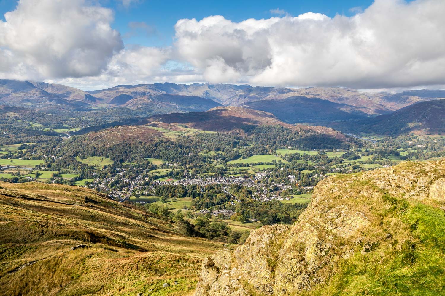
Another view back over Ambleside

Windermere from Wansfell Pike

...and Ambleside and Loughrigg Fell

Gilly and Bonnie on the rocky top

Wansfell, the true top of the fell, and Ill Bell beyond

Windermere again

We start the descent towards Troutbeck

Walking along Nanny Lane - impossible to get lost here...


Troutbeck below

One of 3 wells in the village, the other 2 being dedicated to St James and St John

Lovely old cottages in Troutbeck...


A view across the valley as we walk through the village

Time for coffee at the Old Post Office - highly recommended. We leave the road here to follow Robin Lane out of the village

Looking across the valley to the lower slopes of Sour Howes

A view back along the lane

Lovely views on our left as we gain height

We contour around the slopes of Wansfell

We pass by an old stone barn

The track leading to High Skelghyll

High Skelghyll bottom right and the Langdale Pikes in the background


We follow the winding track through the farm

Windermere

Looking back along the track

Beyond High Skelghyll now, we continue along the track, with more views of Windermere on our left...


The path enters into Skelghyll Wood...


A short diversion to admire the view of Windermere from Jenkin Crag

We join a lane above Ambleside, which takes us back down into the town

Stock Ghyll again, and from here it's a short stroll back to the end of a five star walk

It was good to see a hedgehog in the garden at the end of the day
