
Route: Traigh Seilebost
Area: Outer Hebrides, South Harris
Date of walk: 10th March 2024
Walkers: Andrew and Gilly
Distance: 2.2 miles
Ascent: 500 feet
Weather: Sunny, exceptionally windy
Click on the icon below for the route map (subscribers to OS Maps can view detailed maps of the route, visualise it in aerial 3D, and download the GPX file. Non-subscribers will see a base map)

Scroll down – or click on any photo to enlarge it and you can then view as a slideshow

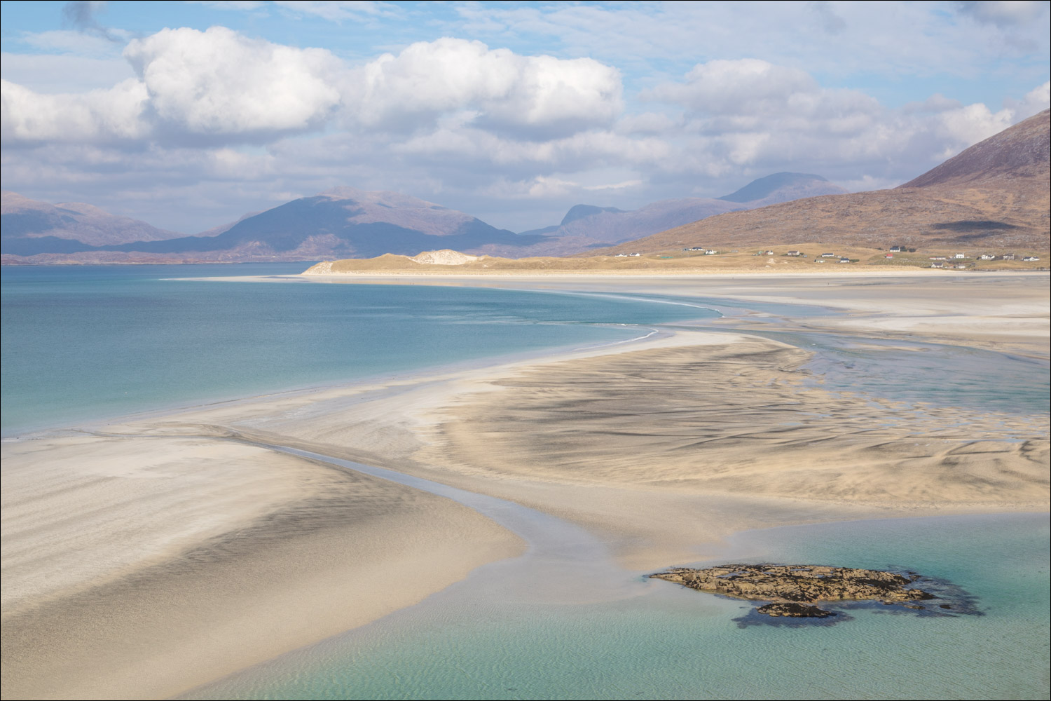
Just before the start of the walk we stopped the car in a layby from where there is a wonderful view of Traigh Seilebost looking towards Luskentyre and the mountains of North Harris

Panorama from the same spot (click for a larger view)...
Follow the link for more walks in Scotland (44)

The start of the walk as we cross the machair. Machair is a unique habitat and, though it may be hard to imagine, this area will be full of wildflowers and rare wildlife in the summer months

We cross over the sand dunes before the beach

Traigh Seilebost, looking towards Luskentyre

Traigh Losgaintir (Luskentyre beach) on our right, the tide is covering the sands

Looking back to Beinn Dhubh

Views of Luskentyre...


Taransay. The sands may look tempting, but it's dangerous to wander too far out due to the risks of quicksand and a fast incoming tide

Crystal clear aquamarine sea looking across to Luskentyre

Taransay again

The mountains of North Harris

Looking back along the sand dunes which line the beach

Sea, sand and mountains

At the end of Traigh Seilebost we come across a 'parcel' or 'stew' of oystercatchers

The birds fly off to a nearby strand giving me some good photo opportunities as we start the return section of the walk....


Looking across to Luskentyre...


We walk across to the dunes at the edge of the beach

We climb up to the dunes

A final view over Traigh Seilebost as we make our way back to the nearby car park
